Category:Kaiserliches Postamt (Bad Liebenwerda)
Jump to navigation
Jump to search
| Object location | | View all coordinates using: OpenStreetMap |
|---|
This is the category of the Brandenburger Baudenkmal (cultural heritage monument) with the ID 09135748 (Wikidata)
|
 | |||||
| Upload media | |||||
| Instance of |
| ||||
|---|---|---|---|---|---|
| Location | Bad Liebenwerda, Elbe-Elster District, Brandenburg, Germany | ||||
| Heritage designation | |||||
 | |||||
Media in category "Kaiserliches Postamt (Bad Liebenwerda)"
The following 11 files are in this category, out of 11 total.
-
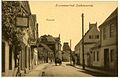
 01826-Liebenwerda-1901-Schloßstraße-Brück & Sohn Kunstverlag.jpg 1,000 × 1,523; 443 KB
-
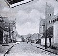
 14224-Liebenwerda-1912-Ortsansicht mit Postamt-Brück & Sohn Kunstverlag.jpg 1,548 × 1,000; 619 KB
-
 18837-Liebenwerda-1915-Schloß- und Dresdner Straße-Brück & Sohn Kunstverlag.jpg 1,519 × 1,000; 564 KB
-
 Alte Post Liebenwerda.JPG 2,272 × 1,704; 909 KB
-
 Altes Kaiserliches Postamt Liebenwerda.jpeg 3,052 × 2,225; 7.24 MB
-
 Bad Liebenwerda 0019.jpg 803 × 1,200; 265 KB
-
 Kaiserliches Postamt Liebenwerda 2.jpeg 1,283 × 1,238; 643 KB
-
 Kaiserliches Postamt Liebenwerda 3.jpeg 1,266 × 832; 355 KB
-
 Liebenwerda Kaiserliches Postamt.jpg 5,080 × 3,810; 3.74 MB
-
 Post Liebenwerda.jpg 1,959 × 1,559; 621 KB
-
 Schlossstrasse bad Liebenwerda.JPG 1,704 × 2,272; 826 KB


