Category:Kagoshima Municipal Matsumoto Junior High School
Jump to navigation
Jump to search
English: Category for Kagoshima Municipal Matsumoto Junior High School
日本語: 鹿児島市立松元中学校に関するカテゴリ
| Object location | | View all coordinates using: OpenStreetMap |
|---|
 | |||||
| Upload media | |||||
| Instance of | |||||
|---|---|---|---|---|---|
| Location | Kamitaniguchi-chō, Kagoshima, Kagoshima Prefecture, Japan | ||||
| Street address |
| ||||
| Maintained by | |||||
| Inception |
| ||||
| official website | |||||
 | |||||
Media in category "Kagoshima Municipal Matsumoto Junior High School"
The following 4 files are in this category, out of 4 total.
-
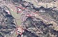 Kagoshima Matsumoto Map.jpg 1,015 × 653; 279 KB
-
 MJHS.jpg 300 × 225; 50 KB
-
 MJHSImage12.jpg 447 × 238; 33 KB
-
 Old MJHS.JPG 2,048 × 1,536; 750 KB

