Category:Kaag en Braassem in the 19th century
Jump to navigation
Jump to search
Kaag en Braassem by century: (BCE) (CE) 17th century · 18th century · 19th century · 20th century · 21st century ·
Media in category "Kaag en Braassem in the 19th century"
The following 13 files are in this category, out of 13 total.
-
 Alkemade 1865.gif 1,600 × 1,334; 241 KB
-
 Leimuiden, Gemeenteatlas van Nederland.jpg 2,576 × 2,099; 1.2 MB
-
 Netherlands, Alkemade, map of 1865.PNG 2,423 × 1,977; 7.33 MB
-
 Netherlands, Kaag en Braassem, Ade (2).jpg 5,544 × 3,584; 3.27 MB
-
 Netherlands, Kaag en Braassem, Blauwe Polder.jpg 5,544 × 3,568; 3.43 MB
-
 Netherlands, Kaag en Braassem, Doespolder, Kooijpolder, Piespolder, Voorofsche Polder.jpg 5,600 × 3,625; 1.77 MB
-
 Netherlands, Kaag en Braassem, Googer polder, map of 1855.jpg 4,000 × 4,590; 8.95 MB
-
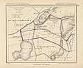
 Netherlands, Kaag en Braassem, Hoogmade, map of 1876.jpg 670 × 796; 264 KB
-
 Netherlands, Kaag en Braassem, Hoogmade, Piestpolders (1).jpg 2,080 × 1,604; 963 KB
-
 Netherlands, Warmond, Lakerpolder, Tuinder- of Kogjespolder.jpg 5,488 × 3,504; 3.01 MB
-
 Netherlands, Woubrugge, map of 1867.jpg 2,336 × 1,980; 1.82 MB
-
 Netherlands, Zijl (4).jpg 1,176 × 1,540; 1,014 KB
-
 Rijnsaterwoude, Gemeenteatlas van Nederland.jpg 2,621 × 2,023; 1.01 MB


.jpg)


.jpg)


.jpg)
