
Category:K-23 (Kansas highway)
 | number: | (twenty-three) |
|---|---|---|
| State highways in Kansas: | 3 · 4 · 5 · 7 · 9 · 10 · 11 · 13 · 14 · 15 · 16 · 17 · 18 · 19 · 20 · 22 · 23 · 25 · 26 · 27 · 30 · 31 · 32 · 33 · 34 · 39 · 41 · 42 · 43 |
state highway in Kansas, United States  | |||||
| Upload media | |||||
| Instance of | |||||
|---|---|---|---|---|---|
| Location | |||||
| Transport network | |||||
| Owned by | |||||
| Maintained by | |||||
| Inception |
| ||||
| Length |
| ||||
| |||||
English: Media related to K-23 (Kansas highway)
Subcategories
This category has only the following subcategory.
Media in category "K-23 (Kansas highway)"
The following 10 files are in this category, out of 10 total.
-
 K-23 (1926).svg 400 × 400; 18 KB
-
 K-23 (1962).svg 600 × 600; 48 KB
-
 K-23.svg 600 × 600; 39 KB
-
 K-23map.svg 1,495 × 804; 2.03 MB
-
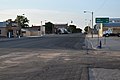 K23 Alternate entering Grainfield.JPG 6,000 × 4,000; 7.14 MB
-
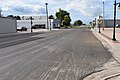
 K23 Alternate southern terminus.jpg 6,000 × 4,000; 6.42 MB
-
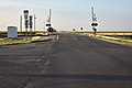 K23 northbound from K23 Spur.JPG 6,000 × 4,000; 6.85 MB
-
 K23 northbound from K96.JPG 6,000 × 4,000; 6.26 MB
-
 K23 southbound from K23 Spur.JPG 6,000 × 4,000; 6.13 MB
-
 K96 westbound at K23.JPG 6,000 × 4,000; 6.14 MB
.svg)
.svg)


