Category:Köppen climate classification maps of the United States
Jump to navigation
Jump to search
Subcategories
This category has only the following subcategory.
Media in category "Köppen climate classification maps of the United States"
The following 16 files are in this category, out of 16 total.
-
Indiana 2016 Koppen update vs old map with text explanations.png 2,658 × 1,600; 233 KB
-
Koppen climate updated 2017.png 1,500 × 1,292; 1.45 MB
-
Koppen-Geiger Map PRI future.svg 1,640 × 850; 621 KB
-
Koppen-Geiger Map USA future.svg 1,816 × 850; 10.22 MB
-
Köppen Climate Types US 50.png 2,376 × 2,692; 723 KB
-
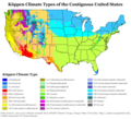
Köppen Climate Types US.png 2,376 × 2,158; 613 KB
-
Köppen Csc US West Coast.png 4,200 × 7,200; 295 KB
-
New England Köppen.png 6,000 × 9,900; 509 KB
-
Northwestern US Köppen.png 6,000 × 7,919; 679 KB
-
Puerto Rico Köppen.png 6,600 × 4,019; 196 KB
-
Tipos climáticos dos Estados Unidos (Köppen).svg 900 × 1,071; 4.82 MB
-
United States Köppen.png 9,000 × 7,381; 1.43 MB
-
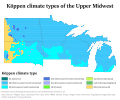
Upper Midwest Köppen.svg 900 × 747; 1.46 MB
-
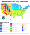
US 50 states Köppen.svg 900 × 1,071; 5.41 MB
-
USA map of Köppen climate classification.svg 1,824 × 1,553; 1.03 MB
-
West Coast Köppen.svg 1,080 × 1,530; 2.06 MB


