Category:Kármán József primary school in Lučenec
Jump to navigation
Jump to search
| Object location | | View all coordinates using: OpenStreetMap |
|---|
Media in category "Kármán József primary school in Lučenec"
The following 11 files are in this category, out of 11 total.
-
 Losonc037.JPG 2,611 × 1,558; 972 KB
-
 Losonc038.JPG 2,816 × 1,880; 780 KB
-
 Losonc039.JPG 2,493 × 1,589; 768 KB
-
 Losonc040.JPG 1,880 × 2,816; 345 KB
-
 Losonc041.JPG 1,880 × 2,816; 302 KB
-
 Lučenec - 100. výročie.jpg 2,043 × 1,729; 951 KB
-
 Lučenec - Juraj Palkovič -a.jpg 2,218 × 2,314; 1.4 MB
-
 Lučenec - Scherrer Lajos - Szilassy Aladár -a.jpg 3,326 × 2,401; 2.79 MB
-
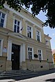
 Lučenec - ZŠ s materskou školou J.Kármána (1).jpg 4,608 × 3,072; 3.61 MB
-
 Lučenec - ZŠ s materskou školou J.Kármána.jpg 4,608 × 3,072; 3.63 MB
-
 Z. škola s materskou školou Józsefa Kármána - Lučenec.jpg 3,472 × 2,604; 1.59 MB


.jpg)

