Category:Kálvária cemetery, Szentes
Jump to navigation
Jump to search
Kálvária temető - Szentes, Hadzsy János út (a református temető mellett?)
| Object location | | View all coordinates using: OpenStreetMap |
|---|
Media in category "Kálvária cemetery, Szentes"
The following 5 files are in this category, out of 5 total.
-
 1953 Cicatricis-L-dr-sirja-01.JPG 1,600 × 1,200; 1.09 MB
-
 1953 Cicatricis-L-dr-sirja-02.JPG 1,200 × 1,600; 913 KB
-
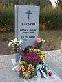 Bácskai Mihály sírja.JPG 1,200 × 1,600; 893 KB
-
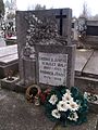 Fridrich János (1874-1959) fényképész sírköve.jpg 1,944 × 2,592; 1.41 MB
-
 Koszta József dísz-sírja a szentesi Kálvária temetőben.JPG 1,600 × 1,200; 1.11 MB


_f%C3%A9nyk%C3%A9p%C3%A9sz_s%C3%ADrk%C3%B6ve.jpg)
