Category:June 2021 in Colorado
Jump to navigation
Jump to search
English: Images/pictures taken in Colorado during June 2021. Note this is not the date of the upload, nor the date a photo was scanned.
States of the United States: Alabama · Alaska · Arizona · California · Colorado · Connecticut · Delaware · Florida · Georgia · Hawaii · Idaho · Illinois · Indiana · Iowa · Kansas · Kentucky · Louisiana · Maryland · Massachusetts · Michigan · Minnesota · Mississippi · Montana · Nebraska · Nevada · New Hampshire · New Jersey · New Mexico · New York · North Carolina · North Dakota · Ohio · Oklahoma · Oregon · Pennsylvania · Rhode Island · South Carolina · South Dakota · Tennessee · Texas · Utah · Vermont · Virginia · Washington · West Virginia · Wisconsin · Wyoming – Washington, D.C.
| June 2020 | ← | June 2021 | → | June 2022 | |||||||||
| Jan | Feb | Mar | Apr | May | Jun | Jul | Aug | Sep | Oct | Nov | Dec | ||
| ← | 6 | 6 | 14 | 14 | 116 | 110 | 63 | 19 | 15 | 72 | 39 | 19 | → |
|---|---|---|---|---|---|---|---|---|---|---|---|---|---|
Media in category "June 2021 in Colorado"
The following 110 files are in this category, out of 110 total.
-
 Alice, Colorado.JPG 5,149 × 3,786; 10.34 MB
-
 Barrier with Sign.jpg 4,896 × 3,672; 4.1 MB
-
 Battlement Mesa Schoolhouse 2021.JPG 4,466 × 3,805; 8.32 MB
-
 Battlement Mesa.JPG 6,000 × 3,526; 17.17 MB
-
 Be Snake Awake Sign.jpg 4,896 × 3,672; 6.24 MB
-
 Big Beaver Dam.JPG 5,459 × 3,656; 13.85 MB
-
 Big Beaver Ditch.JPG 4,971 × 3,686; 15.75 MB
-
 Buford, Colorado.JPG 5,762 × 3,780; 15.54 MB
-
 Chatfield Reservoir looking east from Chatfield Swim Beach.jpeg 4,032 × 3,024; 5.05 MB
-
 CO 26 WB past I-25-US 85-US 87.jpeg 4,032 × 3,024; 3.9 MB
-
 CO 30 EB past I-25-US 87-US 285.jpeg 4,032 × 3,024; 4.35 MB
-
 CO 88 WB past Quebec Street.jpeg 4,032 × 3,024; 3.24 MB
-
 Coal Oil Rim.JPG 6,000 × 3,025; 11.35 MB
-
 Colorado Northwestern Community College sign.JPG 4,788 × 2,758; 9.91 MB
-
 Confluence of Sheephorn Creek and the Colorado River.JPG 5,071 × 4,000; 17.24 MB
-
 Confluence of the Blue River and the Colorado River.JPG 5,510 × 3,442; 16.45 MB
-
 Confluence of the north and south forks of the White River.JPG 5,464 × 4,000; 17.55 MB
-
 Confluence of the North Fork Gunnison River and the Gunnison River.JPG 5,695 × 3,662; 13.6 MB
-
 Confluence Recreation Area sign.JPG 3,342 × 2,960; 9.36 MB
-
 Dinosaur, Colorado Town Hall.JPG 5,223 × 2,929; 8.6 MB
-
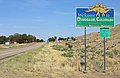 Dinosaur, Colorado welcome sign.JPG 5,122 × 3,346; 13.71 MB
-
 Dunckley Pass information boards.JPG 5,471 × 3,792; 15.57 MB
-
 Dunckley Pass.JPG 4,879 × 3,601; 16.19 MB
-
 East Fork Williams Fork River.JPG 5,003 × 3,820; 18.78 MB
-
 Flat Tops from Routt County.JPG 6,000 × 4,000; 10.97 MB
-
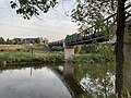
 Fourth Street Pedestrian Bridge (Pueblo, Colorado).JPG 4,394 × 3,272; 10.04 MB
-
 GazeboSoprisParkCarbondaleColorado.jpg 768 × 1,024; 478 KB
-
 Grand Mesa Summit.JPG 5,673 × 3,826; 13.61 MB
-
 Green Mountain Dam from below.JPG 5,786 × 3,640; 14.34 MB
-
 Green Mountain Dam.JPG 5,877 × 4,000; 14.89 MB
-
 Green Mountain Powerplant.JPG 4,682 × 2,883; 14.19 MB
-
 Gunnison Gorge National Conservation Area sign.JPG 4,394 × 2,709; 8.06 MB
-
 Hogback ridges in Colorado.jpg 2,848 × 2,136; 1.47 MB
-
 Horsetooth Reservoir panorama.jpg 2,848 × 707; 448 KB
-
 Horsetooth Reservoir.jpg 4,032 × 3,024; 5.62 MB
-
 I-70 BL-US 40 WB-US 287 NB past York Street.jpeg 4,032 × 3,024; 3.83 MB
-
 Inlet Bay at Horsetooth Reservoir.jpg 2,848 × 2,136; 1.46 MB
-
 Interstate 25 in southern Pueblo County.JPG 5,093 × 2,889; 13.04 MB
-
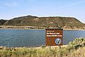
 Kenney Reservoir.JPG 5,612 × 3,475; 13.52 MB
-
 Kruger Rock Trailhead.jpg 4,896 × 3,672; 3.84 MB
-
 Kruger Rock.jpg 4,896 × 3,672; 4.41 MB
-
 Lake Avery.JPG 5,527 × 3,312; 9.55 MB
-
 Limber Pine - Kruger Rock Trail Junction Marker.jpg 4,896 × 3,672; 6.52 MB
-
 Looking across Kenney Reservoir.JPG 5,290 × 4,000; 13.03 MB
-
 Main Street in Rangely, Colorado.jpg 5,752 × 3,488; 13.2 MB
-
 Meeker Dome.JPG 5,267 × 2,766; 8.09 MB
-
 Meeker Massacre site.JPG 5,764 × 3,910; 19 MB
-
 Mesa in Colorado.jpg 3,024 × 2,154; 1.21 MB
-
 Mesa, Colorado.JPG 5,374 × 3,019; 10.08 MB
-
 North Fork White River.JPG 5,081 × 4,000; 16.94 MB
-
 Oil well in Rangely, Colorado.JPG 5,300 × 2,580; 6.92 MB
-
 Piceance Creek.JPG 5,933 × 3,752; 16.65 MB
-
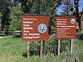
 Piceance State Wildlife Area information boards.JPG 6,000 × 4,000; 16.56 MB
-
 Powderhorn Mountain Resort.JPG 4,534 × 3,730; 11.25 MB
-
 Prospect001.jpg 3,840 × 2,160; 2.65 MB
-
 Pyramid Peak (Rio Blanco County, Colorado).JPG 4,422 × 3,110; 7.87 MB
-
 Radium from the bridge.JPG 4,541 × 2,754; 7.55 MB
-
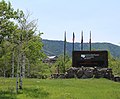
 Radium State Wildlife Area O.C. Mugrage Campground.JPG 5,313 × 3,927; 18.87 MB
-
 Radium, Colorado from across the river.JPG 4,647 × 2,354; 8.37 MB
-
 Rangely, Colorado welcome sign.JPG 4,360 × 2,862; 7.91 MB
-
 Rifle Creek.JPG 5,245 × 4,000; 19.81 MB
-
 Rio Blanco Lake State Wildlife Area.JPG 5,583 × 3,780; 15.28 MB
-
 Ripple Creek Overlook 1.JPG 3,768 × 2,462; 8.83 MB
-
 Ripple Creek Overlook sign.JPG 3,626 × 3,843; 1.38 MB
-
 Ripple Creek Overlook-2.JPG 3,751 × 2,828; 8.1 MB
-
 Ripple Creek Overlook-3.JPG 3,521 × 1,822; 4.12 MB
-
 Ripple Creek Overlook-4.JPG 4,032 × 2,769; 9.39 MB
-
 Ripple Creek Overlook-5.JPG 4,032 × 2,773; 8.95 MB
-
 Ripple Creek Overlook-6.JPG 4,032 × 2,631; 11.04 MB
-
 Ripple Creek Overlook-7.JPG 3,699 × 2,164; 5.8 MB
-
 Ripple Creek Overlook.JPG 5,567 × 3,527; 15.94 MB
-
 Ripple Creek Pass.JPG 6,000 × 2,951; 9.66 MB
-
 Rulison, Colorado and the Roan Cliffs.JPG 5,431 × 4,000; 14.99 MB
-
 Sacred Heart Catholic Church in Durango Colorado.jpg 1,665 × 1,619; 738 KB
-
 Saint Columba Catholic Church in Durango Colorado.jpg 1,835 × 2,687; 995 KB
-
 Saint Daniel the Prophet Catholic Church in Ouray Colorado.jpg 2,252 × 1,586; 1.2 MB
-
 Saint Patrick Catholic Church in Silverton Colorado.jpg 1,443 × 2,033; 495 KB
-
 Sheephorn Creek at Mugrage Campground.JPG 4,783 × 2,929; 15.65 MB
-
 Silver Lake (Colorado).JPG 5,850 × 3,838; 15.62 MB
-
 Slow down blind corner ahead sign.jpg 4,896 × 3,672; 4.41 MB
-
 Southern Pacific No. 18 in Silverton side view.jpg 3,000 × 2,000; 2.43 MB
-
 Southern Pacific No. 18 in Silverton.jpg 2,000 × 3,000; 2.57 MB
-
 St. Mary's Glacier welcome sign.JPG 1,879 × 2,258; 4.19 MB
-
 St. Mary's, Colorado.JPG 5,498 × 3,792; 14.39 MB
-
 State Bridge, Colorado.JPG 5,589 × 3,572; 15.86 MB
-
 Taylor Draw Dam and power plant.JPG 3,833 × 2,287; 6.06 MB
-
 Taylor Draw Dam.JPG 5,132 × 2,934; 8.36 MB
-
 Tim Geitner (Colorado politician) 2.jpg 6,000 × 4,000; 9.24 MB
-
 Trail Sign.jpg 4,896 × 3,672; 4.46 MB
-
 Tyrannosaurus street sign.JPG 3,769 × 2,496; 7.73 MB
-
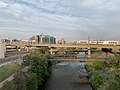
 Union Station North 001.jpg 2,928 × 1,475; 3.27 MB
-
 Union Station North 003.jpg 4,032 × 3,024; 3.63 MB
-
 Union Station North 004.jpg 4,032 × 3,024; 5.06 MB
-
 Union Station North 005.jpg 3,886 × 3,024; 9.41 MB
-
 Union Station North 006.jpg 3,612 × 2,490; 8.48 MB
-
 Union Station North 025.jpg 4,032 × 3,024; 3.91 MB
-
 Union Station North 026.jpg 4,032 × 2,424; 6.41 MB
-
 Union Station North 027.jpg 3,883 × 2,471; 6.88 MB
-
 Union Station North 028.jpg 2,630 × 1,437; 3.3 MB
-
 Union Station North 029.jpg 2,891 × 2,299; 6.08 MB
-
 Union Station North 030.jpg 4,032 × 3,024; 3.94 MB
-
 Union Station North 031.jpg 3,247 × 1,668; 3.99 MB
-
 Union Station North 032.jpg 4,032 × 3,024; 4.36 MB
-
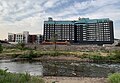
 Union Station North, Denver, Colorado, Railroad.jpg 960 × 541; 618 KB
-
 Vaughan Lake.JPG 5,058 × 2,822; 10.31 MB
-
 View from Dunckley Pass.JPG 3,914 × 2,710; 10.64 MB
-
 White River City, Colorado.JPG 6,000 × 3,499; 13.5 MB
-
 Wild Loop Footbridge 1.jpg 4,896 × 3,672; 6.6 MB
-
 Yampa volcanic field outcrop.JPG 3,666 × 3,228; 9.04 MB
-
 Zoelsmann's Bakery.JPG 5,401 × 3,154; 10.89 MB


.JPG)


.JPG)


.JPG)


_2.jpg)


