Category:June 2016 in Leeds
Jump to navigation
Jump to search
Subcategories
This category has only the following subcategory.
Media in category "June 2016 in Leeds"
The following 127 files are in this category, out of 127 total.
-

-

-
 Barleyfields Court - Barleyfields Road (geograph 4996083).jpg 640 × 480; 83 KB
-
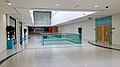
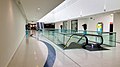
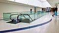
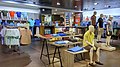 BHS, Trinity, Albion Arcade, Leeds (geograph 5013679).jpg 1,280 × 720; 524 KB
-
 BHS, Trinity, Albion Arcade, Leeds (geograph 5013684).jpg 1,280 × 720; 440 KB
-
 BHS, Trinity, Albion Arcade, Leeds (geograph 5013688).jpg 1,280 × 720; 456 KB
-
 BHS, Trinity, Albion Arcade, Leeds (geograph 5013696).jpg 1,280 × 720; 574 KB
-
 BHS, Trinity, Albion Arcade, Leeds (geograph 5013701).jpg 1,280 × 720; 420 KB
-
 BHS, Trinity, Albion Arcade, Leeds (geograph 5013707).jpg 1,280 × 720; 517 KB
-
 Bond Street, Trinity, Leeds (geograph 4998329).jpg 1,280 × 853; 576 KB
-
 Braine Road - School Road (geograph 4995973).jpg 640 × 480; 68 KB
-
 Car park for the new Kirkstall Forge Station (geograph 5002455).jpg 1,024 × 768; 148 KB
-
 City House, New Station Street, Leeds (geograph 4988919).jpg 1,280 × 853; 499 KB
-
 Clayton Grange Flats being refurbished (geograph 4992259).jpg 1,024 × 768; 220 KB
-
 Clayton Grange, Leeds (geograph 5126016).jpg 1,280 × 720; 542 KB
-
 Edward Boyle Library, University of Leeds, during refurbishment. 1st January, 2016.jpg 2,780 × 3,705; 5.86 MB
-
 Edward Boyle Library, University of Leeds, during refurbishment. 20th June, 2016.jpg 4,032 × 3,024; 7.49 MB
-
 Eel Mires Garth - Templar Gardens - geograph.org.uk - 4996022.jpg 640 × 480; 59 KB
-
 Electricity Substation - Knights Croft (geograph 4996030).jpg 640 × 480; 123 KB
-
-
 Electricity Substation No 407 - York Road (geograph 4995980).jpg 640 × 480; 72 KB
-
 Fourth Avenue - Third Avenue (geograph 4995836).jpg 640 × 455; 52 KB
-
 Foxhill - Barleyfields Road (geograph 4996084).jpg 640 × 480; 72 KB
-
 Hallfield Crescent - Third Avenue (geograph 4995852).jpg 640 × 480; 68 KB
-
 Kirkgate Market, George Street, Leeds (geograph 5003209).jpg 1,280 × 853; 537 KB
-
 Kirkgate Market, George Street, Leeds (geograph 5003210).jpg 1,280 × 853; 612 KB
-
 Kirkgate Market, George Street, Leeds (geograph 5003212).jpg 1,280 × 853; 594 KB
-
 Kirkgate Market, George Street, Leeds (geograph 5003213).jpg 1,280 × 853; 600 KB
-
 Kirkstall Forge Station, Leeds (geograph 5002365).jpg 1,280 × 853; 578 KB
-
 Kirkstall Forge Station, Leeds (geograph 5002473).jpg 1,280 × 766; 553 KB
-
 Kirkstall Forge. Leeds (33712735744).jpg 1,280 × 853; 417 KB
-
 Kirkstall Forge. Leeds (33712738124).jpg 1,280 × 853; 483 KB
-
 Kirkstall Forge. Leeds (33745062893).jpg 1,280 × 853; 669 KB
-
 Kirkstall Forge. Leeds (34169413130).jpg 1,280 × 853; 627 KB
-
 Kirkstall Forge. Leeds (34394171652).jpg 1,280 × 853; 811 KB
-
 Kirkstall Forge. Leeds (34555133085).jpg 1,280 × 853; 489 KB
-
 Kirkstall Forge. Leeds (34555204025).jpg 1,280 × 853; 680 KB
-
 Knights Croft - Templar Gardens - geograph.org.uk - 4996026.jpg 640 × 480; 52 KB
-
 Law Close - Templar Gardens - geograph.org.uk - 4996024.jpg 640 × 480; 73 KB
-
 Leeds (33562538824).jpg 1,280 × 720; 395 KB
-
 Leeds (34019506550).jpg 1,280 × 720; 526 KB
-
 Leeds (34245465712).jpg 1,280 × 720; 334 KB
-
 Leeds (34245466842).jpg 1,280 × 720; 447 KB
-
 Leeds (34362778726).jpg 1,280 × 720; 372 KB
-
 Leeds (34404322565).jpg 1,280 × 720; 420 KB
-
 Leeds Kirkgate Market, George Street, Leeds (geograph 5003208).jpg 960 × 534; 97 KB
-
 Leeds RailwayStation TypeG.jpg 914 × 1,280; 599 KB
-
 K2 Tower.jpg 3,024 × 4,032; 2.84 MB
-
 McBride Way - School Road (geograph 4995975).jpg 640 × 416; 51 KB
-
 North Grove Approach - Deighton Road (geograph 4996038).jpg 640 × 480; 90 KB
-
 North Grove Court - North Grove Approach - geograph.org.uk - 4996069.jpg 640 × 480; 102 KB
-

-

-
 North Street - viewed from York Place (geograph 4996542).jpg 640 × 480; 72 KB
-
 Northfield Avenue - Northfield Place (geograph 4996074).jpg 640 × 480; 71 KB
-
 Nursery Garth - School Road - geograph.org.uk - 4995971.jpg 640 × 480; 62 KB
-
 On the footbridge, Kirkstall Forge Station (geograph 5003084).jpg 1,024 × 768; 285 KB
-
 Opening day, Kirkstall Forge railway station (19th June 2016) 001.jpg 3,872 × 2,176; 2.44 MB
-
 Opening day, Kirkstall Forge railway station (19th June 2016) 002.jpg 3,872 × 2,176; 2.44 MB
-
 Opening day, Kirkstall Forge railway station (19th June 2016) 003.jpg 3,872 × 2,176; 3.13 MB
-
 Opening day, Kirkstall Forge railway station (19th June 2016) 004.jpg 3,872 × 2,176; 2.91 MB
-
 Opening day, Kirkstall Forge railway station (19th June 2016) 005.jpg 3,872 × 2,176; 2.84 MB
-
 Opening day, Kirkstall Forge railway station (19th June 2016) 006.jpg 2,176 × 3,872; 2.38 MB
-
 Opening day, Kirkstall Forge railway station (19th June 2016) 007.jpg 3,872 × 2,176; 3.69 MB
-
 Opening day, Kirkstall Forge railway station (19th June 2016) 008.jpg 3,872 × 2,176; 2.84 MB
-
 Opening day, Kirkstall Forge railway station (19th June 2016) 009.jpg 3,872 × 2,176; 3.28 MB
-
 Opening day, Kirkstall Forge railway station (19th June 2016) 010.jpg 3,872 × 2,176; 3.16 MB
-
 Opening day, Kirkstall Forge railway station (19th June 2016) 011.jpg 3,872 × 2,176; 3.94 MB
-
 Opening day, Kirkstall Forge railway station (19th June 2016) 012.jpg 3,872 × 2,176; 2.63 MB
-
 Opening day, Kirkstall Forge railway station (19th June 2016) 013.jpg 3,872 × 2,176; 2.44 MB
-
 Opening day, Kirkstall Forge railway station (19th June 2016) 014.jpg 3,872 × 2,176; 3.88 MB
-
 Opening day, Kirkstall Forge railway station (19th June 2016) 015.jpg 2,176 × 3,872; 2.31 MB
-
 Opening day, Kirkstall Forge railway station (19th June 2016) 016.jpg 3,872 × 2,176; 3.03 MB
-
 Opening day, Kirkstall Forge railway station (19th June 2016) 017.jpg 3,872 × 2,176; 3.56 MB
-
 Opening day, Kirkstall Forge railway station (19th June 2016) 018.jpg 3,872 × 2,176; 2.81 MB
-
 Opening day, Kirkstall Forge railway station (19th June 2016) 019.jpg 3,872 × 2,176; 3.16 MB
-
 Opening day, Kirkstall Forge railway station (19th June 2016) 020.jpg 3,872 × 2,176; 3.44 MB
-
 Opening day, Kirkstall Forge railway station (19th June 2016) 021.jpg 2,176 × 3,872; 2.63 MB
-
 Opening day, Kirkstall Forge railway station (19th June 2016) 022.jpg 3,872 × 2,176; 3.31 MB
-
 Opening day, Kirkstall Forge railway station (19th June 2016) 023.jpg 3,872 × 2,176; 3.22 MB
-
 Opening day, Kirkstall Forge railway station (19th June 2016) 024.jpg 3,872 × 2,176; 2.53 MB
-
 Otley Social WM Club, Hollin Gate, Otley, Leeds (geograph 5043433).jpg 1,280 × 720; 443 KB
-
 Photographing us, Kirkstall Forge station (geograph 5003714).jpg 1,024 × 768; 186 KB
-
 Platform 2, Kirkstall Forge Station (geograph 5003078).jpg 1,024 × 768; 267 KB
-
 Poplar Court, Bramley, Leeds (geograph 4949511).jpg 1,280 × 853; 514 KB
-
 Priory Close - Templar Gardens - geograph.org.uk - 4996025.jpg 640 × 480; 63 KB
-

-
 Sandringham Road - Barleyfields Road (geograph 4996532).jpg 640 × 480; 68 KB
-
 Second Avenue - Fourth Avenue (geograph 4995834).jpg 640 × 442; 57 KB
-
-

-

-

-

-

-

-

-

-

-

-

-

-

-

-

-

-

-
 St Jamess University Hospital, Leeds (geograph 5016146).jpg 1,280 × 720; 600 KB
-

-
-
 The first train will be at Kirkstall Forge soon (geograph 5002152).jpg 1,024 × 768; 110 KB
-
 The Merrion Centre, Leeds (geograph 5000990).jpg 1,280 × 720; 393 KB
-
 The Merrion Centre, Leeds (geograph 5000991).jpg 1,280 × 720; 389 KB
-
 The Merrion Centre, Leeds (geograph 5000992).jpg 1,280 × 720; 330 KB
-
 The Merrion Centre, Leeds (geograph 5000993).jpg 1,280 × 720; 573 KB
-
 The Merrion Centre, Leeds (geograph 5001003).jpg 1,280 × 720; 571 KB
-
 The Merrion Centre, Leeds (geograph 5001008).jpg 1,280 × 720; 590 KB
-
 The Merrion Centre, Leeds (geograph 5001010).jpg 1,280 × 720; 513 KB
-
 The Merrion Centre, Leeds (geograph 5001011).jpg 1,280 × 720; 452 KB
-
 The Merrion Centre, Leeds (geograph 5001013).jpg 1,280 × 720; 499 KB
-
 The Merrion Centre, Leeds (geograph 5001015).jpg 1,280 × 720; 504 KB
-
 The Merrion Centre, Leeds (geograph 5001021).jpg 1,280 × 720; 469 KB
-
 Waiting for the first train at Kirkstall Forge Station (geograph 5000960).jpg 1,024 × 768; 222 KB
-
 Woodhill View - Sandringham Road - geograph.org.uk - 4996533.jpg 640 × 480; 69 KB
-
 York Gate Garden entrance 2016.jpg 3,264 × 1,840; 2.45 MB
-
 York Place - viewed from Grosvenor Terrace (geograph 4996539).jpg 640 × 480; 56 KB
-
 York Road - viewed from Hallfield Lane (geograph 4995858).jpg 640 × 480; 92 KB


.jpg)
.jpg)
.jpg)
.jpg)
.jpg)
.jpg)
.jpg)
.jpg)
.jpg)
.jpg)
.jpg)
.jpg)
.jpg)


.jpg)
.jpg)
.jpg)
.jpg)
.jpg)
.jpg)
.jpg)
.jpg)
.jpg)
.jpg)
.jpg)
.jpg)
.jpg)
.jpg)
.jpg)
.jpg)
.jpg)
.jpg)
.jpg)


.jpg)
.jpg)
.jpg)
.jpg)
.jpg)
.jpg)
.jpg)


.jpg)
.jpg)


.jpg)
.jpg)

.jpg)
_001.jpg)
_002.jpg)
_003.jpg)
_004.jpg)
_005.jpg)
_006.jpg)
_007.jpg)
_008.jpg)
_009.jpg)
_010.jpg)
_011.jpg)
_012.jpg)
_013.jpg)
_014.jpg)
_015.jpg)
_016.jpg)
_017.jpg)
_018.jpg)
_019.jpg)
_020.jpg)
_021.jpg)
_022.jpg)
_023.jpg)
_024.jpg)
.jpg)
.jpg)
.jpg)
.jpg)

.jpg)
.jpg)
.jpg)
.jpg)
.jpg)
.jpg)
.jpg)
.jpg)
.jpg)
.jpg)
.jpg)
.jpg)
.jpg)
.jpg)
.jpg)
.jpg)
.jpg)
.jpg)
.jpg)
.jpg)
.jpg)
.jpg)
.jpg)
.jpg)
.jpg)
.jpg)
.jpg)
.jpg)
.jpg)
.jpg)
.jpg)
.jpg)
.jpg)
.jpg)
.jpg)
.jpg)
.jpg)


.jpg)
.jpg)