Category:June 2013 in York
Jump to navigation
Jump to search
Deutsch: Bilder, die im Juni 2013 in York aufgenommen worden sind. Bitte beachten Sie, dass dies weder das Datum des Uploads noch das Datum des Scannens eines Fotos ist.
English: Images/pictures taken in York during June 2013. Note this is not the date of the upload, nor the date a photo was scanned.
Español: Fotografías o imágenes tomadas en York durante junio 2013. No es la fecha de subida ni escaneo, sino la fecha en que las fotografías o imágenes se crearon.
Esperanto: Bildoj faritaj en York en junio 2013. Tio ne estas la dato, kiam la bildoj estis alŝutitaj aŭ skanitaj.
Français : Photographies ou images prises en York durant juin 2013. Ce n'est pas la date du téléchargement ou du scan.
Galego: Fotografías ou imaxes tomadas en York durante xuño 2013. Non é a data de subida nin escaneamento, senón a data na que se crearon as fotografías ou imaxes.
Italiano: Fotografie o immagini scattate a York nel giugno 2013. Nota bene: la data non si riferisce né a quella di upload né a quella in cui la foto è stata digitalizzata.
Norsk bokmål: Bilder tatt i York i løpet av juni 2013. Merk at dette ikke er datoen for opplasting, eller når et bilde har blitt skannet.
Norsk nynorsk: Bilete teke i York i løpet av juni 2013. Merk at dette ikkje er datoen for opplasting, eller når eit bilete har vorte skanna.
Русский: Изображения, сделанные в York в течение июнь 2013 (не дата загрузки изображения).
Українська: Зображення, зроблені в York протягом червень 2013. Зауважте, що це не дата завантаження чи дата сканування фотографії.
| June 2012 | ← | June 2013 | → | June 2014 | |||||||
| Jan | Feb | Mar | Apr | May | Jun | Jul | Aug | Sep | Oct | Nov | Dec |
| 31 | 88 | 97 | 43 | 370 | 203 | 370 | 42 | 63 | 113 | 234 | 82 |
|---|---|---|---|---|---|---|---|---|---|---|---|
Media in category "June 2013 in York"
The following 200 files are in this category, out of 203 total.
(previous page) (next page)-
 A view Eastwards on Wetherby Road, Rufforth, North Yorkshire (12th June 2013).JPG 3,872 × 1,933; 1.25 MB
-
 Acomb Police Station, Acomb Road, York (12th June 2013).JPG 3,872 × 2,176; 3.26 MB
-
 Acomb Road, Holgate Road, Poppleton Road junction, York (12th June 2013).JPG 3,872 × 1,922; 1.08 MB
-
 Acomb Working Mens Club (12th June 2013).JPG 3,872 × 2,176; 2.76 MB
-
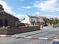
 St Stephen's Church, Acomb, York (12th June 2013) 001.JPG 2,176 × 3,872; 2.83 MB
-
 St Stephen's Church, Acomb, York (12th June 2013) 005.JPG 3,872 × 2,176; 2.69 MB
-
 St Stephen's Church, Acomb, York (12th June 2013) 006.JPG 2,176 × 3,872; 2.23 MB
-
 Alexander Snee Vehicles, Holgate Road, York (12th June 2013).JPG 3,872 × 2,176; 1.48 MB
-
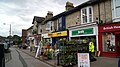
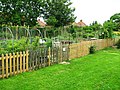 Allotment Gargens, Haxby Road - geograph.org.uk - 3525593.jpg 640 × 480; 131 KB
-
 Along the floodbank - geograph.org.uk - 3502340.jpg 640 × 427; 74 KB
-

-
 Apollo Stage - geograph.org.uk - 3534532.jpg 640 × 427; 88 KB
-
 Approach to golf course bridge over A64 - panoramio.jpg 2,560 × 1,920; 1.99 MB
-
 Argos, Piccadilly, York (12th June 2013).JPG 3,872 × 2,176; 2.39 MB
-
 Artful Dodger, Micklegate, York (12th June 2013).JPG 2,176 × 3,872; 1.57 MB
-
 Bay Horse, The Mount, York (12th June 2013) 001.jpg 3,872 × 2,176; 1.4 MB
-
 Bay Horse, The Mount, York (12th June 2013) 002.JPG 3,872 × 2,176; 1.55 MB
-
 Bicycles at York Station - geograph.org.uk - 3501015.jpg 640 × 427; 115 KB
-
 Bicycles in York station - geograph.org.uk - 3530483.jpg 4,608 × 2,860; 5.07 MB
-
 Big hole - geograph.org.uk - 3489402.jpg 640 × 427; 108 KB
-
 Blockbuster, York Road, Acomb, York (12th June 2013).JPG 2,176 × 2,584; 908 KB
-
 Boots the Chemist, Coney Street, York (12th June 2013).JPG 3,768 × 1,972; 1.95 MB
-
 Boots the Chemist, Front Street, Acomb, York (12th June 2013).JPG 2,176 × 3,872; 2.27 MB
-
 Bridge over the Derwent - geograph.org.uk - 3521884.jpg 640 × 427; 85 KB
-
 Bridleway - panoramio (1).jpg 1,920 × 2,560; 1.24 MB
-
 Bridleway - panoramio.jpg 1,920 × 2,560; 1.46 MB
-
 Bridleway approaching Gipsey Corner - geograph.org.uk - 3521833.jpg 427 × 640; 93 KB
-
 Bridleway at Crockey Hill - geograph.org.uk - 3521896.jpg 640 × 427; 78 KB
-
 Brigantes, Micklegate, York (12th June 2013).JPG 3,872 × 2,176; 1.75 MB
-
 Britannia, The Green, Acomb, York (12th June 2013).JPG 3,872 × 2,176; 2.67 MB
-
 Cars wait on Holgate Road, York (12th June 2013).JPG 3,872 × 2,176; 2.52 MB
-
 Clifton Park - geograph.org.uk - 3534522.jpg 640 × 427; 102 KB
-
 Co-op, York Road, Acomb, York (12th June 2013).JPG 3,872 × 1,815; 1.14 MB
-
 Construction and Water World - geograph.org.uk - 3489407.jpg 640 × 427; 111 KB
-
 Construction site from Jockey Lane - geograph.org.uk - 3489410.jpg 640 × 427; 68 KB
-
 Construction site near the Park and Ride - geograph.org.uk - 3489403.jpg 640 × 427; 103 KB
-

-

-
 Crescent Working Mens' Club, The Crescent, York (12th June 2013).JPG 2,176 × 3,872; 1.48 MB
-
 Crystal Palace, Holgate Road, York (12th June 2013) 001.JPG 2,176 × 3,872; 1.41 MB
-
 Crystal Palace, Holgate Road, York (12th June 2013) 002.JPG 2,176 × 3,872; 1.08 MB
-
 Crystal Palace, Holgate Road, York (12th June 2013) 003.JPG 3,872 × 2,176; 3.44 MB
-
 Cut through - geograph.org.uk - 3501931.jpg 427 × 640; 91 KB
-
 Cycle path to Monks Cross - geograph.org.uk - 3489398.jpg 640 × 427; 99 KB
-
 Demolished Terry's Chocolate Factory - geograph.org.uk - 3525605.jpg 640 × 480; 71 KB
-
 Derwent looking downstream - geograph.org.uk - 3521886.jpg 640 × 427; 85 KB
-
 Farmland off Wheldrake Lane - geograph.org.uk - 3521835.jpg 640 × 427; 89 KB
-
 Flood meadows - geograph.org.uk - 3521879.jpg 640 × 427; 78 KB
-
 Floodbank - geograph.org.uk - 3501940.jpg 640 × 427; 79 KB
-
 From the floodbank - geograph.org.uk - 3502342.jpg 640 × 427; 77 KB
-
 Front Street, Acomb, York (12th June 2013) 001.JPG 3,872 × 2,176; 1.31 MB
-
 Front Street, Acomb, York (12th June 2013) 002.JPG 3,872 × 2,176; 1.33 MB
-
 Ghost train - geograph.org.uk - 3534514.jpg 640 × 427; 110 KB
-
 Halifax, Parliament Street, York (12th June 2013).JPG 2,176 × 3,872; 1.3 MB
-
 Halifax, York Road, Acomb, York (12th June 2013).JPG 3,872 × 2,176; 1.34 MB
-
 Hawkins Bazaar, High Ousegate, York (12th June 2013).JPG 2,176 × 3,872; 2.62 MB
-
 High Petergate with Bootham Bar, York, UK - panoramio (51).jpg 1,350 × 1,800; 595 KB
-
 High Petergate with Bootham Bar, York, UK - panoramio (52).jpg 2,400 × 1,800; 968 KB
-
 HMV, Coney Street, York (12th June 2013).JPG 3,872 × 2,176; 2.67 MB
-
 Holgate Bridge News, Food and Wine, Holgate Road, York (12th June 2013).JPG 2,176 × 3,872; 1.37 MB
-
 Holgate Methodist Church, Acomb Road, York (12th June 2013).JPG 3,872 × 2,176; 2 MB
-
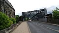 Holgate Road bridge, York (12th June 2013).JPG 3,872 × 2,176; 1.5 MB
-
 Holgate Road Tyres, York (12th June 2013).JPG 3,872 × 2,176; 1.53 MB
-
 Holgate Road, York (12th June 2013).JPG 3,872 × 2,176; 1.54 MB
-
 Holgate Villa, Holgate Road, York (12th June 2013).JPG 2,176 × 3,872; 1.53 MB
-
 Holgate WMC New Lane, York (12th June 2013) 002.JPG 3,872 × 2,176; 1.32 MB
-
 Houses on Sycamore Terrace - geograph.org.uk - 3502344.jpg 640 × 427; 117 KB
-
 Housing, Acomb Road, York (12th June 2013).JPG 2,176 × 3,872; 1.78 MB
-
 Jessops, Spurriergate, York (12th June 2013).JPG 3,872 × 2,176; 2.34 MB
-
 Jockey Lane - geograph.org.uk - 3489412.jpg 640 × 427; 80 KB
-
 Ken Spelman, Booksellers, Micklegate, York (12th June 2013).JPG 2,176 × 3,872; 1.77 MB
-
 Kings Arms from Ouse Bridge, York (12th June 2013).JPG 3,872 × 2,176; 3.6 MB
-
 La Senza and the Willow Restaurant, Coney Street, York (12th June 2013).jpg 2,176 × 3,872; 1.46 MB
-
 Lady Peckitt's Yard, York Geograph-3502353-by-DS-Pugh.jpg 427 × 640; 125 KB
-
 Leeds Building Society, York Road, Acomb, York (12th June 2013).JPG 2,176 × 3,872; 1.42 MB
-
 Level crossing at Common Road - geograph.org.uk - 3557921.jpg 4,608 × 3,456; 5.44 MB
-
 Level crossing, York Road - geograph.org.uk - 3557880.jpg 4,500 × 3,308; 4.32 MB
-
 Levi's shop, High Ousegate, York (12th June 2013).JPG 2,176 × 3,872; 2.28 MB
-

-
 Long Lane - geograph.org.uk - 3521826.jpg 427 × 640; 109 KB
-
 Looking towards York on the B1224 at Rufforth (12th June 2013).JPG 3,872 × 2,176; 1.43 MB
-
 Lower Derwent Valley Nature Reserve - geograph.org.uk - 3521847.jpg 640 × 427; 83 KB
-
 Main Street - geograph.org.uk - 3521837.jpg 640 × 427; 78 KB
-
 Marks & Spencer, Parliament Street, York (12th June 2013).JPG 3,872 × 2,176; 2.71 MB
-

-
 Melton College School of English, Holgate Road, York (12th June 2013).JPG 3,872 × 2,176; 1.79 MB
-
 Micklegate Bar, York (12th June 2013).JPG 3,872 × 2,176; 1.73 MB
-
 Micklegate Post Office, Micklegate, York (12th June 2013).JPG 2,176 × 3,872; 1.46 MB
-
 Micklegate Stray - geograph.org.uk - 5073032.jpg 1,024 × 768; 184 KB
-
 Music stage - geograph.org.uk - 3534518.jpg 640 × 427; 81 KB
-
 Nagshead, Micklegate, York (12th June 2013).JPG 2,176 × 3,872; 1.28 MB
-
 Nando's, High Ousegate, York (12th June 2013).JPG 2,176 × 3,872; 2.2 MB
-
 Nature reserve car park - geograph.org.uk - 3521871.jpg 640 × 427; 82 KB
-

-
 NRM York 20130617 130902 (49312599527).jpg 3,264 × 2,448; 1.33 MB
-
 NRM York 20130617 130932 (49311925698).jpg 3,264 × 2,448; 795 KB
-
 NRM York 20130617 142941 (49312634222).jpg 3,264 × 2,448; 1.62 MB
-
 NRM York 20130617 142951 (49311933553).jpg 3,264 × 2,448; 1.41 MB
-
 NRM York 20130617 151012 (49312435861).jpg 3,264 × 2,448; 1.12 MB
-
 NRM York 20130617 151025 (49312444541).jpg 3,264 × 2,448; 1.01 MB
-
 NRM York 20130620 113026 (49312641792).jpg 3,264 × 2,448; 1.03 MB
-
 NRM York 20130620 113638 (49312648437).jpg 3,264 × 2,448; 1.13 MB
-
 NRM York 20130620 113647 (49312441671).jpg 3,264 × 2,448; 1.19 MB
-
 NRM York 20130620 113657 (49312653192).jpg 3,264 × 2,448; 1.08 MB
-
 NRM York 20130620 113716 (49312449076).jpg 3,264 × 2,448; 1.16 MB
-
 Overgrown road - geograph.org.uk - 3521873.jpg 427 × 640; 107 KB
-
 Parish Church of All Saints Pavement, Coppergate, York (12th June 2013) 001.jpg 2,176 × 3,872; 1.18 MB
-
 Parish Church of All Saints Pavement, Coppergate, York (12th June 2013) 002.JPG 2,176 × 3,872; 2.11 MB
-
 Path to New Lane - geograph.org.uk - 3489399.jpg 640 × 427; 99 KB
-
 Peacocks, Front Street, Acomb, York (12th June 2013).JPG 2,176 × 3,872; 2.25 MB
-
 Pedestrian and cycle paths off Holgate Road, York (12th June 2013).JPG 3,872 × 2,176; 2.03 MB
-
 Power lines, Whiteland Field - geograph.org.uk - 3557830.jpg 4,524 × 3,340; 4.39 MB
-
 Public bridleway - panoramio (1).jpg 2,560 × 1,920; 2.19 MB
-
 Public footpath near Fulford Golf Club - panoramio (1).jpg 2,560 × 1,920; 1.93 MB
-
 Public footpath near Fulford Golf Club - panoramio.jpg 1,920 × 2,560; 2.41 MB
-
 Pylon along public bridleway - panoramio.jpg 1,920 × 2,560; 1.3 MB
-
 Railway works from Holgate Road, York (12th June 2013).JPG 3,872 × 1,804; 1.12 MB
-
 Rape off Greengales Lane - geograph.org.uk - 3521836.jpg 640 × 427; 75 KB
-
 Reel Cinema, The Mount, York (12th June 2013) 001.JPG 2,176 × 3,872; 1.97 MB
-
 Reel Cinema, The Mount, York (12th June 2013) 002.JPG 2,176 × 3,872; 2.48 MB
-
 Reel Cinema, The Mount, York (12th June 2013) 003.JPG 2,176 × 3,872; 1.99 MB
-
 River cruise boats, River Ouse, York - geograph.org.uk - 3490174.jpg 480 × 640; 78 KB
-
 River Ouse - geograph.org.uk - 3502346.jpg 640 × 427; 92 KB
-
 River Ouse looking downstream from Ouse Bridge, York (12th June 2013).JPG 3,872 × 1,519; 877 KB
-
 Rowing on the River Ouse seen from Ouse Bridge, York (12th June 2013).JPG 3,872 × 2,176; 3.46 MB
-
 Silver Star, Chiropodist and Spar, Acomb Road, York (12th June 2013).JPG 3,872 × 2,176; 1.45 MB
-
 St Helen's Square, York.jpg 4,913 × 3,456; 1.03 MB
-
 St Martin-le-Grand church, Coney Street, York (12th June 2013).JPG 2,176 × 3,872; 1.84 MB
-
 St Olaves School - geograph.org.uk - 3501945.jpg 640 × 427; 77 KB
-
 St Paul's Holgate, Holgate Road, York (12th June 2013).JPG 2,176 × 3,872; 1.17 MB
-
 St Paul's Lodge, Holgate Road, York (12th June 2013).JPG 2,176 × 3,872; 1.87 MB
-
 St Stephen's Church, Acomb, York (12th June 2013) 002.JPG 2,176 × 3,872; 2.11 MB
-
 St Stephen's Church, Acomb, York (12th June 2013) 003.JPG 2,176 × 3,872; 2.7 MB
-
 St Stephen's Church, Acomb, York (12th June 2013) 004.JPG 3,872 × 2,176; 2.83 MB
-
 The Black Swan, Peaseholme Green, York, UK - panoramio (81).jpg 2,400 × 1,800; 806 KB
-
 The Carlton Tavern, Acomb Road, York (12th June 2013) 001.JPG 3,872 × 2,176; 1.82 MB
-
 The Carlton Tavern, Acomb Road, York (12th June 2013) 002.JPG 3,872 × 2,176; 2.71 MB
-
 The Carlton Tavern, Acomb Road, York (12th June 2013) 003.JPG 3,872 × 2,176; 2.02 MB
-
 The Crescent, York (12th June 2013).JPG 3,872 × 2,176; 1.52 MB
-
 The Fox, Holgate Road, York (12th June 2013) 001.JPG 3,872 × 2,176; 1.75 MB
-
 The Fox, Holgate Road, York (12th June 2013) 002.JPG 2,176 × 3,872; 1.46 MB
-
 The Fox, Holgate Road, York (12th June 2013) 003.JPG 2,176 × 3,872; 2.92 MB
-
 The Fox, Holgate Road, York (12th June 2013) 004.JPG 3,872 × 2,176; 2.49 MB
-
 The Fox, Holgate Road, York (12th June 2013) 005.JPG 3,872 × 2,176; 2.15 MB
-
 The Green, Acomb (12th June 2013).JPG 3,872 × 2,176; 2.59 MB
-
 The Priory, Micklegate, York (12th June 2013).JPG 3,872 × 2,176; 1.47 MB
-
-
 The River Foss - geograph.org.uk - 3557853.jpg 4,608 × 3,456; 5.95 MB
-
 The Six Bells at Strensall (geograph 3525815).jpg 1,024 × 768; 245 KB
-
 The Six Bells at Strensall - geograph.org.uk - 3525818.jpg 768 × 1,024; 233 KB
-
 The Sun Inn, The Green, Acomb, York (12th June 2013) 001.JPG 2,176 × 3,872; 2 MB
-
 The Sun Inn, The Green, Acomb, York (12th June 2013) 002.JPG 3,872 × 2,176; 2.28 MB
-

-
 Three Tuns, Coppergate, York (12th June 2013).JPG 2,176 × 3,872; 2.03 MB
-
 Traffic at A64 Junction.jpg 2,560 × 1,920; 2.09 MB
-
 Train for Doncaster - geograph.org.uk - 3501018.jpg 640 × 427; 108 KB
-
 Tree boundary - geograph.org.uk - 3521828.jpg 640 × 427; 83 KB
-
 Two A4s - geograph.org.uk - 3489394.jpg 640 × 277; 89 KB
-
 Upstream on the Derwent - geograph.org.uk - 3521885.jpg 640 × 427; 88 KB
-
 View across fields along public bridleway - panoramio.jpg 2,560 × 1,920; 1.39 MB
-
 Volunteer Arms, Watson Street, York (12th June 2013) 001.jpg 3,872 × 2,176; 1.56 MB
-
 Volunteer Arms, Watson Street, York (12th June 2013) 002.JPG 3,872 × 2,176; 1.53 MB
-
 Volunteer Arms, Watson Street, York (12th June 2013) 003.JPG 2,176 × 3,872; 1.17 MB
-
 Volunteer Arms, Watson Street, York (12th June 2013) 004.JPG 2,176 × 3,872; 2.03 MB
-
 Waterstones, High Ousegate, York (12th June 2013).JPG 3,872 × 2,176; 1.41 MB
-
 Wetherby Road, Rufforth, North Yorkshire (12th June 2013).JPG 2,176 × 3,872; 1.88 MB
-
 WH Smith, Coney Street, York (12th June 2013).JPG 3,872 × 2,176; 1.49 MB
-
 Wheldrake Ings - geograph.org.uk - 3521877.jpg 640 × 427; 83 KB
-

-
 Woodsmill Quay seen from Ouse Bridge, York (12th June 2013).JPG 3,872 × 2,176; 2.46 MB
-
 York 'beach'. Under Ouse bridge - geograph.org.uk - 3490138.jpg 480 × 640; 75 KB
-
 York Baptist Church, Priory Street, York (12th June 2013).JPG 3,872 × 2,176; 1.37 MB
-
 York Bridge Centre, Holgate Road, York (12th June 2013).JPG 3,872 × 2,176; 1.9 MB
-
 York Labour Party, Holgate Road, York (12th June 2013).JPG 2,176 × 3,872; 1.33 MB
-
 York Minster - June 2013 - Ceiling of the Central Tower.jpg 3,606 × 2,680; 3.08 MB
-
 York Pullman 318 FFK312 (9125715405).jpg 3,424 × 2,568; 3.33 MB
-
 York Road at Haxby Gates - geograph.org.uk - 3557783.jpg 4,608 × 3,456; 5.83 MB
-
 York Road, Acomb, York (12th June 2013).JPG 3,872 × 2,176; 1.51 MB
-
 York Station - geograph.org.uk - 3500580.jpg 640 × 427; 127 KB
-
 York, UK - panoramio (15).jpg 1,350 × 1,800; 735 KB
-
 York, UK - panoramio (17).jpg 2,400 × 1,800; 1.11 MB
-
 York, UK - panoramio (18).jpg 2,400 × 1,800; 1.04 MB
-
 York, UK - panoramio (20).jpg 2,400 × 1,800; 571 KB
-
 York, UK - panoramio (22).jpg 2,400 × 1,800; 978 KB
-
 York, UK - panoramio (25).jpg 2,400 × 1,800; 1.2 MB
-
 York, UK - panoramio (28).jpg 1,350 × 1,800; 800 KB
-
 York, UK - panoramio (32).jpg 2,400 × 1,800; 1.1 MB
-
 York, UK - panoramio (41).jpg 2,400 × 1,800; 1.03 MB
-
 York, UK - panoramio (45).jpg 2,400 × 1,800; 929 KB
-
 York, UK - panoramio (46).jpg 2,400 × 1,800; 850 KB
-
 York, UK - panoramio (47).jpg 2,400 × 1,800; 840 KB
-
 York, UK - panoramio (48).jpg 2,400 × 1,800; 923 KB
-
 York, UK - panoramio (49).jpg 2,400 × 1,800; 1.18 MB
-
 York, UK - panoramio (50).jpg 2,400 × 1,800; 891 KB
-
 York, UK - panoramio (54).jpg 2,400 × 1,800; 965 KB
-
 York, UK - panoramio (57).jpg 1,350 × 1,800; 528 KB
-
 York, UK - panoramio (59).jpg 2,400 × 1,800; 875 KB
-
 York, UK - panoramio (70).jpg 2,400 × 1,800; 903 KB
-
 York, UK - panoramio (72).jpg 1,350 × 1,800; 561 KB
-
 York, UK - panoramio (76).jpg 2,400 × 1,800; 875 KB
.JPG)
.JPG)
.JPG)
.JPG)
_001.JPG)
_005.JPG)
_006.JPG)
.JPG)


.JPG)
.JPG)
_001.jpg)
_002.JPG)


.JPG)
.JPG)
.JPG)

.jpg)


.JPG)
.JPG)
.JPG)

.JPG)


.JPG)
_001.JPG)
_002.JPG)
_003.JPG)


_001.JPG)
_002.JPG)

.JPG)
.JPG)
.JPG)
.jpg)
.jpg)
.JPG)
.JPG)
.JPG)
.JPG)
.JPG)
.JPG)
.JPG)
_002.JPG)

.JPG)
.JPG)

.JPG)
.JPG)
.jpg)

.JPG)


.JPG)


.JPG)


.JPG)
.jpg)
.JPG)
.JPG)
.JPG)


.JPG)
.JPG)


.jpg)
.jpg)
.jpg)
.jpg)
.jpg)
.jpg)
.jpg)
.jpg)
.jpg)
.jpg)
.jpg)

_001.jpg)
_002.JPG)

.JPG)
.JPG)

.jpg)
.jpg)


.JPG)

_001.JPG)
_002.JPG)
_003.JPG)


.JPG)
.JPG)

.JPG)

.JPG)
.JPG)
_002.JPG)
_003.JPG)
_004.JPG)
.jpg)
_001.JPG)
_002.JPG)
_003.JPG)
.JPG)
_001.JPG)
_002.JPG)
_003.JPG)
_004.JPG)
_005.JPG)
.JPG)
.JPG)
.JPG)

.jpg)

_001.JPG)
_002.JPG)

.JPG)


_001.jpg)
_002.JPG)
_003.JPG)
_004.JPG)
.JPG)
.JPG)
.JPG)


.JPG)

.JPG)
.JPG)
.JPG)

.jpg)

.JPG)

.jpg)
.jpg)
.jpg)
.jpg)
.jpg)
.jpg)
.jpg)
.jpg)
.jpg)
.jpg)
.jpg)
.jpg)
.jpg)
.jpg)
.jpg)
.jpg)
.jpg)
.jpg)
.jpg)
.jpg)
.jpg)
.JPG)