Category:June 2010 in Argyll and Bute
Jump to navigation
Jump to search
Council areas (municipalities) of Scotland: Aberdeen · Argyll and Bute · Dumfries and Galloway · Edinburgh · Glasgow · Highland ·
Deutsch: Bilder, die im Juni 2010 in Argyll and Bute aufgenommen worden sind. Bitte beachten Sie, dass dies weder das Datum des Uploads noch das Datum des Scannens eines Fotos ist.
English: Images/pictures taken in Argyll and Bute during June 2010. Note this is not the date of the upload, nor the date a photo was scanned.
Español: Fotografías o imágenes tomadas en Argyll and Bute durante junio 2010. No es la fecha de subida ni escaneo, sino la fecha en que las fotografías o imágenes se crearon.
Esperanto: Bildoj faritaj en Argyll and Bute en junio 2010. Tio ne estas la dato, kiam la bildoj estis alŝutitaj aŭ skanitaj.
Français : Photographies ou images prises en Argyll and Bute durant juin 2010. Ce n'est pas la date du téléchargement ou du scan.
Galego: Fotografías ou imaxes tomadas en Argyll and Bute durante xuño 2010. Non é a data de subida nin escaneamento, senón a data na que se crearon as fotografías ou imaxes.
Italiano: Fotografie o immagini scattate a Argyll and Bute nel giugno 2010. Nota bene: la data non si riferisce né a quella di upload né a quella in cui la foto è stata digitalizzata.
Norsk bokmål: Bilder tatt i Argyll and Bute i løpet av juni 2010. Merk at dette ikke er datoen for opplasting, eller når et bilde har blitt skannet.
Norsk nynorsk: Bilete teke i Argyll and Bute i løpet av juni 2010. Merk at dette ikkje er datoen for opplasting, eller når eit bilete har vorte skanna.
Русский: Изображения, сделанные в Argyll and Bute в течение июнь 2010 (не дата загрузки изображения).
Українська: Зображення, зроблені в Argyll and Bute протягом червень 2010. Зауважте, що це не дата завантаження чи дата сканування фотографії.
| June 2009 | ← | June 2010 | → | June 2011 | |||||||
| Jan | Feb | Mar | Apr | May | Jun | Jul | Aug | Sep | Oct | Nov | Dec |
| 9 | 15 | 15 | 62 | 8 | 36 | 3 | 15 | 3 | 11 | 0 | 13 |
|---|---|---|---|---|---|---|---|---|---|---|---|
Media in category "June 2010 in Argyll and Bute"
The following 36 files are in this category, out of 36 total.
-
 Bullwood Quarry development - geograph.org.uk - 1968845.jpg 3,648 × 2,178; 1.6 MB
-
 Coast Guard (CHC Scotia) Sikorsky S-92A.jpg 1,600 × 1,067; 521 KB
-
 Colonsay banner House.JPG 2,800 × 400; 232 KB
-
 Colonsay House.JPG 2,816 × 2,112; 1.35 MB
-
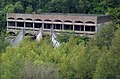 Distant Exterior View of Seminary.jpg 2,985 × 1,968; 6.51 MB
-
 Dunoon East Bay - geograph.org.uk - 1965474.jpg 3,638 × 1,976; 1.67 MB
-
 Dunoon Pier - geograph.org.uk - 1965461.jpg 3,648 × 2,012; 1.5 MB
-
 Dunoon Reservoir - geograph.org.uk - 1917323.jpg 1,600 × 1,200; 301 KB
-
 Dunoon Reservoir And Surrounding Forestry - geograph.org.uk - 1917341.jpg 1,200 × 1,600; 610 KB
-
 Exterior View of seminary.jpg 3,072 × 2,048; 5.93 MB
-
 Ferry into Hunters Quay, by Dunoon - geograph.org.uk - 1951986.jpg 640 × 480; 78 KB
-
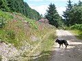
 Finart Bay - geograph.org.uk - 1917651.jpg 1,200 × 1,600; 488 KB
-
 Firebreak in the forest - geograph.org.uk - 1935429.jpg 3,648 × 2,736; 2.08 MB
-
 Forest edge on Kilmun Hill - geograph.org.uk - 1935442.jpg 3,648 × 2,736; 2.26 MB
-
 Forestry road Strone - geograph.org.uk - 1935406.jpg 3,648 × 2,736; 2.32 MB
-
 Forestry road Strone - geograph.org.uk - 1935410.jpg 3,648 × 2,736; 2.28 MB
-
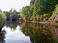 Glen Finart Burn - geograph.org.uk - 1917660.jpg 1,600 × 1,200; 621 KB
-
 Glen Finart Burn Mouth - geograph.org.uk - 1917670.jpg 1,600 × 1,200; 320 KB
-
 Higher Interior View of Seminary.jpg 3,072 × 2,048; 5.7 MB
-
 Interior View of Seminary.jpg 3,072 × 2,048; 5.12 MB
-
 Lower slopes of Kilmun Hill shown as 449m on O.S. map - geograph.org.uk - 1935439.jpg 3,648 × 2,736; 2.12 MB
-
 Maersk Boston Container Ship - Port Detail - geograph.org.uk - 1917404.jpg 1,200 × 1,600; 464 KB
-
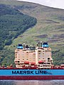
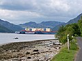
 Maersk Container Ships - geograph.org.uk - 1917376.jpg 1,600 × 1,200; 483 KB
-
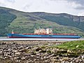
 Maersk Container Ships In Loch Striven - geograph.org.uk - 1917442.jpg 1,600 × 1,200; 407 KB
-
 Maersk Container Ships In Loch Striven - geograph.org.uk - 1917504.jpg 1,600 × 1,200; 473 KB
-
 Moorland Above Glen Finart - geograph.org.uk - 1917684.jpg 1,200 × 1,600; 486 KB
-
 Old boundary wall below Strone Hill - geograph.org.uk - 1935415.jpg 3,648 × 2,736; 2.1 MB
-
 Rhodos Colonsay house.JPG 2,816 × 2,112; 1.37 MB
-
 Shepherd's Point - geograph.org.uk - 1917641.jpg 1,600 × 1,200; 397 KB
-
 Structural View.jpg 2,048 × 3,072; 5.04 MB
-
 The Gantocks Rocks and lighthouse - geograph.org.uk - 1965464.jpg 3,646 × 2,102; 1.39 MB
-
 Trig Point Strone Hill - geograph.org.uk - 1935419.jpg 3,648 × 2,736; 2.27 MB
-
 Trig point Strone hill - geograph.org.uk - 1935426.jpg 3,648 × 2,736; 2.05 MB
-
 View of Prayer Areas.jpg 1,875 × 1,351; 2.29 MB
-
 View of Seminary Altar.jpg 3,072 × 2,048; 3.43 MB
-
 View Through Seminary.jpg 2,667 × 1,842; 2.05 MB

_Sikorsky_S-92A.jpg)


