Category:June 2008 in North Yorkshire
Jump to navigation
Jump to search
Deutsch: Bilder, die im Juni 2008 in North Yorkshire aufgenommen worden sind. Bitte beachten Sie, dass dies weder das Datum des Uploads noch das Datum des Scannens eines Fotos ist.
English: Images/pictures taken in North Yorkshire during June 2008. Note this is not the date of the upload, nor the date a photo was scanned.
Español: Fotografías o imágenes tomadas en North Yorkshire durante junio 2008. No es la fecha de subida ni escaneo, sino la fecha en que las fotografías o imágenes se crearon.
Esperanto: Bildoj faritaj en North Yorkshire en junio 2008. Tio ne estas la dato, kiam la bildoj estis alŝutitaj aŭ skanitaj.
Français : Photographies ou images prises en North Yorkshire durant juin 2008. Ce n'est pas la date du téléchargement ou du scan.
Galego: Fotografías ou imaxes tomadas en North Yorkshire durante xuño 2008. Non é a data de subida nin escaneamento, senón a data na que se crearon as fotografías ou imaxes.
Italiano: Fotografie o immagini scattate a North Yorkshire nel giugno 2008. Nota bene: la data non si riferisce né a quella di upload né a quella in cui la foto è stata digitalizzata.
Norsk bokmål: Bilder tatt i North Yorkshire i løpet av juni 2008. Merk at dette ikke er datoen for opplasting, eller når et bilde har blitt skannet.
Norsk nynorsk: Bilete teke i North Yorkshire i løpet av juni 2008. Merk at dette ikkje er datoen for opplasting, eller når eit bilete har vorte skanna.
Русский: Изображения, сделанные в North Yorkshire в течение июнь 2008 (не дата загрузки изображения).
Українська: Зображення, зроблені в North Yorkshire протягом червень 2008. Зауважте, що це не дата завантаження чи дата сканування фотографії.
| June 2007 | ← | June 2008 | → | June 2009 | |||||||
| Jan | Feb | Mar | Apr | May | Jun | Jul | Aug | Sep | Oct | Nov | Dec |
| 133 | 133 | 124 | 106 | 170 | 192 | 124 | 157 | 83 | 58 | 93 | 52 |
|---|---|---|---|---|---|---|---|---|---|---|---|
Subcategories
This category has only the following subcategory.
Y
Media in category "June 2008 in North Yorkshire"
The following 191 files are in this category, out of 191 total.
-
 Matthew Wilson - geograph.org.uk - 843395.jpg 638 × 480; 128 KB
-
 Thirsk Station - geograph.org.uk - 851104.jpg 640 × 480; 93 KB
-
 37248 Loch Arkaig - geograph.org.uk - 853819.jpg 640 × 427; 256 KB
-
 A distant view of Ingleborough - geograph.org.uk - 1115147.jpg 640 × 427; 339 KB
-

-
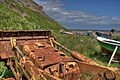
 Abandoned Bulldozer, Port Mulgrave - geograph.org.uk - 857698.jpg 640 × 427; 222 KB
-
 Abandoned Bulldozer, Port Mulgrave - geograph.org.uk - 857704.jpg 640 × 427; 264 KB
-
 Aysgarth railway station (site), Yorkshire (geograph 3268226).jpg 1,024 × 768; 259 KB
-
 Band Stand - geograph.org.uk - 930516.jpg 640 × 480; 81 KB
-
 Barn, Near Cuckoo Hill - geograph.org.uk - 839276.jpg 640 × 427; 282 KB
-
 Beck - geograph.org.uk - 863429.jpg 640 × 480; 79 KB
-
 Beck - Main Street, Pannal - geograph.org.uk - 859235.jpg 640 × 577; 386 KB
-
 Belle Vue Mills - geograph.org.uk - 843280.jpg 640 × 480; 112 KB
-
 Beulah Street - geograph.org.uk - 859393.jpg 640 × 480; 222 KB
-
 Black Bull - geograph.org.uk - 848629.jpg 640 × 480; 73 KB
-
 Blacksmiths Arms - geograph.org.uk - 849777.jpg 640 × 480; 81 KB
-
 Bleaberry Beck ford - geograph.org.uk - 849261.jpg 480 × 640; 97 KB
-
 Bleaberry Gill - geograph.org.uk - 838534.jpg 640 × 427; 338 KB
-
 Bleaberry Gill - geograph.org.uk - 848206.jpg 640 × 480; 80 KB
-
 Bold Venture Street, Skipton - geograph.org.uk - 848449.jpg 640 × 480; 110 KB
-

-
 Brewery Swing Bridge - geograph.org.uk - 843287.jpg 640 × 480; 117 KB
-
 Bridge - geograph.org.uk - 863440.jpg 640 × 480; 89 KB
-
 Bridge Cottage - geograph.org.uk - 843150.jpg 640 × 427; 77 KB
-

-
 Buttercup Field - geograph.org.uk - 831238.jpg 640 × 427; 95 KB
-
 Calcining Kilns, East Rosedale Mine - geograph.org.uk - 847426.jpg 640 × 427; 210 KB
-

-
 Christ Church - geograph.org.uk - 861000.jpg 640 × 421; 53 KB
-
 Cleveland Way - geograph.org.uk - 836463.jpg 640 × 480; 52 KB
-
 Cleveland Way Staithes - geograph.org.uk - 1558013.jpg 640 × 480; 107 KB
-
 Co-op store, Gargrave, Yorkshire - geograph.org.uk - 879299.jpg 640 × 421; 64 KB
-

-
 Cottage Overlooking Fore Gill - geograph.org.uk - 837368.jpg 640 × 427; 76 KB
-
 Cottages in Westerdale - geograph.org.uk - 831374.jpg 640 × 427; 124 KB
-
 Crosby Road - geograph.org.uk - 865287.jpg 640 × 427; 216 KB
-
 Cutting the Silage - geograph.org.uk - 865324.jpg 640 × 427; 255 KB
-
 Dales Cottage Cafe - geograph.org.uk - 843406.jpg 640 × 480; 125 KB
-
 Dismantled Railway - geograph.org.uk - 837528.jpg 640 × 427; 104 KB
-
 Disused Shaft, Wenshaw Bottom - geograph.org.uk - 837354.jpg 640 × 427; 280 KB
-
 Drury Lane - Spacey Houses - geograph.org.uk - 859210.jpg 640 × 480; 245 KB
-
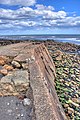
 Dulcey Dock - geograph.org.uk - 835224.jpg 640 × 480; 196 KB
-
 East and North Yorkshire - geograph.org.uk - 835256.jpg 640 × 313; 188 KB
-
 East tower of Helmsley Castle - geograph.org.uk - 2167242.jpg 2,560 × 1,920; 1,013 KB
-
 East tower of Helmsley Castle - geograph.org.uk - 2167266.jpg 2,560 × 1,920; 966 KB
-
 Fell Lane and a sheepfold - geograph.org.uk - 863370.jpg 640 × 480; 204 KB
-
 Fence Post, Flincher Gill - geograph.org.uk - 838643.jpg 640 × 427; 365 KB
-
 Field Gate - geograph.org.uk - 844027.jpg 640 × 427; 78 KB
-
 Finkle Street - geograph.org.uk - 848607.jpg 640 × 480; 85 KB
-
 Fishermen's Huts, Port Mulgrave - geograph.org.uk - 855852.jpg 640 × 427; 248 KB
-
 Fishermen's Huts, Port Mulgrave - geograph.org.uk - 855855.jpg 427 × 640; 252 KB
-
 Fishermen's Huts, Port Mulgrave - geograph.org.uk - 857724.jpg 640 × 427; 261 KB
-
 Fishermen's Huts, Port Mulgrave - geograph.org.uk - 857728.jpg 427 × 640; 270 KB
-
 Fly Camping at Force Gill Gate - geograph.org.uk - 837361.jpg 640 × 427; 273 KB
-
 Footbridge Over Scugdale Beck - geograph.org.uk - 849345.jpg 640 × 427; 259 KB
-
 Footpath - Leadhall Lane - geograph.org.uk - 859341.jpg 551 × 640; 363 KB
-
 Footpath Alongside Slei Gill - geograph.org.uk - 839220.jpg 640 × 427; 341 KB
-
 Footpath and Meadow - geograph.org.uk - 835830.jpg 640 × 452; 110 KB
-
 Footpath Below Nova Scotia - geograph.org.uk - 839491.jpg 640 × 427; 307 KB
-
 Footpath north west of Buckden - geograph.org.uk - 834628.jpg 640 × 480; 152 KB
-
 Footpath Sign, Holly Bush Farm - geograph.org.uk - 846556.jpg 640 × 427; 264 KB
-
 Footpath to Hawes - geograph.org.uk - 857181.jpg 640 × 480; 99 KB
-
 Footpath to Stoupe Beck Sands - geograph.org.uk - 836412.jpg 480 × 640; 148 KB
-
 Fore Gill - geograph.org.uk - 839207.jpg 640 × 427; 313 KB
-
 Former Lead Workings at Bleaberry Gill - geograph.org.uk - 837351.jpg 640 × 427; 265 KB
-
 Former Lead Workings at Bleaberry Gill - geograph.org.uk - 839197.jpg 640 × 427; 345 KB
-
 Former Lead Workings at Bleaberry Gill - geograph.org.uk - 839201.jpg 640 × 427; 326 KB
-
 Former Lead Workings at Fore Gill - geograph.org.uk - 837363.jpg 640 × 427; 281 KB
-
 Former Northallerton Grammar School - geograph.org.uk - 864097.jpg 640 × 427; 223 KB
-
 Former Police Station - geograph.org.uk - 849367.jpg 640 × 427; 202 KB
-
 Former Rosedale Goods Depot - geograph.org.uk - 847347.jpg 640 × 427; 204 KB
-
 The 'Fountaine' Inn, Linton, Yorkshire - geograph.org.uk - 879350.jpg 640 × 446; 108 KB
-
 Foxgloves at Fisher Green - geograph.org.uk - 842623.jpg 640 × 446; 114 KB
-
 Friday Market - geograph.org.uk - 843341.jpg 640 × 480; 113 KB
-
 Gargrave Post Office - geograph.org.uk - 879293.jpg 640 × 473; 78 KB
-
 Gate and Footpath - geograph.org.uk - 840666.jpg 400 × 600; 257 KB
-
 Gate and lambs alongside Fell Lane - geograph.org.uk - 862286.jpg 640 × 480; 208 KB
-
 Gate in wall. - geograph.org.uk - 1105871.jpg 640 × 480; 65 KB
-
 Gate into Easby Park Stable - geograph.org.uk - 832221.jpg 640 × 480; 107 KB
-
 Gate on Cow Close Fell - geograph.org.uk - 856855.jpg 640 × 480; 54 KB
-
 Going nowhere - geograph.org.uk - 857162.jpg 640 × 480; 106 KB
-
 Grouse Butts above Bleaberry Gill - geograph.org.uk - 848225.jpg 640 × 480; 61 KB
-
 Hallikeld Plantation - geograph.org.uk - 841284.jpg 640 × 427; 54 KB
-
 Hambleton Street - geograph.org.uk - 862556.jpg 640 × 480; 242 KB
-
 Hambleton Street - geograph.org.uk - 862692.jpg 640 × 480; 251 KB
-
 St Mark's Church - Leeds Road - geograph.org.uk - 859368.jpg 640 × 431; 188 KB
-
 Hawes Post Office - geograph.org.uk - 857157.jpg 640 × 480; 82 KB
-
 Haytime in Farndale - geograph.org.uk - 1038362.jpg 640 × 480; 79 KB
-
 Holy Trinity Church, Cowling - geograph.org.uk - 862728.jpg 640 × 480; 95 KB
-
 Hood Hill - geograph.org.uk - 863200.jpg 640 × 421; 57 KB
-
 Horses near Stamford Bridge - geograph.org.uk - 189531.jpg 640 × 479; 43 KB
-
 Huthwaite Green, Scugdale - geograph.org.uk - 849362.jpg 640 × 427; 197 KB
-
 Huthwaite Green, Scugdale - geograph.org.uk - 849363.jpg 640 × 427; 212 KB
-
 Ingleborough Summit Cairn and Trig Point - geograph.org.uk - 1116844.jpg 640 × 427; 331 KB
-
 Iron Calcining Kilns, Rosedale East Mine - geograph.org.uk - 847410.jpg 640 × 427; 282 KB
-
 JCB Fastrac, Claas Jaguar, Elvington 2008.jpg 3,264 × 2,448; 511 KB
-
 Junction - geograph.org.uk - 827964.jpg 640 × 480; 34 KB
-
 Leeds and Liverpool Canal - geograph.org.uk - 843284.jpg 640 × 480; 107 KB
-
 Leeds and Liverpool Canal, Skipton - geograph.org.uk - 848370.jpg 640 × 480; 133 KB
-
 Leeds and Liverpool Canal, Skipton - geograph.org.uk - 848398.jpg 640 × 480; 116 KB
-

-
 Limestone pavement and a lonely tree - geograph.org.uk - 857560.jpg 640 × 480; 74 KB
-
 Low Bridge - geograph.org.uk - 831146.jpg 640 × 427; 119 KB
-
 Market Day - geograph.org.uk - 843346.jpg 640 × 480; 120 KB
-
 Markington Beck - geograph.org.uk - 831185.jpg 640 × 427; 125 KB
-
 Markington Grange - geograph.org.uk - 831205.jpg 640 × 427; 67 KB
-
 Methodist Church, Filey.jpg 480 × 640; 184 KB
-
 Meugher West Summit - geograph.org.uk - 856803.jpg 640 × 480; 73 KB
-
 Middleton from the Pennine Way - geograph.org.uk - 864963.jpg 640 × 480; 90 KB
-
 Milepost - Mount Street, Leeds Road - geograph.org.uk - 859353.jpg 640 × 526; 253 KB
-
 Mobile Post Office - geograph.org.uk - 848566.jpg 640 × 480; 72 KB
-
 Narrow street in Robin Hood's Bay - geograph.org.uk - 836492.jpg 480 × 640; 83 KB
-
 NYMR steam train - geograph.org.uk - 930544.jpg 640 × 480; 83 KB
-
 NYMR steam train - geograph.org.uk - 930553.jpg 640 × 480; 91 KB
-
 Oatlands Mount Post Office - Leeds Road - geograph.org.uk - 859351.jpg 479 × 640; 283 KB
-

-
 Otley Street - geograph.org.uk - 843330.jpg 640 × 479; 129 KB
-
 Outside Rackhams - geograph.org.uk - 843336.jpg 640 × 480; 121 KB
-
 Pannal railway station in 2008.jpg 640 × 496; 266 KB
-
 Pork Pies - geograph.org.uk - 843297.jpg 640 × 480; 144 KB
-
 Port Mulgrave - geograph.org.uk - 855834.jpg 640 × 427; 258 KB
-
 Port Mulgrave - geograph.org.uk - 855843.jpg 640 × 427; 233 KB
-
 Port Mulgrave - geograph.org.uk - 855851.jpg 640 × 427; 275 KB
-
 Port Mulgrave - geograph.org.uk - 857712.jpg 427 × 640; 268 KB
-
 Port Mulgrave - geograph.org.uk - 857731.jpg 640 × 427; 240 KB
-
 Port Mulgrave abandoned mine - geograph.org.uk - 1082270.jpg 634 × 419; 151 KB
-
 Port Mulgrave mine - geograph.org.uk - 1082262.jpg 640 × 426; 172 KB
-
 Port Mulgrave portal - geograph.org.uk - 1082264.jpg 640 × 426; 122 KB
-
 Port Mulgrave roof collapse - geograph.org.uk - 1082267.jpg 640 × 426; 183 KB
-
 Power lines near the A19 - geograph.org.uk - 836298.jpg 640 × 427; 56 KB
-
 RAF Menwith Hill 1.jpg 2,592 × 1,944; 745 KB
-
 RAF Menwith Hill 2 excerpt.jpg 1,879 × 746; 107 KB
-
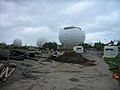 RAF Menwith Hill 2.jpg 2,592 × 1,944; 454 KB
-
 River Doe nr Ingleton - geograph.org.uk - 1122317.jpg 640 × 427; 75 KB
-
 Rope coil, Staithes harbour - geograph.org.uk - 849530.jpg 640 × 480; 141 KB
-
 Rosedale East Mine - geograph.org.uk - 849622.jpg 640 × 427; 279 KB
-
 Royal Crescent - geograph.org.uk - 859371.jpg 640 × 478; 265 KB
-
 Settrington Station - geograph.org.uk - 1401115.jpg 640 × 482; 81 KB
-
 Settrington Station - geograph.org.uk - 1401120.jpg 640 × 482; 103 KB
-
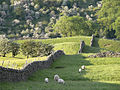 Sheep and May, Arkengarthdale.jpg 653 × 490; 295 KB
-
 Sheepfold by Fell Lane - geograph.org.uk - 855910.jpg 640 × 480; 183 KB
-
 Sheepfold by the B6255 - geograph.org.uk - 857060.jpg 640 × 480; 179 KB
-
 Sheepfold on Surrender Ground - geograph.org.uk - 848204.jpg 640 × 480; 84 KB
-
 Sign at Beck Hole.jpg 2,400 × 1,800; 2.95 MB
-

-
 Skinningrove and Hummersea Scar - geograph.org.uk - 1210386.jpg 640 × 480; 60 KB
-
 Skipton High Street - geograph.org.uk - 843354.jpg 640 × 480; 117 KB
-
 Skipton Holy Trinity - geograph.org.uk - 843318.jpg 640 × 480; 130 KB
-
 Sleights Pasture Rocks - geograph.org.uk - 849505.jpg 640 × 480; 95 KB
-
 Speeton Sands - geograph.org.uk - 834111.jpg 640 × 398; 104 KB
-
 Springs Junction - geograph.org.uk - 843239.jpg 640 × 478; 110 KB
-
 St Leonard's Church, Burton Leonard - geograph.org.uk - 842433.jpg 640 × 480; 61 KB
-
 St Robert's Church - Main Street, Pannal - geograph.org.uk - 859242.jpg 640 × 471; 212 KB
-

-
 St Stephens - geograph.org.uk - 843292.jpg 640 × 480; 126 KB
-
 Staithes - geograph.org.uk - 849508.jpg 640 × 480; 186 KB
-
 Static Caravan Site - geograph.org.uk - 839216.jpg 640 × 427; 302 KB
-
 Station House - geograph.org.uk - 851150.jpg 640 × 480; 86 KB
-
 Stepping Stones, Scugdale Beck - geograph.org.uk - 849302.jpg 640 × 427; 286 KB
-
 Stream at Wetshaw Bottom - geograph.org.uk - 837290.jpg 640 × 427; 271 KB
-
 Tap and Spile - Tower Street - geograph.org.uk - 859381.jpg 640 × 516; 246 KB
-

-
 The end of Speeton Sands - geograph.org.uk - 835206.jpg 480 × 640; 171 KB
-
 The Headland Way - geograph.org.uk - 835190.jpg 538 × 640; 234 KB
-
 The Headland Way - geograph.org.uk - 835250.jpg 640 × 416; 207 KB
-
 The old railway line at Wath - geograph.org.uk - 847847.jpg 640 × 480; 62 KB
-

-
 Thirsk Station - geograph.org.uk - 851082.jpg 640 × 480; 104 KB
-
 Thwaites Lane - geograph.org.uk - 831420.jpg 640 × 427; 77 KB
-
 Track to Turf Moor - geograph.org.uk - 849254.jpg 640 × 480; 83 KB
-
 Traditional housing, Skipton - geograph.org.uk - 859034.jpg 640 × 480; 59 KB
-
 Trinity Methodist Church - Trinity Road - geograph.org.uk - 859374.jpg 466 × 640; 160 KB
-

-
 View from Station Road - Pannal - geograph.org.uk - 859229.jpg 640 × 517; 278 KB
-
 Wall Junction, Hambleton Street - geograph.org.uk - 862697.jpg 640 × 480; 264 KB
-
 War Memorial - geograph.org.uk - 843310.jpg 640 × 480; 129 KB
-
 War Memorial - geograph.org.uk - 843364.jpg 640 × 478; 118 KB
-
 Weir, Arkle Beck - geograph.org.uk - 839562.jpg 640 × 427; 375 KB
-
 Wensley railway station (site), Yorkshire (geograph 3268168).jpg 1,024 × 768; 167 KB
-
 Wensley railway station (site), Yorkshire (geograph 3268177).jpg 1,024 × 768; 222 KB
-
 Wheatsheaf Inn - geograph.org.uk - 849084.jpg 640 × 485; 87 KB
-
 Where did my footpath go^ - geograph.org.uk - 834151.jpg 480 × 640; 206 KB
-

-
 Whitby Beach - geograph.org.uk - 854699.jpg 640 × 480; 68 KB
-
 Whitby Harbour Mouth - geograph.org.uk - 854744.jpg 640 × 480; 49 KB
-
 Wistow fish shop - geograph.org.uk - 872086.jpg 480 × 640; 85 KB
-
 Witherick Wood - geograph.org.uk - 840989.jpg 640 × 427; 79 KB
-
 Wood Lane, near Austwick Bridge - geograph.org.uk - 1727142.jpg 640 × 480; 202 KB
-
 You're not kidding! - geograph.org.uk - 857566.jpg 640 × 480; 83 KB
-
 Beck valley - geograph.org.uk - 838663.jpg 640 × 480; 179 KB
-
 Blue Boat - geograph.org.uk - 835197.jpg 3,888 × 2,592; 4.28 MB


,_Yorkshire_(geograph_3268226).jpg)


,_Yorkshire_(geograph_3268168).jpg)
,_Yorkshire_(geograph_3268177).jpg)


