Category:June 2008 in Norfolk, England
Jump to navigation
Jump to search
Deutsch: Bilder, die im Juni 2008 in Norfolk, England aufgenommen worden sind. Bitte beachten Sie, dass dies weder das Datum des Uploads noch das Datum des Scannens eines Fotos ist.
English: Images/pictures taken in Norfolk, England during June 2008. Note this is not the date of the upload, nor the date a photo was scanned.
Español: Fotografías o imágenes tomadas en Norfolk, England durante junio 2008. No es la fecha de subida ni escaneo, sino la fecha en que las fotografías o imágenes se crearon.
Esperanto: Bildoj faritaj en Norfolk, England en junio 2008. Tio ne estas la dato, kiam la bildoj estis alŝutitaj aŭ skanitaj.
Français : Photographies ou images prises en Norfolk, England durant juin 2008. Ce n'est pas la date du téléchargement ou du scan.
Galego: Fotografías ou imaxes tomadas en Norfolk, England durante xuño 2008. Non é a data de subida nin escaneamento, senón a data na que se crearon as fotografías ou imaxes.
Italiano: Fotografie o immagini scattate a Norfolk, England nel giugno 2008. Nota bene: la data non si riferisce né a quella di upload né a quella in cui la foto è stata digitalizzata.
Norsk bokmål: Bilder tatt i Norfolk, England i løpet av juni 2008. Merk at dette ikke er datoen for opplasting, eller når et bilde har blitt skannet.
Norsk nynorsk: Bilete teke i Norfolk, England i løpet av juni 2008. Merk at dette ikkje er datoen for opplasting, eller når eit bilete har vorte skanna.
Русский: Изображения, сделанные в Norfolk, England в течение июнь 2008 (не дата загрузки изображения).
Українська: Зображення, зроблені в Norfolk, England протягом червень 2008. Зауважте, що це не дата завантаження чи дата сканування фотографії.
| June 2007 | ← | June 2008 | → | June 2009 | |||||||
| Jan | Feb | Mar | Apr | May | Jun | Jul | Aug | Sep | Oct | Nov | Dec |
| 97 | 243 | 216 | 265 | 344 | 118 | 130 | 335 | 124 | 195 | 180 | 250 |
|---|---|---|---|---|---|---|---|---|---|---|---|
Subcategories
This category has the following 3 subcategories, out of 3 total.
Media in category "June 2008 in Norfolk, England"
The following 115 files are in this category, out of 115 total.
-
 -2008-06-02 Town Green, Wymondham, Norfolk.jpg 640 × 480; 76 KB
-
 Access to the Home Farm Enterprise Zone - geograph.org.uk - 839014.jpg 480 × 640; 160 KB
-
 Hugh llewelyn 90 036 (5605479027).jpg 4,592 × 3,056; 2.08 MB
-
 Hugh llewelyn 90 002 (5606064826).jpg 4,592 × 3,056; 2.59 MB
-
 Hugh llewelyn 90 002 (5606063818).jpg 4,592 × 3,056; 2.38 MB
-
 Hugh llewelyn 90 004 (5606065784).jpg 4,592 × 3,056; 2.56 MB
-
 Hugh llewelyn 90 006 (5606066978).jpg 4,592 × 3,056; 2.79 MB
-
 Hugh llewelyn 90 006 (5605485357).jpg 4,592 × 3,056; 2.74 MB
-
 Hugh llewelyn 90 007 (5605486337).jpg 4,592 × 3,056; 2.58 MB
-
-
 A stone lion sitting proudly - geograph.org.uk - 839059.jpg 480 × 640; 195 KB
-
 A variety of rhododendrons - geograph.org.uk - 829204.jpg 480 × 640; 197 KB
-
 All Saints Church - C15 baptismal font - geograph.org.uk - 850542.jpg 480 × 640; 117 KB
-
 All Saints Church - church organ - geograph.org.uk - 850537.jpg 480 × 640; 160 KB
-
 All Saints Church - north aisle - geograph.org.uk - 850536.jpg 480 × 640; 159 KB
-
 All Saints Church - view east - geograph.org.uk - 850535.jpg 480 × 640; 138 KB
-
 All Saints Church - view west - geograph.org.uk - 850540.jpg 466 × 631; 155 KB
-

-

-
-
 All Saints, Tibenham, Norfolk - Font - geograph.org.uk - 851703.jpg 458 × 640; 73 KB
-
 All Saints, Tibenham, Norfolk - Organ - geograph.org.uk - 851712.jpg 459 × 640; 72 KB
-

-

-

-
 Amazona - car park off Hall Road - geograph.org.uk - 838986.jpg 640 × 457; 162 KB
-

-
 Amazona - view along the boundary fence - geograph.org.uk - 838979.jpg 640 × 464; 162 KB
-
 Approaching High Street (A149) - geograph.org.uk - 842789.jpg 455 × 630; 142 KB
-
 Blue Flag Iris (Iris versicolor) - geograph.org.uk - 857990.jpg 480 × 640; 150 KB
-
 Blue Flag Iris (Iris versicolor) - geograph.org.uk - 857993.jpg 640 × 480; 172 KB
-
 Blue Flag Iris (Iris versicolor) - geograph.org.uk - 857996.jpg 480 × 640; 155 KB
-
 Blue tractor by fisherman's cottage - geograph.org.uk - 842797.jpg 449 × 640; 171 KB
-
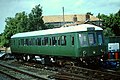
 BR Mk.I SK No.25189 (6730046123).jpg 600 × 399; 77 KB
-
 By Rhoon Road - geograph.org.uk - 853651.jpg 3,008 × 2,000; 3.06 MB
-
 Coastguard Lookout - geograph.org.uk - 837023.jpg 480 × 640; 161 KB
-

-
 Common horsetail (Equisetum arvense ) - geograph.org.uk - 828907.jpg 480 × 640; 195 KB
-
 Common mallow (Malva sylvestris) - geograph.org.uk - 841419.jpg 480 × 640; 182 KB
-
 Copse surrounded by oil seed rape - geograph.org.uk - 845677.jpg 640 × 480; 151 KB
-
 Cromer Hall.JPG 640 × 460; 148 KB
-

-
 Drain near Admiral's Farm - geograph.org.uk - 853482.jpg 2,000 × 3,008; 2.93 MB
-
 Drewry No.2583 (5606142392).jpg 4,592 × 3,056; 4.47 MB
-
 Entrance to Cromer Hall - geograph.org.uk - 839047.jpg 640 × 462; 188 KB
-
 St Andrew's church - geograph.org.uk - 861103.jpg 640 × 480; 182 KB
-
 St Mary, Feltwell, Norfolk - geograph.org.uk - 855813.jpg 640 × 480; 92 KB
-
 St Mary, Feltwell, Norfolk - geograph.org.uk - 855825.jpg 503 × 640; 83 KB
-
 Footpath at East Harling Common - geograph.org.uk - 832246.jpg 640 × 427; 84 KB
-
 Gatehouse beside Hall Road - detail - geograph.org.uk - 839001.jpg 466 × 640; 125 KB
-
 Gatehouse beside Hall Road - geograph.org.uk - 838999.jpg 480 × 640; 142 KB
-
 Great Fransham - geograph.org.uk - 846216.jpg 640 × 480; 83 KB
-
 Great Yarmouth Coach park.JPG 2,576 × 1,920; 1.32 MB
-
 Green field - geograph.org.uk - 858042.jpg 640 × 480; 76 KB
-
 Hall Farm - geograph.org.uk - 828897.jpg 480 × 640; 167 KB
-
 House beside Hall Road - geograph.org.uk - 839018.jpg 640 × 443; 121 KB
-

-
 Hugh llewelyn 170 207 (6384843611).jpg 4,592 × 3,056; 2.36 MB
-
 Hugh llewelyn 82 107 (5606111756).jpg 4,592 × 3,056; 2.53 MB
-
 Hugh llewelyn hugh llewelyn 82 118 (5605531385).jpg 4,592 × 3,056; 2.29 MB
-
 Hugh llewelyn L836 (5605584637).jpg 4,592 × 3,056; 2.98 MB
-
 Hugh llewelyn L836 (5605586147).jpg 2,802 × 1,865; 1.07 MB
-
 Hugh llewelyn L836 (5606165950).jpg 4,592 × 3,056; 3.34 MB
-
 Hunstanton lighthouse - geograph.org.uk - 837014.jpg 480 × 640; 148 KB
-
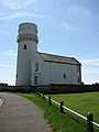 Hunstanton lighthouse - geograph.org.uk - 837015.jpg 480 × 640; 163 KB
-
 Hunstanton lighthouse - plaque - geograph.org.uk - 837018.jpg 640 × 440; 182 KB
-

-
-
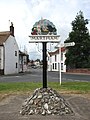
 All Saints Church, Kettlestone, Norfolk - geograph.org.uk - 850512.jpg 480 × 640; 167 KB
-

-

-
 Little Ellingham Road - geograph.org.uk - 846604.jpg 480 × 640; 197 KB
-
 Lonely postbox - geograph.org.uk - 828881.jpg 480 × 640; 225 KB
-

-
 M55009.jpg 3,764 × 2,507; 6.55 MB
-
 Moorings on the Wensum - geograph.org.uk - 811821.jpg 640 × 426; 72 KB
-

-
 Path on Howard's Hill - geograph.org.uk - 838878.jpg 480 × 640; 202 KB
-
 Popham's Farm - geograph.org.uk - 828900.jpg 480 × 640; 196 KB
-
 Postbox - geograph.org.uk - 889073.jpg 640 × 480; 140 KB
-
 Reepham Road past Thurning Hall - geograph.org.uk - 828887.jpg 640 × 480; 163 KB
-
 River Wensum Costessey,JPG.jpg 2,304 × 1,728; 1.59 MB
-
 Road junction at Blickling Hall - geograph.org.uk - 928275.jpg 640 × 481; 90 KB
-
-

-

-
 St Mary's church - brass - geograph.org.uk - 840912.jpg 427 × 640; 179 KB
-
 St Mary's church - headstone detail - geograph.org.uk - 840885.jpg 640 × 480; 164 KB
-
 St Mary's church - view east - geograph.org.uk - 840900.jpg 467 × 624; 178 KB
-
 St Mary's church - view west - geograph.org.uk - 840902.jpg 480 × 640; 192 KB
-
 St Mary's church - war memorial - geograph.org.uk - 840897.jpg 480 × 640; 151 KB
-
 St Mary's church - war memorial - geograph.org.uk - 853286.jpg 480 × 640; 152 KB
-
 The clubhouse from the train - geograph.org.uk - 928300.jpg 640 × 481; 47 KB
-
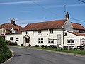
 The Crown public house - geograph.org.uk - 860865.jpg 640 × 480; 105 KB
-

-
 The Lookout Station at Sheringham - geograph.org.uk - 928282.jpg 640 × 481; 57 KB
-
 The Old Post Office - geograph.org.uk - 861760.jpg 480 × 640; 191 KB
-
 The Post Office - geograph.org.uk - 860849.jpg 640 × 480; 136 KB
-

-
 The Wiveton Bell - geograph.org.uk - 841473.jpg 640 × 480; 151 KB
-
 Thorpe Marriott.JPG 2,304 × 1,728; 1.68 MB
-
 View along Repps Road (B1152) - geograph.org.uk - 853068.jpg 480 × 640; 144 KB
-
 View east along Howard's Hill - geograph.org.uk - 838922.jpg 480 × 640; 149 KB
-
 View from All Saints, Tibenham, Norfolk - geograph.org.uk - 851672.jpg 640 × 480; 119 KB
-
 View north along Hall Road - geograph.org.uk - 839007.jpg 480 × 640; 160 KB
-
 View north along Shipden Avenue - geograph.org.uk - 838913.jpg 480 × 640; 143 KB
-
 View northeasterly across churchyard - geograph.org.uk - 840868.jpg 480 × 640; 194 KB
-
 View south along the Peddars Way North - geograph.org.uk - 837421.jpg 640 × 462; 145 KB
-
 View west along Aylsham Road (B1145) - geograph.org.uk - 861054.jpg 640 × 480; 105 KB
-
 Village sign - detail - geograph.org.uk - 837249.jpg 480 × 640; 161 KB
-
 Village sign - detail - geograph.org.uk - 838397.jpg 640 × 480; 149 KB
-
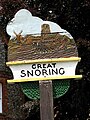 Village sign - geograph.org.uk - 848632.jpg 480 × 640; 156 KB
-
 Village sign - geograph.org.uk - 861049.jpg 640 × 480; 128 KB
-
 Woodland at East Harling Common - geograph.org.uk - 832239.jpg 640 × 427; 73 KB
-
 Woodland at Swangey Fen - geograph.org.uk - 832256.jpg 640 × 427; 67 KB


.jpg)
.jpg)
.jpg)
.jpg)
.jpg)
.jpg)
.jpg)


_-_geograph.org.uk_-_842789.jpg)
_-_geograph.org.uk_-_857990.jpg)
_-_geograph.org.uk_-_857993.jpg)
_-_geograph.org.uk_-_857996.jpg)

.jpg)


_-_detail_of_flower_-_geograph.org.uk_-_855282.jpg)
_-_geograph.org.uk_-_828907.jpg)
_-_geograph.org.uk_-_841419.jpg)


.jpg)


.jpg)
.jpg)
.jpg)
.jpg)
.jpg)
.jpg)


_-_geograph.org.uk_-_853068.jpg)


_-_geograph.org.uk_-_861054.jpg)


