Category:July 2018 in the Metropolitan Borough of Kirklees
Jump to navigation
Jump to search
Media in category "July 2018 in the Metropolitan Borough of Kirklees"
The following 20 files are in this category, out of 20 total.
-
 156489 in NR white.jpg 4,608 × 3,456; 3.77 MB
-
 Platform 2 for the Penistone Line.jpg 3,405 × 2,569; 2.48 MB
-
 Deighton railway station 2018.jpg 4,608 × 3,456; 3.8 MB
-
 A629 at Ravensknowle Park (geograph 5855102).jpg 1,024 × 728; 154 KB
-
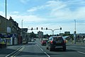 A629 Wakefield Road at Colne Street (geograph 5855110).jpg 1,024 × 694; 97 KB
-
 A644 at The Shepherds Boy public house (geograph 5885027).jpg 1,024 × 776; 142 KB
-
 A644 Huddersfield Road (geograph 5885006).jpg 1,024 × 744; 123 KB
-
 A644 Huddersfield Road at Cranshaw Street (geograph 5885017).jpg 1,024 × 764; 139 KB
-
 A644 Huddersfield Road, Ravensthorpe (geograph 5885013).jpg 1,024 × 764; 109 KB
-
 A644 passes under Spen Valley Greenway (geograph 5885023).jpg 1,024 × 731; 147 KB
-
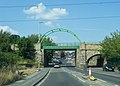
 A652 Bradford Road under railway arch (geograph 5885047).jpg 1,024 × 758; 131 KB
-
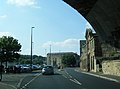
 A652 Bradford Road, Batley Carr (geograph 5885057).jpg 1,024 × 746; 127 KB
-
 Ashenhurst Avenue, Ashenhurst, Huddersfield (geograph 5852137).jpg 4,000 × 3,000; 3.37 MB
-
 Dewsbury Minster from Adams Road (geograph 5885042).jpg 1,024 × 767; 132 KB
-
 Marsden platform sign 2018.jpg 4,608 × 3,456; 3.98 MB
-
 Pathway between housing at Dewsbury Moor (geograph 5856465).jpg 4,000 × 3,000; 3.78 MB
-
 Terrace on Barnsley Road (geograph 5828271).jpg 1,600 × 1,200; 535 KB
-
 Track Road approaching Halifax Road (A638) at Batley Carr (geograph 5856469).jpg 4,000 × 3,000; 3.8 MB
-
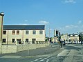
 Wellington Street, Batley (geograph 5856474).jpg 4,000 × 3,000; 3.23 MB
-
 Wheathouse Terrace (geograph 5832214).jpg 1,280 × 800; 897 KB


.jpg)
.jpg)
.jpg)
.jpg)
.jpg)
.jpg)
.jpg)
.jpg)
.jpg)
.jpg)
.jpg)

.jpg)
.jpg)
_at_Batley_Carr_(geograph_5856469).jpg)
.jpg)
.jpg)