Category:July 2013 in Lincolnshire
Jump to navigation
Jump to search
Deutsch: Bilder, die im Juli 2013 in Lincolnshire aufgenommen worden sind. Bitte beachten Sie, dass dies weder das Datum des Uploads noch das Datum des Scannens eines Fotos ist.
English: Images/pictures taken in Lincolnshire during July 2013. Note this is not the date of the upload, nor the date a photo was scanned.
Español: Fotografías o imágenes tomadas en Lincolnshire durante julio 2013. No es la fecha de subida ni escaneo, sino la fecha en que las fotografías o imágenes se crearon.
Esperanto: Bildoj faritaj en Lincolnshire en julio 2013. Tio ne estas la dato, kiam la bildoj estis alŝutitaj aŭ skanitaj.
Français : Photographies ou images prises en Lincolnshire durant juillet 2013. Ce n'est pas la date du téléchargement ou du scan.
Galego: Fotografías ou imaxes tomadas en Lincolnshire durante xullo 2013. Non é a data de subida nin escaneamento, senón a data na que se crearon as fotografías ou imaxes.
Italiano: Fotografie o immagini scattate a Lincolnshire nel luglio 2013. Nota bene: la data non si riferisce né a quella di upload né a quella in cui la foto è stata digitalizzata.
Norsk bokmål: Bilder tatt i Lincolnshire i løpet av juli 2013. Merk at dette ikke er datoen for opplasting, eller når et bilde har blitt skannet.
Norsk nynorsk: Bilete teke i Lincolnshire i løpet av juli 2013. Merk at dette ikkje er datoen for opplasting, eller når eit bilete har vorte skanna.
Русский: Изображения, сделанные в Lincolnshire в течение июль 2013 (не дата загрузки изображения).
Українська: Зображення, зроблені в Lincolnshire протягом липень 2013. Зауважте, що це не дата завантаження чи дата сканування фотографії.
| July 2012 | ← | July 2013 | → | July 2014 | |||||||
| Jan | Feb | Mar | Apr | May | Jun | Jul | Aug | Sep | Oct | Nov | Dec |
| 9 | 5 | 7 | 14 | 37 | 22 | 38 | 40 | 15 | 22 | 19 | 8 |
|---|---|---|---|---|---|---|---|---|---|---|---|
Subcategories
This category has the following 4 subcategories, out of 4 total.
Media in category "July 2013 in Lincolnshire"
The following 34 files are in this category, out of 34 total.
-
 A17 bridge across the River Welland (geograph 3583900).jpg 2,853 × 2,124; 2.33 MB
-
 The ford at the bottom of Beck Hill (geograph 3556559).jpg 640 × 427; 94 KB
-
 Two bridges and a green river, Tattersall Bridge.jpg 640 × 427; 60 KB
-
 Corby Glen St John's - baptismal font.jpg 2,200 × 3,746; 3.8 MB
-
 Corby Glen St John's - communion rail.jpg 3,000 × 2,250; 3.77 MB
-
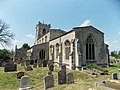
 Corby Glen St John's - from the north-east.jpg 3,000 × 2,094; 3.55 MB
-
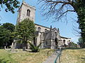
 Corby Glen St John's - from the north-west.jpg 2,500 × 1,875; 3.15 MB
-
 Corby Glen St John's - from the south-east.jpg 2,667 × 2,000; 3.52 MB
-
 Corby Glen St John's - from the south-west.jpg 2,500 × 1,875; 3.9 MB
-
 Corby Glen St John's - iron bound chest.jpg 3,400 × 2,251; 3.93 MB
-
 Corby Glen St John's - memorial to Charles Farebrother.jpg 2,461 × 2,800; 3.99 MB
-
 Corby Glen St John's - memorial to Francis Wilcox.jpg 2,100 × 3,920; 3.9 MB
-
 Corby Glen St John's - memorial to Sophia Farebrother.jpg 2,000 × 2,850; 3.72 MB
-
 Corby Glen St John's - memorial to William Willerton.jpg 3,500 × 2,713; 3.99 MB
-
 Corby Glen St John's - piscina.jpg 3,000 × 2,492; 3.85 MB
-
 Corby Glen St John's - pulpit.jpg 3,000 × 4,000; 3.8 MB
-
 Corby Glen St John's - rood screen door above the pulpit.jpg 2,500 × 3,332; 4 MB
-
 Robert Wyatt in Louth (9369959018).jpg 4,354 × 2,903; 1.66 MB
-
 Stamford College (geograph 3572709).jpg 2,048 × 1,536; 829 KB
-
 A17 over the River Welland (geograph 3554582).jpg 1,749 × 1,104; 1.1 MB
-
 Digby - geograph-3567721-by-Chris.jpg 640 × 427; 90 KB
-
 Float 31, River Humber (geograph 3589569).jpg 1,024 × 768; 106 KB
-
 Float 32A, River Humber (geograph 3597009).jpg 1,024 × 768; 107 KB
-
 Fulbeck St Nicholas - Fane family plot.jpg 3,000 × 2,250; 3.37 MB
-
 Humber Bridge Walkway.JPG 3,648 × 2,736; 2.03 MB
-
 Lower Whitton Float, River Humber (geograph 3589579).jpg 1,024 × 768; 74 KB
-
 Minor road heading past Mere Hall Farm (geograph 3563903).jpg 640 × 480; 52 KB
-
 Mudbank at the eastern end of Read's Island (geograph 3597003).jpg 1,024 × 768; 122 KB
-
 Mudbank on the north side of Read's Island (geograph 3597005).jpg 1,024 × 768; 123 KB
-
 Normanton St Nicholas - from the south-west.jpg 4,608 × 3,456; 5.2 MB
-
 Saturday market in Red Lion Square - geograph.org.uk - 3551701.jpg 1,600 × 1,200; 551 KB
-
 Sewstern Lane, Sedgebrook, Lincolnshire (geograph 3558897).jpg 640 × 427; 124 KB
-
 Sewstern Lane.jpg 640 × 427; 115 KB
-
 YarnBomb Bassingham UK.jpg 480 × 720; 89 KB
.jpg)
.jpg)


.jpg)
.jpg)
.jpg)

.jpg)
.jpg)


.jpg)
.jpg)
.jpg)
.jpg)


.jpg)

