Category:July 2007 on the Isle of Wight
Jump to navigation
Jump to search
English: Images/pictures taken on the Isle of Wight during July 2007. Note this is not the date of the upload, nor the date a photo was scanned.
| July 2006 | ← | July 2007 | → | July 2008 | |||||||
| Jan | Feb | Mar | Apr | May | Jun | Jul | Aug | Sep | Oct | Nov | Dec |
Media in category "July 2007 on the Isle of Wight"
The following 100 files are in this category, out of 100 total.
-
 483004 Shanklin 1.JPG 2,048 × 1,536; 1,000 KB
-
 483004 Shanklin Interior.JPG 2,048 × 1,536; 1.1 MB
-
 483008 Ryde Pier Head.JPG 1,511 × 1,149; 389 KB
-
 A powerboat passes The Needles - geograph.org.uk - 508847.jpg 640 × 480; 43 KB
-
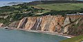 Alum Bay.jpg 3,432 × 1,755; 1.16 MB
-
 Behind Newbarn Farm - geograph.org.uk - 499906.jpg 640 × 477; 96 KB
-
 Brading-station-exterior.JPG 1,600 × 1,200; 367 KB
-
 Barn at Thorncross Farm - geograph.org.uk - 511435.jpg 640 × 477; 73 KB
-
 Chale Green - geograph.org.uk - 519658.jpg 640 × 477; 52 KB
-
 Chalk downland below Chillerton Down - geograph.org.uk - 500021.jpg 640 × 477; 89 KB
-
 Chillerton TV transmitter - geograph.org.uk - 496480.jpg 640 × 477; 87 KB
-
 Chillerton TV transmitter - geograph.org.uk - 499998.jpg 640 × 477; 72 KB
-
 Class483 interior.JPG 1,600 × 1,200; 376 KB
-
 Derelict buildings at Kingston Manor - geograph.org.uk - 511538.jpg 640 × 477; 86 KB
-
 Descending Chillerton Down - geograph.org.uk - 499993.jpg 640 × 477; 81 KB
-
 Descent from Chillerton Down - geograph.org.uk - 496471.jpg 640 × 477; 82 KB
-
 Garlic crop at Bathingbourne Farm - geograph.org.uk - 500775.jpg 480 × 640; 121 KB
-
 Garstons Down - geograph.org.uk - 496490.jpg 640 × 477; 86 KB
-
 Geology on the Shepherd's Trail - geograph.org.uk - 499852.jpg 640 × 477; 119 KB
-
 Godshill 01.jpg 2,560 × 1,920; 2.15 MB
-
 Godshill 02.jpg 2,560 × 1,920; 2.48 MB
-
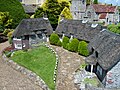
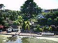
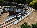
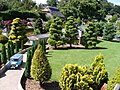
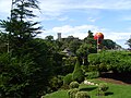
 Godshill Model Village 01.jpg 2,560 × 1,920; 2.26 MB
-
 Godshill Model Village 02.jpg 2,560 × 1,920; 2.35 MB
-
 Godshill Model Village 03.jpg 2,560 × 1,920; 2.26 MB
-
 Godshill Model Village 04.jpg 2,560 × 1,920; 2.3 MB
-
 Godshill Model Village 05.jpg 2,560 × 1,920; 2.04 MB
-
 Godshill Model Village 06.jpg 2,560 × 1,920; 2.26 MB
-
 Godshill Model Village 07.jpg 2,560 × 1,920; 2.38 MB
-
 Godshill Model Village 08.jpg 2,560 × 1,920; 2.43 MB
-
 Godshill Model Village 09.jpg 2,560 × 1,920; 2.39 MB
-
 Godshill Model Village 10.jpg 2,560 × 1,920; 2.16 MB
-
 Godshill Model Village 11.jpg 2,560 × 1,920; 2.12 MB
-
 Godshill Model Village 12.jpg 2,560 × 1,920; 2.17 MB
-
 Godshill Model Village 13.jpg 2,560 × 1,920; 2.17 MB
-
 Godshill Model Village 14.jpg 2,560 × 1,920; 2.44 MB
-
 Godshill Model Village 15.jpg 2,560 × 1,920; 2.1 MB
-
 Godshill Model Village 16.jpg 2,560 × 1,920; 2.29 MB
-
 Godshill Model Village 17.jpg 2,560 × 1,920; 2.13 MB
-
 Godshill Model Village 18.jpg 2,560 × 1,920; 2.42 MB
-
 Godshill Model Village 19.jpg 2,560 × 1,920; 2.4 MB
-
 Godshill Model Village 2.jpg 2,848 × 2,136; 1.57 MB
-
 Godshill Model Village 20.jpg 2,560 × 1,920; 2.36 MB
-
 Godshill Model Village 21.jpg 2,560 × 1,920; 2.45 MB
-
 Godshill Model Village 22.jpg 2,560 × 1,920; 2.34 MB
-
 Godshill Model Village 23.jpg 2,560 × 1,920; 2.46 MB
-
 Godshill Model Village 3.jpg 2,219 × 1,666; 937 KB
-
 Godshill Model Village Church Hill cottages.jpg 2,848 × 2,136; 1.56 MB
-
 Godshill Model Village Church Hollow.jpg 2,717 × 2,039; 1.51 MB
-
 Godshill Model Village football ground.jpg 2,848 × 2,136; 1.68 MB
-
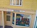
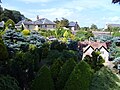
 Godshill Model Village.jpg 1,280 × 960; 739 KB
-
 Hale Common fishing lake - geograph.org.uk - 500753.jpg 640 × 480; 137 KB
-
 Holiday Chalets - geograph.org.uk - 495587.jpg 640 × 428; 110 KB
-
 Hovertravel 1.JPG 1,600 × 1,200; 370 KB
-
 Kingston Manor and chapel - geograph.org.uk - 511506.jpg 640 × 477; 77 KB
-
 Limerstone - geograph.org.uk - 502316.jpg 640 × 477; 70 KB
-
 Limerstone Farm - geograph.org.uk - 502311.jpg 640 × 477; 79 KB
-
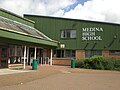 Medina High School.JPG 3,072 × 2,304; 2.23 MB
-
 Middle Barn - geograph.org.uk - 508255.jpg 640 × 479; 153 KB
-
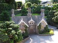
 Morton Manor, Brading 01.jpg 2,560 × 1,920; 2.26 MB
-
 Morton Manor, Brading 02.jpg 2,560 × 1,920; 2.39 MB
-
 Morton Manor, Brading 03.jpg 1,920 × 2,560; 2.41 MB
-
 Morton Manor, Brading 04.jpg 2,560 × 1,920; 2.17 MB
-
 Morton Manor, Brading 05.jpg 1,920 × 2,560; 2.49 MB
-
 Morton Manor, Brading 06.jpg 2,560 × 1,920; 2.44 MB
-
 Mouth of Grange Chine - geograph.org.uk - 495580.jpg 640 × 428; 139 KB
-
 Newport-cowes wb.jpg 800 × 600; 128 KB
-
 Newport-cowes.jpg 1,296 × 972; 159 KB
-
 No galloping sign in Isle of Wight - geograph.org.uk - 512665.jpg 640 × 477; 123 KB
-
 On Chillerton Down - geograph.org.uk - 499953.jpg 640 × 477; 64 KB
-
 On Chillerton Down - geograph.org.uk - 499958.jpg 640 × 477; 73 KB
-
 Radio Mast, Stenbury Down - geograph.org.uk - 508570.jpg 479 × 640; 135 KB
-
 Ryde-aerial.jpg 1,037 × 778; 81 KB
-
 Steps, Homelands Pit Farm - geograph.org.uk - 508516.jpg 479 × 640; 243 KB
-
 SVOpenTop.JPG 1,600 × 1,200; 385 KB
-
 The Castle Inn - geograph.org.uk - 498283.jpg 640 × 477; 87 KB
-
 The hounds - geograph.org.uk - 499892.jpg 640 × 477; 135 KB
-
 The needles bus stop.JPG 1,600 × 1,200; 401 KB
-
 Ventnor Harbour, Isle of Wight - geograph.org.uk - 907884.jpg 640 × 480; 74 KB
-
 West of Grange Chine - geograph.org.uk - 495586.jpg 640 × 428; 112 KB
-
 Approaching Dungewood Farm - geograph.org.uk - 511484.jpg 640 × 477; 98 KB
-
 Approaching Garstons - geograph.org.uk - 499720.jpg 640 × 477; 92 KB
-
 Apse Manor Farm - geograph.org.uk - 508748.jpg 640 × 479; 177 KB
-
 Barn, Little Stenbury - geograph.org.uk - 508585.jpg 640 × 479; 121 KB
-
 Bowcombe Farm - geograph.org.uk - 499702.jpg 640 × 477; 73 KB
-
 Britten Norman aircraft factory - geograph.org.uk - 496802.jpg 640 × 428; 60 KB
-
 Cheverton Farmhouse - geograph.org.uk - 502159.jpg 640 × 477; 66 KB
-
 Dungewood Farm - geograph.org.uk - 511479.jpg 640 × 477; 123 KB
-
 Flax below Garstons Down - geograph.org.uk - 499909.jpg 640 × 477; 129 KB
-
 Garstons - geograph.org.uk - 499722.jpg 640 × 477; 104 KB
-
 Great Appleford Barns - geograph.org.uk - 496616.jpg 640 × 477; 87 KB
-
 Hungry boys^ - geograph.org.uk - 499947.jpg 640 × 477; 95 KB
-
 Hut on Dungewood Lane - geograph.org.uk - 511475.jpg 640 × 477; 98 KB
-
 Manor Farm - geograph.org.uk - 488966.jpg 640 × 480; 91 KB
-
 Ninham Farm - geograph.org.uk - 508774.jpg 479 × 640; 162 KB
-
 Old Farm building at Black Pan - geograph.org.uk - 508968.jpg 640 × 480; 109 KB
-
 On Limerstone Down - geograph.org.uk - 496458.jpg 640 × 477; 76 KB
-
 Part of Whitelane Farm - geograph.org.uk - 498366.jpg 640 × 477; 64 KB
-
 Rookley Farm House - geograph.org.uk - 496613.jpg 640 × 477; 93 KB
-
 Roslin Farm - geograph.org.uk - 512593.jpg 640 × 477; 77 KB
-
 Shaggy long horn - geograph.org.uk - 511865.jpg 640 × 480; 138 KB


