Category:Jufferenstraat 1, Elburg
Jump to navigation
Jump to search
| Object location | | View all coordinates using: OpenStreetMap |
|---|
building in Elburg, Netherlands  | |||||
| Upload media | |||||
| Instance of | |||||
|---|---|---|---|---|---|
| Location | Elburg, Gelderland, Netherlands | ||||
| Street address |
| ||||
| Located on street |
| ||||
| Heritage designation |
| ||||
 | |||||
|
This is a category about rijksmonument number 14759
|
| Address |
|
Media in category "Jufferenstraat 1, Elburg"
The following 38 files are in this category, out of 38 total.
-
 Bovenlicht boven de deur in de voorgevel - Elburg - 20412279 - RCE.jpg 2,848 × 4,288; 1.96 MB
-
 Deur met bovenlicht in de voorgevel - Elburg - 20412280 - RCE.jpg 2,848 × 4,288; 3.42 MB
-
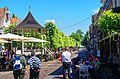
 Elburg - Beekstraat - Jufferenstraat - Vischpoortstraat 01.jpg 3,873 × 2,592; 10.84 MB
-
 Elburg - Beekstraat - Jufferenstraat - Vischpoortstraat 02.jpg 3,873 × 2,592; 11.34 MB
-
 Elburg - Beekstraat - Jufferenstraat - Vischpoortstraat 03.jpg 2,592 × 3,898; 10.94 MB
-
 Elburg - Beekstraat - Jufferenstraat - Vischpoortstraat 04.jpg 2,592 × 3,915; 9.69 MB
-
 Elburg - Beekstraat - Jufferenstraat - Vischpoortstraat 05.jpg 2,592 × 3,915; 9.84 MB
-
 Elburg - Beekstraat - Jufferenstraat - Vischpoortstraat 06.jpg 3,915 × 2,592; 11.29 MB
-
 Elburg - Beekstraat - Jufferenstraat - Vischpoortstraat 07.jpg 3,915 × 2,592; 10.69 MB
-
 Elburg - Beekstraat - Jufferenstraat - Vischpoortstraat 08.jpg 3,915 × 2,592; 11.72 MB
-
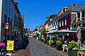 Elburg - Jufferenstraat - View NW.jpg 3,915 × 2,592; 11.58 MB
-
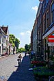 Elburg - Jufferenstraat - View SE I.jpg 2,592 × 3,915; 9.96 MB
-
 Elburg - Jufferenstraat 1 RM14759.JPG 4,032 × 3,150; 2.66 MB
-

-

-

-

-

-

-

-

-

-

-

-

-

-

-

-

-

-
 Overzicht van de achterzijde met binnentuin - Elburg - 20412238 - RCE.jpg 4,288 × 2,848; 3.1 MB
-

-

-

-

-
 Overzicht van het hoekpand, rechts de Zuiderwalstraat - Elburg - 20412208 - RCE.jpg 4,288 × 2,848; 2.49 MB
-
 Overzicht van raam in de linkerzijgevel - Elburg - 20412230 - RCE.jpg 797 × 1,200; 227 KB
-
 Straatbeeld gezien vanuit het centrum - Elburg - 20412281 - RCE.jpg 1,200 × 797; 229 KB


