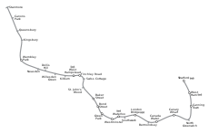
Category:Jubilee Line
Jump to navigation
Jump to search

English:
Main Wikipedia article: Jubilee Line.
London Underground line | |||||
| Upload media | |||||
| Instance of | |||||
|---|---|---|---|---|---|
| Named after | |||||
| Location | London, Greater London, London, England | ||||
| Transport network | |||||
| Operator | |||||
| Inception |
| ||||
| Date of official opening |
| ||||
| Length |
| ||||
| Terminus | |||||
| Train depot | |||||
| official website | |||||
| |||||
Subcategories
This category has the following 33 subcategories, out of 33 total.
- Maps of the Jubilee line (5 F)
1
B
C
D
F
G
K
L
N
- Neasden Depot (59 F)
Q
S
- Stratford Market Depot (8 F)
W
Media in category "Jubilee Line"
The following 44 files are in this category, out of 44 total.
-
A5, Kilburn - geograph.org.uk - 6510568.jpg 1,024 × 684; 142 KB
-
Cumberland Road, Queensbury - geograph.org.uk - 2276943.jpg 4,320 × 3,240; 3.81 MB
-
Fryent Country Park next to the Jubilee Line - geograph.org.uk - 4549993.jpg 4,000 × 3,000; 4.33 MB
-
Fryent Country Park next to the Jubilee Line - geograph.org.uk - 4550018.jpg 4,000 × 3,000; 4.23 MB
-
Jubilee line (25263783131).jpg 3,000 × 4,000; 2.11 MB
-
Jubilee Line - geograph.org.uk - 4781711.jpg 640 × 480; 147 KB
-
Jubilee line colour strip sign (roundel).svg 700 × 150; 11 KB
-
Jubilee line colour strip sign.svg 700 × 150; 7 KB
-
Jubilee line distance marker.jpg 3,648 × 2,736; 4.21 MB
-
Jubilee Line from Dalkeith Grove - geograph.org.uk - 6015301.jpg 1,024 × 683; 514 KB
-
Jubilee Line near West Ham Station - geograph.org.uk - 445320.jpg 640 × 480; 112 KB
-
Jubilee Line Nortbound Train Approaches Canons Park Station.jpg 4,586 × 3,057; 10.89 MB
-
Jubilee Line Northbound Train between Queensbury & Canons Park.jpg 5,046 × 3,881; 11.24 MB
-
Jubilee Line south of Kingsbury - geograph.org.uk - 4781505.jpg 640 × 480; 161 KB
-
Jubilee Line tunnel (detraining during April 2008 power failure).jpg 2,272 × 1,704; 892 KB
-
Jubilee Line Ventilation tower 277.jpg 2,736 × 3,648; 4.38 MB
-
Jubilee Line Ventilation tower 278.jpg 2,736 × 3,648; 4.13 MB
-
Jubilee Line Ventilation tower 279.jpg 2,736 × 3,648; 4.2 MB
-
Jubilee Line Ventilation tower 284.jpg 2,736 × 3,648; 3.81 MB
-
Jubilee Line Ventilation tower 285.jpg 2,736 × 3,648; 3.73 MB
-
Jubilee Line Ventilation tower 286.jpg 2,736 × 3,648; 4.3 MB
-
Jubilee Line Ventilation tower 287.jpg 2,736 × 3,648; 4.01 MB
-
Jubilee Line Ventilation tower 288.jpg 2,736 × 3,648; 3.83 MB
-
Jubilee Line Ventilation tower 289.jpg 2,736 × 3,648; 4.26 MB
-
London MMB «G3 15 Westferry Circus.jpg 3,945 × 2,592; 3.03 MB
-
London Underground lines from the Chiltern Main Line - DSCF0489.JPG 4,000 × 3,000; 2.98 MB
-
London Underground train from the Chiltern Main Line - DSCF0491.JPG 4,000 × 3,000; 2.87 MB
-
Loveridge Road, NW6 - geograph.org.uk - 372550.jpg 640 × 480; 114 KB
-
Metropolitan Railway Bridge - geograph.org.uk - 2308316.jpg 1,039 × 1,600; 404 KB
-
Metropolitan Railway Bridge Kilburn.jpg 640 × 480; 126 KB
-
Metropolitan Railway Bridge Kilburn2.jpg 640 × 480; 121 KB
-
Queensbury, Bridge over Cumberland Road - geograph.org.uk - 4722182.jpg 4,320 × 3,240; 6.6 MB
-
Rail lines from Dudden Hill Lane - geograph.org.uk - 574791.jpg 640 × 480; 123 KB
-
Railway Bridge, The Avenue - geograph.org.uk - 5458799.jpg 640 × 426; 55 KB
-
Railway Bridge,The Avenue - geograph.org.uk - 5458795.jpg 640 × 426; 77 KB
-
Step-free access notification (Jubilee line).png 939 × 125; 16 KB


