Category:Jose P. Laurel Highway
Jump to navigation
Jump to search
major highway in the province of Batangas, Philippines | |||||
| Upload media | |||||
| Instance of | |||||
|---|---|---|---|---|---|
| Location |
| ||||
| |||||
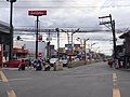
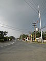
English: The President Jose P. Laurel Highway or Manila-Batangas Road is a 47 kilometer highway linking the Pan-Philippine Highway/Daaang Maharlika/AH26 in the province of Batangas, the Philippines.
Subcategories
This category has the following 6 subcategories, out of 6 total.
M
Media in category "Jose P. Laurel Highway"
The following 18 files are in this category, out of 18 total.
-
 102Barangays of Malvar, Batangas 62.jpg 4,608 × 3,456; 6.48 MB
-
 9856Lipa City Malvar, Batangas 42.jpg 4,608 × 3,456; 6.69 MB
-
 9856Lipa City Malvar, Batangas 43.jpg 4,608 × 3,456; 6.75 MB
-
 J.P. Laurel Highway, Malvar (Batangas; 12-23-2021).jpg 3,552 × 2,664; 4.08 MB
-
 J.P. Laurel Highway, Tanauan (Batangas; 12-23-2021).jpg 3,552 × 2,664; 3.6 MB
-
 Lemery,Batangasjf4328 06.JPG 4,608 × 3,456; 6.41 MB
-
 Lemery,Batangasjf4328 07.JPG 4,608 × 3,456; 6.11 MB
-
 LipaMalvarjf7847 07.JPG 4,608 × 3,456; 5.86 MB
-
 LipaTanauanjf7833 01.JPG 4,608 × 3,456; 5.75 MB
-
 LipaTanauanjf7833 07.JPG 4,608 × 3,456; 6.25 MB
-
 LipaTanauanjf7833 08.JPG 4,608 × 3,456; 6.43 MB
-
 Malvar,Batangasjf8005 05.JPG 4,608 × 3,456; 6.06 MB
-
 Malvar-Tanauanjf8374 07.JPG 4,608 × 3,456; 6.49 MB
-
 Malvar-Tanauanjf8374 10.JPG 4,608 × 3,456; 6.33 MB
-
 MMTCIjf8361 11.JPG 4,608 × 3,456; 5.84 MB
-
 SanJose,Batangasjf1700 18.JPG 4,608 × 3,456; 6.94 MB
-
 SanJoseHospitaljf1691 07.JPG 4,608 × 3,456; 6.95 MB
-
 SanJoseHospitaljf1691 09.JPG 3,456 × 4,608; 6.5 MB


.jpg)
.jpg)


