Category:Joods poortje (Gouda)
Jump to navigation
Jump to search
| Object location | | View all coordinates using: OpenStreetMap |
|---|
former cemetery in Gouda, the Netherlands  | |||||
| Upload media | |||||
| Instance of | |||||
|---|---|---|---|---|---|
| Location | Gouda, South Holland, Netherlands | ||||
| Owned by |
| ||||
 | |||||
Media in category "Joods poortje (Gouda)"
The following 9 files are in this category, out of 9 total.
-
 Exterieur TOEGANGSHEK - Gouda - 20295053 - RCE.jpg 1,183 × 1,200; 473 KB
-
 Gouda kunstwerk joods poortje.jpg 1,755 × 1,715; 1.13 MB
-
 Inscriptie joodse begraafplaats.jpg 1,201 × 651; 647 KB
-
 Joods poortje Gouda.jpg 1,296 × 972; 293 KB
-
 Joods Poortje, Gouda. Informatiebord.jpg 4,000 × 3,000; 6.08 MB
-
 Joodse begraafplaats Gouda bij avond.jpg 1,821 × 2,020; 171 KB
-
 Kadasterkaart Gouda 1832 detail.jpg 2,000 × 1,464; 683 KB
-
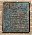 Plaquette Joodse begraafplaats, Boelekade, Gouda.jpg 2,385 × 2,591; 4.21 MB
-
 Poort van de Joodse begraafplaats in Gouda.jpg 1,143 × 676; 225 KB


