Category:Jana Pawła II Street in Kielce
Jump to navigation
Jump to search
| Object location | | View all coordinates using: OpenStreetMap |
|---|
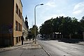
Polski: Zabudowa ulicy Jana Pawła II w Kielcach, Polska.
 | |||||
| Upload media | |||||
| Instance of | |||||
|---|---|---|---|---|---|
| Location | Kielce, Świętokrzyskie Voivodeship, Poland | ||||
| Street address |
| ||||
| Heritage designation |
| ||||
| Inception |
| ||||
 | |||||
Subcategories
This category has the following 6 subcategories, out of 6 total.
8
9
- 9 Jana Pawła II Street in Kielce (11 F)
L
- Laszczyks' Manor house in Kielce (11 F)
S
- Seminary in Kielce (11 F)
T
- Tumlin Canonry in Kielce (9 F)
Media in category "Jana Pawła II Street in Kielce"
The following 11 files are in this category, out of 11 total.
-
 Zabudowa ul. Jana Pawła II w Kielcach (1) (jw14).JPG 2,272 × 1,704; 978 KB
-
 Zabudowa ul. Jana Pawła II w Kielcach (13) (jw14).JPG 1,704 × 2,272; 988 KB
-
 Zabudowa ul. Jana Pawła II w Kielcach (14) (jw14).JPG 1,704 × 2,272; 914 KB
-
 Zabudowa ul. Jana Pawła II w Kielcach (2) (jw14).JPG 1,704 × 2,272; 964 KB
-
 Zabudowa ul. Jana Pawła II w Kielcach (3) (jw14).JPG 2,272 × 1,704; 937 KB
-
 Zabudowa ul. Jana Pawła II w Kielcach (4) (jw14).JPG 1,704 × 2,272; 1,016 KB
-
 Zabudowa ul. Jana Pawła II w Kielcach (5) (jw14).JPG 2,272 × 1,704; 1.01 MB
-
 Zabudowa ul. Jana Pawła II w Kielcach (6) (jw14).JPG 2,272 × 1,704; 933 KB
-
 Zabudowa ul. Jana Pawła II w Kielcach (7) (jw14).JPG 2,272 × 1,704; 956 KB
-
 Zabudowa ulicy J.P.II-Asirek 030.jpg 3,872 × 2,592; 3.39 MB
-
 Zabudowa ulicy J.P.II-Asirek 031.jpg 3,872 × 2,592; 5.5 MB
_(jw14).JPG)
_(jw14).JPG)
_(jw14).JPG)
_(jw14).JPG)
_(jw14).JPG)
_(jw14).JPG)
_(jw14).JPG)
_(jw14).JPG)
_(jw14).JPG)
