Category:Jaberg (Hilden)
Jump to navigation
Jump to search
| Object location | | View all coordinates using: OpenStreetMap |
|---|
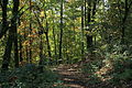
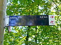
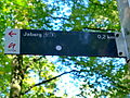
hill in Hilden, Germany  | |||||
| Upload media | |||||
| Instance of | |||||
|---|---|---|---|---|---|
| Location | Hilden, Mettmann, Düsseldorf Government Region, North Rhine-Westphalia, Germany | ||||
| Mountain range | |||||
| Elevation above sea level |
| ||||
 | |||||
Media in category "Jaberg (Hilden)"
The following 13 files are in this category, out of 13 total.
-
 Hilden - Hildener Heide - Hundewiese + Jaberg 01 ies.jpg 5,616 × 3,744; 19.02 MB
-
 Hilden - Hildener Heide - Hundewiese + Jaberg 02 ies.jpg 5,616 × 3,744; 16.91 MB
-
 Hilden - Hildener Heide - Jaberg (Aussichtsturm) 01 ies.jpg 5,616 × 3,744; 26.06 MB
-
 Hilden - Hildener Heide - Jaberg 01 ies.jpg 5,616 × 3,744; 21.47 MB
-
 Hilden - Hildener Heide - Jaberg 02 ies.jpg 5,616 × 3,744; 22.36 MB
-
 Hilden - Hildener Heide - Jaberg 03 ies.jpg 5,616 × 3,744; 25.02 MB
-
 Hilden - Hildener Heide - Jaberg 04 ies.jpg 5,616 × 3,744; 20.37 MB
-
 Jaberg 4.JPG 1,500 × 1,125; 900 KB
-
 Jaberg 5.JPG 1,125 × 1,500; 1.12 MB
-
 Jaberg 6.JPG 1,500 × 1,125; 922 KB
-
 Jaberg 7.JPG 1,125 × 1,500; 1,019 KB
-
 Jaberg Umgebung 2220-161.jpg 7,360 × 4,912; 42.32 MB
-
 Jaberg-Turm Aussicht Haan 2210-151.jpg 7,360 × 4,912; 36.88 MB


_01_ies.jpg)


