Category:J.W. & J.S. Moulton
Jump to navigation
Jump to search
Subcategories
This category has the following 2 subcategories, out of 2 total.
Media in category "J.W. & J.S. Moulton"
The following 96 files are in this category, out of 96 total.
-
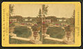
 Front view of Salem station, 1873.jpg 1,722 × 1,582; 234 KB
-
 Grand Army Plaza Fountain 1874.png 428 × 457; 157 KB
-
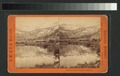
 Sentinel Rock, 3270 feet high (NYPL b11707317-G89F395 001ZF).tiff 3,072 × 1,964; 17.26 MB
-
 Sentinel Rock, 3270 feet high (NYPL b11707317-G89F395 001ZB).tiff 3,072 × 1,897; 16.68 MB
-
 Old man of the mountain from Mirror Lake (NYPL b11707317-G89F395 002ZF).tiff 3,072 × 1,926; 16.93 MB
-
 Old man of the mountain from Mirror Lake (NYPL b11707317-G89F395 002ZB).tiff 3,072 × 1,931; 16.97 MB
-
 Vernal Falls, 350 feet high (NYPL b11707317-G89F395 003ZF).tiff 3,072 × 1,924; 16.91 MB
-
 Vernal Falls, 350 feet high (NYPL b11707317-G89F395 003ZB).tiff 3,072 × 1,933; 16.99 MB
-
 Lake Tenaya looking eas from the Mono Trail (NYPL b11707317-G89F395 004ZF).tiff 3,072 × 1,959; 17.22 MB
-
 Lake Tenaya looking eas from the Mono Trail (NYPL b11707317-G89F395 004ZB).tiff 3,072 × 1,906; 16.75 MB
-
 Sentinel Rock (3270 feet high) and Hutching's Hotel (NYPL b11707317-G89F395 005ZF).tiff 3,072 × 1,924; 16.91 MB
-
 Sentinel Rock (3270 feet high) and Hutching's Hotel (NYPL b11707317-G89F395 005ZB).tiff 3,072 × 1,961; 17.24 MB
-
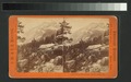
 Three Brothers and Bridal Veil Falls from Harding's Trail (NYPL b11707317-G89F395 006ZF).tiff 3,072 × 1,943; 17.08 MB
-
 Three Brothers and Bridal Veil Falls from Harding's Trail (NYPL b11707317-G89F395 006ZB).tiff 3,072 × 1,960; 17.23 MB
-
 General view of the Valley from the Glacier Point (NYPL b11707317-G89F395 007ZF).tiff 3,072 × 1,937; 17.03 MB
-
 General view of the Valley from the Glacier Point (NYPL b11707317-G89F395 007ZB).tiff 3,072 × 1,942; 17.07 MB
-
 Mirror Lake and Mt. Watkins, Yos. Val. Cal (NYPL b11707317-G89F395 008ZF).tiff 3,072 × 1,935; 17.01 MB
-
 Mirror Lake and Mt. Watkins, Yos. Val. Cal (NYPL b11707317-G89F395 008ZB).tiff 3,072 × 1,945; 17.1 MB
-
 Nevada Falls and Cap of Liberty (NYPL b11707317-G89F395 009ZF).tiff 3,072 × 1,939; 17.04 MB
-
 Nevada Falls and Cap of Liberty (NYPL b11707317-G89F395 009ZB).tiff 3,072 × 1,964; 17.26 MB
-
 Looking up the Merced River, Yos. Val. Cal (NYPL b11707317-G89F395 010ZF).tiff 3,072 × 1,929; 16.96 MB
-
 Looking up the Merced River, Yos. Val. Cal (NYPL b11707317-G89F395 010ZB).tiff 3,072 × 1,954; 17.18 MB
-
 Bridal Veil Falls, xxx feet high, Yos. val. Cal (NYPL b11707317-G89F395 011ZF).tiff 3,072 × 1,942; 17.07 MB
-
 Bridal Veil Falls, xxx feet high, Yos. val. Cal (NYPL b11707317-G89F395 011ZB).tiff 3,072 × 1,976; 17.37 MB
-
 Looking up the Merced River, Yosemite Valley, Cal (NYPL b11707317-G89F395 012ZF).tiff 3,072 × 1,959; 17.22 MB
-
 Looking up the Merced River, Yosemite Valley, Cal (NYPL b11707317-G89F395 012ZB).tiff 3,072 × 1,948; 17.12 MB
-
 Mt. Lyell from the Toulumne Valley, California (NYPL b11707317-G89F395 013ZF).tiff 3,072 × 1,941; 17.06 MB
-
 Mt. Lyell from the Toulumne Valley, California (NYPL b11707317-G89F395 013ZB).tiff 3,072 × 1,924; 16.91 MB
-
 Sentinel Rock, 3270 feet high, Yosemite Valley, Cal (NYPL b11707317-G89F395 014ZF).tiff 3,072 × 1,930; 16.97 MB
-
 Sentinel Rock, 3270 feet high, Yosemite Valley, Cal (NYPL b11707317-G89F395 014ZB).tiff 3,072 × 1,954; 17.18 MB
-
 Mirror Lake and Mt. Watkins, Yosemite Valley, Cal (NYPL b11707317-G89F395 015ZF).tiff 3,072 × 1,979; 17.4 MB
-
 Mirror Lake and Mt. Watkins, Yosemite Valley, Cal (NYPL b11707317-G89F395 015ZB).tiff 3,072 × 1,970; 17.32 MB
-
 Tenaya Canyon from the South Dome, Yosemite Val., (NYPL b11707317-G89F395 016ZF).tiff 3,072 × 1,946; 17.11 MB
-
 Tenaya Canyon from the South Dome, Yosemite Val., (NYPL b11707317-G89F395 016ZB).tiff 3,072 × 1,973; 17.34 MB
-
 Yosemite Valley, from Cloud's Rest, Yosemite Val. Cal (NYPL b11707317-G89F395 017ZF).tiff 3,072 × 1,939; 17.04 MB
-
 Yosemite Valley, from Cloud's Rest, Yosemite Val. Cal (NYPL b11707317-G89F395 017ZB).tiff 3,072 × 1,977; 17.38 MB
-
 Cloud's Rest, 6450 feet high, Yosemite Valley, Cal (NYPL b11707317-G89F395 018ZF).tiff 3,072 × 1,932; 16.98 MB
-
 Cloud's Rest, 6450 feet high, Yosemite Valley, Cal (NYPL b11707317-G89F395 018ZB).tiff 3,072 × 1,951; 17.15 MB
-
 Mirror Lake and Mt. Watkins, Yosemite Valley, Cal (NYPL b11707317-G89F395 019ZF).tiff 3,072 × 1,969; 17.31 MB
-
 Mirror Lake and Mt. Watkins, Yosemite Valley, Cal (NYPL b11707317-G89F395 019ZB).tiff 3,072 × 1,926; 16.93 MB
-
 Yosemite Falls, 2634 feet high, Yosemite Valley, Cal (NYPL b11707317-G89F395 020ZF).tiff 3,072 × 1,905; 16.75 MB
-
 Yosemite Falls, 2634 feet high, Yosemite Valley, Cal (NYPL b11707317-G89F395 020ZB).tiff 3,072 × 1,936; 17.02 MB
-
 Mt. Ord, from Lake in Bloody Canyon, Yosemite Valley, Cal (NYPL b11707317-G89F395 021ZF).tiff 3,072 × 1,963; 17.26 MB
-
 Mt. Ord, from Lake in Bloody Canyon, Yosemite Valley, Cal (NYPL b11707317-G89F395 021ZB).tiff 3,072 × 1,972; 17.33 MB
-
 Yosemite Falls, 2634 feet high, Yosemite Valley, Cal (NYPL b11707317-G89F395 022ZF).tiff 3,072 × 1,941; 17.06 MB
-
 Yosemite Falls, 2634 feet high, Yosemite Valley, Cal (NYPL b11707317-G89F395 022ZB).tiff 3,072 × 1,978; 17.39 MB
-
 Yosemite Falls, 2634 feet high, Yosemite Valley, Cal (NYPL b11707317-G89F395 023ZF).tiff 3,072 × 1,954; 17.18 MB
-
 Yosemite Falls, 2634 feet high, Yosemite Valley, Cal (NYPL b11707317-G89F395 023ZB).tiff 3,072 × 1,967; 17.29 MB
-
 Cathedral Rocks, 2400 feet high, Yosemite valley, Cal (NYPL b11707317-G89F395 024ZF).tiff 3,072 × 1,976; 17.37 MB
-
 Cathedral Rocks, 2400 feet high, Yosemite valley, Cal (NYPL b11707317-G89F395 024ZB).tiff 3,072 × 1,919; 16.87 MB
-
 Yosemite Valley, from the summit of Cloud's Rest (NYPL b11707317-G89F395 025ZF).tiff 3,072 × 1,991; 17.5 MB
-
 Yosemite Valley, from the summit of Cloud's Rest (NYPL b11707317-G89F395 025ZB).tiff 3,072 × 1,972; 17.33 MB
-
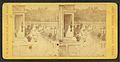
 Station switch and signal (NYPL b11707500-G90F222 004F) cropped.jpg 1,066 × 1,199; 652 KB
-
 Station switch and signal (NYPL b11707500-G90F222 004F).tiff 3,072 × 1,719; 15.11 MB
-
 Station switch and signal (NYPL b11707500-G90F222 004B).tiff 3,072 × 1,700; 14.94 MB
-
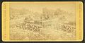
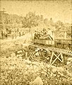 Takes the narrow gauge (NYPL b11707500-G90F222 014F) cropped.jpg 1,039 × 1,222; 740 KB
-
 Takes the narrow gauge (NYPL b11707500-G90F222 014F).tiff 3,072 × 1,689; 14.85 MB
-
 Takes the narrow gauge (NYPL b11707500-G90F222 014B) (cropped).tiff 2,519 × 1,244; 8.97 MB
-
 Takes the narrow gauge (NYPL b11707500-G90F222 014B).tiff 3,072 × 1,708; 15.01 MB
-
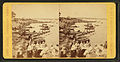
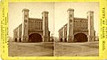 Stereo view of Salem station, 1873.jpg 4,165 × 2,332; 808 KB
-
 The Old South Church, Boston, Mass. (Boston Public Library).jpg 1,500 × 937; 404 KB
-
 Back of the Witch House, by J.W. & J.S. Moulton.jpg 2,737 × 1,582; 1.73 MB
-
 Back of the Witch House, by J.W. & J.S. Moulton.png 2,737 × 1,582; 5.63 MB
-
 Colorized view of a garden, by J.W. & J.S. Moulton.jpg 2,737 × 1,611; 1.66 MB
-
 Colorized view of a garden, by J.W. & J.S. Moulton.png 2,737 × 1,611; 5.58 MB
-
-

-
 Juniper Point from Salem Neck, by J.W. & J.S. Moulton.jpg 2,737 × 1,597; 1.55 MB
-
 Juniper Point from Salem Neck, by J.W. & J.S. Moulton.png 2,737 × 1,597; 5.13 MB
-
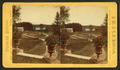
 Juniper Point, Salem Neck, by J.W. & J.S. Moulton 2.jpg 2,737 × 1,430; 1.5 MB
-
 Juniper Point, Salem Neck, by J.W. & J.S. Moulton 2.png 2,737 × 1,430; 4.93 MB
-
 Juniper Point, Salem Neck, by J.W. & J.S. Moulton.jpg 2,737 × 1,439; 1.36 MB
-
 Juniper Point, Salem Neck, by J.W. & J.S. Moulton.png 2,737 × 1,439; 4.55 MB
-
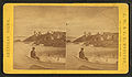 People on the rocks and in a boat at Salem Neck, by J.W. & J.S. Moulton.jpg 2,737 × 1,596; 1.47 MB
-
 People on the rocks and in a boat at Salem Neck, by J.W. & J.S. Moulton.png 2,737 × 1,596; 5 MB
-
 Playing croquet, by J.W. & J.S. Moulton.jpg 2,737 × 1,597; 1.73 MB
-
 Playing croquet, by J.W. & J.S. Moulton.png 2,737 × 1,597; 5.62 MB
-
 Plummer farm on Salem Neck, by J.W. & J.S. Moulton.jpg 2,737 × 1,617; 1.66 MB
-
 Plummer farm on Salem Neck, by J.W. & J.S. Moulton.png 2,737 × 1,617; 5.44 MB
-
 Shore view, Salem Neck, by J.W. & J.S. Moulton.jpg 2,737 × 1,405; 1.38 MB
-
 Shore view, Salem Neck, by J.W. & J.S. Moulton.png 2,737 × 1,405; 4.54 MB
-
 Station switch and signal, by J.W. & J.S. Moulton.jpg 760 × 394; 42 KB
-
 Takes the narrow gauge, by J.W. & J.S. Moulton (cropped).jpg 289 × 342; 15 KB
-
 Takes the narrow gauge, by J.W. & J.S. Moulton.jpg 760 × 387; 43 KB
-
 Unidentified commercial block, by J.W. & J.S. Moulton.jpg 2,737 × 1,605; 1.78 MB
-
 Unidentified commercial block, by J.W. & J.S. Moulton.png 2,737 × 1,605; 5.83 MB
-
 View in Harmony Grove, by J.W. & J.S. Moulton.jpg 2,737 × 1,434; 1.63 MB
-
 View in Harmony Grove, by J.W. & J.S. Moulton.png 2,737 × 1,434; 5.39 MB
-
 View in Kernwood, Salem, Mass, by J.W. & J.S. Moulton.jpg 2,737 × 1,587; 1.78 MB
-
 View in Kernwood, Salem, Mass, by J.W. & J.S. Moulton.png 2,737 × 1,587; 5.75 MB
-
 View of an unidentified building, by J.W. & J.S. Moulton.jpg 2,737 × 1,587; 1.7 MB
-
 View of an unidentified building, by J.W. & J.S. Moulton.png 2,737 × 1,587; 5.57 MB
-
 Willows, by J.W. & J.S. Moulton.jpg 2,737 × 1,434; 1.53 MB
-
 Willows, by J.W. & J.S. Moulton.png 2,737 × 1,434; 5.04 MB
-
 Willows, Salem Neck, by J.W. & J.S. Moulton.jpg 2,737 × 1,591; 1.6 MB
-
 Willows, Salem Neck, by J.W. & J.S. Moulton.png 2,737 × 1,591; 5.38 MB


_cropped.jpg)
_cropped.jpg)

.jpg)


.jpg)


