Category:Jüdischer Friedhof Smarlingen
Jump to navigation
Jump to search
| Object location | | View all coordinates using: OpenStreetMap |
|---|
Jewish cemetery in Germany | |||||
| Upload media | |||||
| Instance of | |||||
|---|---|---|---|---|---|
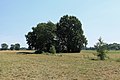
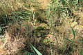
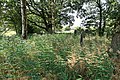
| Location | Weener, Leer, Lower Saxony, Germany | ||||
 | |||||
Media in category "Jüdischer Friedhof Smarlingen"
The following 26 files are in this category, out of 26 total.
-
 Der Jüdische Friedhof smarlingen94.jpg 4,752 × 3,168; 4.21 MB
-
 Weener - Smarlingen - Jüdischer Friedhof 01 ies.jpg 5,616 × 3,745; 19.04 MB
-
 Weener - Smarlingen - Jüdischer Friedhof 02 ies.jpg 5,616 × 3,744; 18.93 MB
-
 Weener - Smarlingen - Jüdischer Friedhof 03 ies.jpg 5,616 × 3,744; 21.74 MB
-
 Weener - Smarlingen - Jüdischer Friedhof 04 ies.jpg 3,744 × 5,616; 20.88 MB
-
 Weener - Smarlingen - Jüdischer Friedhof 05 ies.jpg 5,616 × 3,744; 31.73 MB
-
 Weener - Smarlingen - Jüdischer Friedhof 06 ies.jpg 3,744 × 5,616; 26.35 MB
-
 Weener - Smarlingen - Jüdischer Friedhof 07 ies.jpg 3,744 × 5,616; 21.98 MB
-
 Weener - Smarlingen - Jüdischer Friedhof 08 ies.jpg 5,616 × 3,744; 32.75 MB
-
 Weener - Smarlingen - Jüdischer Friedhof 09 ies.jpg 5,616 × 3,744; 31.89 MB
-
 Weener - Smarlingen - Jüdischer Friedhof 10 ies.jpg 5,616 × 3,744; 26.45 MB
-
 Weener - Smarlingen - Jüdischer Friedhof 11 ies.jpg 5,616 × 3,744; 28.98 MB
-
 Weener - Smarlingen - Jüdischer Friedhof 12 ies.jpg 5,616 × 3,744; 33.52 MB
-
 Weener - Smarlingen - Jüdischer Friedhof 13 ies.jpg 5,616 × 3,744; 29.32 MB
-
 Weener - Smarlingen - Jüdischer Friedhof 14 ies.jpg 5,616 × 3,745; 24.76 MB
-
 Weener - Smarlingen - Jüdischer Friedhof 15 ies.jpg 5,616 × 3,744; 33.44 MB
-
 Weener - Smarlingen - Jüdischer Friedhof 16 ies.jpg 5,616 × 3,744; 32.08 MB
-
 Weener - Smarlingen - Jüdischer Friedhof 17 ies.jpg 3,744 × 5,616; 27.08 MB
-
 Weener - Smarlingen - Jüdischer Friedhof 18 ies.jpg 5,616 × 3,744; 24.21 MB
-
 Weener - Smarlingen - Jüdischer Friedhof 19 ies.jpg 3,743 × 5,616; 19.28 MB
-
 Weener - Smarlingen - Jüdischer Friedhof 20 ies.jpg 3,744 × 5,616; 22.18 MB
-
 Weener - Smarlingen - Jüdischer Friedhof 21 ies.jpg 5,616 × 3,744; 21.92 MB
-
 Weener - Smarlingen - Jüdischer Friedhof 22 ies.jpg 5,616 × 3,744; 33.03 MB
-
 Weener - Smarlingen - Jüdischer Friedhof 23 ies.jpg 3,744 × 5,616; 27.28 MB
-
 Weener - Smarlingen - Jüdischer Friedhof 24 ies.jpg 5,616 × 3,744; 32.86 MB
-
 Weener - Smarlingen - Jüdischer Friedhof 25 ies.jpg 5,616 × 3,744; 34.39 MB


