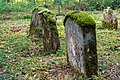
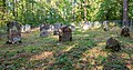
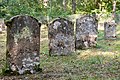
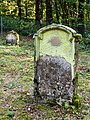
Category:Jüdischer Friedhof Laibach (Dörzbach)
Jump to navigation
Jump to search
| Object location | | View all coordinates using: OpenStreetMap |
|---|
_02.jpg) | |||||
| Upload media | |||||
| Instance of | |||||
|---|---|---|---|---|---|
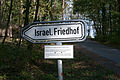
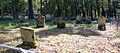
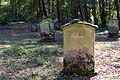
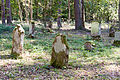
| Location | Dörzbach, Hohenlohe, Stuttgart Government Region, Baden-Württemberg, Germany | ||||
 | |||||
Media in category "Jüdischer Friedhof Laibach (Dörzbach)"
The following 22 files are in this category, out of 22 total.
-
 2015-09-29 Jüdischer Friedhof Laibach (Dörzbach) 01.jpg 4,288 × 2,848; 6.71 MB
-
 2015-09-29 Jüdischer Friedhof Laibach (Dörzbach) 02.jpg 3,991 × 2,651; 11.41 MB
-
 2015-09-29 Jüdischer Friedhof Laibach (Dörzbach) 03.jpg 3,524 × 1,558; 5.24 MB
-
 2015-09-29 Jüdischer Friedhof Laibach (Dörzbach) 04.jpg 3,905 × 2,603; 9.05 MB
-
 2015-09-29 Jüdischer Friedhof Laibach (Dörzbach) 05.jpg 4,288 × 2,848; 12.22 MB
-
 2015-09-29 Jüdischer Friedhof Laibach (Dörzbach) 06.jpg 4,086 × 2,714; 10.63 MB
-
 2020-09-20 Jüdischer Friedhof Laibach (Dörzbach) 01.jpg 4,563 × 2,985; 10.08 MB
-
 2020-09-20 Jüdischer Friedhof Laibach (Dörzbach) 02.jpg 4,587 × 3,058; 7.51 MB
-
 2020-09-20 Jüdischer Friedhof Laibach (Dörzbach) 03.jpg 5,170 × 2,733; 6.23 MB
-
 2020-09-20 Jüdischer Friedhof Laibach (Dörzbach) 04.jpg 5,034 × 3,356; 7.63 MB
-
 2020-09-20 Jüdischer Friedhof Laibach (Dörzbach) 05.jpg 2,722 × 3,629; 6.04 MB
-
 2020-09-20 Jüdischer Friedhof Laibach (Dörzbach) 06.jpg 5,001 × 3,334; 9.68 MB
-
 2020-09-20 Jüdischer Friedhof Laibach (Dörzbach) 07.jpg 3,386 × 3,386; 6.61 MB
-
 2020-09-20 Jüdischer Friedhof Laibach (Dörzbach) 08.jpg 5,307 × 3,538; 9.88 MB
-
 2020-09-20 Jüdischer Friedhof Laibach (Dörzbach) 09.jpg 5,017 × 3,345; 8.31 MB
-
 2020-09-20 Jüdischer Friedhof Laibach (Dörzbach) 10.jpg 5,568 × 3,712; 12.03 MB
-
 2020-09-20 Jüdischer Friedhof Laibach (Dörzbach) 11.jpg 5,546 × 2,588; 9.97 MB
-
 2020-09-20 Jüdischer Friedhof Laibach (Dörzbach) 12.jpg 5,568 × 3,712; 10.26 MB
-
 2020-09-20 Jüdischer Friedhof Laibach (Dörzbach) 13.jpg 4,592 × 3,540; 9.24 MB
-
 2020-09-20 Jüdischer Friedhof Laibach (Dörzbach) 14.jpg 5,060 × 3,373; 8.31 MB
-
 2020-09-20 Jüdischer Friedhof Laibach (Dörzbach) 15.jpg 4,563 × 3,042; 6.48 MB
-
 2020-09-20 Jüdischer Friedhof Laibach (Dörzbach) Infotafel.jpg 2,549 × 3,875; 4.42 MB
_01.jpg)
_03.jpg)
_04.jpg)
_05.jpg)
_06.jpg)
_01.jpg)
_02.jpg)
_03.jpg)
_04.jpg)
_05.jpg)
_06.jpg)
_07.jpg)
_08.jpg)
_09.jpg)
_10.jpg)
_11.jpg)
_12.jpg)
_13.jpg)
_14.jpg)
_15.jpg)
_Infotafel.jpg)