Category:Jüdischer Friedhof (Gemünden (Hunsrück))
Jump to navigation
Jump to search
| Object location | | View all coordinates using: OpenStreetMap |
|---|
| Upload media | |||||
| Instance of | |||||
|---|---|---|---|---|---|
| Location | Gemünden, Rhein-Hunsrück-Kreis, Rhineland-Palatinate, Germany | ||||
| Heritage designation | |||||
 | |||||
Media in category "Jüdischer Friedhof (Gemünden (Hunsrück))"
The following 4 files are in this category, out of 4 total.
-
 Gemünden (Hunsrück), Jüdischer Friedhof, Eingang.jpg 3,264 × 4,928; 8.77 MB
-
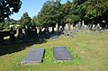
 Gemünden (Hunsrück), Jüdischer Friedhof, Gräber (1).jpg 4,928 × 3,264; 9.03 MB
-
 Gemünden (Hunsrück), Jüdischer Friedhof, Gräber.jpg 4,928 × 3,264; 8.67 MB
-
 Gemünden (Hunsrück), Jüdischer Friedhof, Stele.jpg 3,264 × 4,928; 7.38 MB
,_J%C3%BCdischer_Friedhof,_Eingang.jpg)
,_J%C3%BCdischer_Friedhof,_Gr%C3%A4ber_(1).jpg)
,_J%C3%BCdischer_Friedhof,_Gr%C3%A4ber.jpg)
,_J%C3%BCdischer_Friedhof,_Stele.jpg)