Category:Ivinghoe
Jump to navigation
Jump to search
village and civil parish in Buckinghamshire, England  | |||||
| Upload media | |||||
| Instance of | |||||
|---|---|---|---|---|---|
| Location | Buckinghamshire, South East England, England | ||||
| Population |
| ||||
| Different from | |||||
| Said to be the same as | Ivinghoe (Wikimedia duplicated page, civil parish) | ||||
| official website | |||||
 | |||||
English: Ivinghoe is a village and civil parish within Aylesbury Vale district in Buckinghamshire, England, close to the border with Hertfordshire and Bedfordshire. It is four miles north of Tring and six miles south of Leighton Buzzard, close to the village of Pitstone.
Svenska: Ivinghoe Aston är en by i civil parish Ivinghoe. Namnet hänvisar till en gård öster om Ivinghoe. Byn innehåller fyra gårdar. Det finns även en bygdegård, The Village Swan. En liten å kallad Whistle Brook flyter genom byn, från byn Chilterns ner till River Ouzel nära Slapton.
Subcategories
This category has the following 10 subcategories, out of 10 total.
B
- Ivinghoe Bridge (9 F)
F
- Ford End Watermill, Ivinghoe (22 F)
H
- Horton Lock (12 F)
I
- Ivinghoe Aston (7 F)
- Ivinghoe Town Hall (4 F)
M
R
T
Media in category "Ivinghoe"
The following 200 files are in this category, out of 281 total.
(previous page) (next page)-
 'Meadowsweet' at Ivinghoe Locks - geograph.org.uk - 5895235.jpg 640 × 425; 136 KB
-
 10 Station Road, Ivinghoe, May 2024.jpg 4,032 × 3,024; 5.03 MB
-
 12 and 14 Station Road, Ivinghoe, Buckinghamshire, May 2024.jpg 4,032 × 3,024; 4.68 MB
-
 23 and 25 High Street, Ivinghoe, May 2024.jpg 4,032 × 3,024; 3.02 MB
-
 4, 4a and 6, Vicarage Lane, Ivinghoe, May 2024.jpg 4,032 × 3,024; 3.88 MB
-
 9 High Street, Ivinghoe, Buckinghamshire, May 2024.jpg 3,024 × 4,032; 4.62 MB
-
 9 Vicarage Lane, Ivinghoe, Buckinghamshire, May 2024.jpg 4,032 × 3,024; 5.68 MB
-
 Ashridge - Clipper Down - geograph.org.uk - 5277290.jpg 2,560 × 1,920; 3.24 MB
-
 Ashridge - Cycle Route - geograph.org.uk - 5277285.jpg 1,920 × 2,560; 2.47 MB
-
 Ashridge Estate - Gate - geograph.org.uk - 5277282.jpg 2,560 × 1,920; 2.91 MB
-
 Ashridge Estate - geograph.org.uk - 5056497.jpg 480 × 640; 99 KB
-
 Ashridge Estate - geograph.org.uk - 5056499.jpg 480 × 640; 56 KB
-
 Ashridge Estate - geograph.org.uk - 5056503.jpg 480 × 640; 108 KB
-
 Ashridge Estate - geograph.org.uk - 5056505.jpg 480 × 640; 90 KB
-
 Ashridge Estate - geograph.org.uk - 5056508.jpg 480 × 640; 112 KB
-
 Ashridge Estate - geograph.org.uk - 5276718.jpg 2,560 × 1,920; 2.92 MB
-
 At the foot of Incombe Hole - geograph.org.uk - 5488150.jpg 4,608 × 3,456; 5.55 MB
-
 At the top of the hill. - geograph.org.uk - 2267141.jpg 1,024 × 768; 237 KB
-
 B489 towards Dunstable - geograph.org.uk - 5894990.jpg 640 × 425; 210 KB
-
 B489, near Ivinghoe - geograph.org.uk - 3532821.jpg 4,000 × 3,000; 4.65 MB
-
 Barley End Farm towards Clipper Down - geograph.org.uk - 2630247.jpg 2,592 × 1,944; 2.3 MB
-
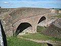
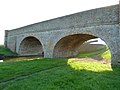 Bridge 121, Grand Junction Canal - geograph.org.uk - 2700535.jpg 4,000 × 3,000; 4.93 MB
-
 Bridge 121, Grand Union Canal - geograph.org.uk - 3997879.jpg 640 × 480; 108 KB
-
 Bridge 122, Grand Junction Canal - geograph.org.uk - 2700572.jpg 4,000 × 3,000; 4.79 MB
-
 Bridgewater Cottage, 6 High Street, Ivinghoe, May 2024.jpg 4,032 × 3,024; 5.39 MB
-
 Bridleway to Church End - geograph.org.uk - 6799906.jpg 1,024 × 576; 118 KB
-
 Broad grassy track on the Ridgeway leading to Steps Hill - geograph.org.uk - 3142971.jpg 2,048 × 1,536; 879 KB
-
 Brook's Statnalls Wood - geograph.org.uk - 1309562.jpg 640 × 480; 158 KB
-
 Bull Pen, Ford End Farm, Ivinghoe - geograph.org.uk - 1250398.jpg 616 × 480; 119 KB
-
 Cattle Grid at Clipper Down - geograph.org.uk - 2626777.jpg 2,896 × 1,944; 1.43 MB
-
 Chalk path leading to Ivinghoe Beacon - geograph.org.uk - 3142983.jpg 2,048 × 1,536; 909 KB
-
 Chalk quarry at Ivinghoe Aston - geograph.org.uk - 5307262.jpg 2,288 × 1,712; 781 KB
-
 Chalk track going up Steps Hill - geograph.org.uk - 3142972.jpg 2,048 × 1,536; 1.02 MB
-
 Chalk track on Pitstone Hill - geograph.org.uk - 3142968.jpg 2,048 × 1,536; 1.21 MB
-
 Chalky route on the Ridgeway towards Ivinghoe Beacon - geograph.org.uk - 3142985.jpg 2,048 × 1,536; 890 KB
-
 Chapel Lane - geograph.org.uk - 4443287.jpg 2,560 × 1,920; 1.89 MB
-
 Chapel Lane - geograph.org.uk - 4443294.jpg 2,560 × 1,920; 2.01 MB
-
 Chapel Lane - geograph.org.uk - 6799911.jpg 1,024 × 576; 192 KB
-
 Chapel Lane before Ivinghoe Aston - geograph.org.uk - 4443366.jpg 2,560 × 1,920; 1.71 MB
-
 Chapel Lane, Horton - geograph.org.uk - 4442936.jpg 2,560 × 1,920; 1.9 MB
-
 Church Road in Ivinghoe - geograph.org.uk - 5009559.jpg 1,500 × 999; 205 KB
-
 Classic tractor and the Dunstable Downs - geograph.org.uk - 3265322.jpg 2,248 × 1,686; 1.21 MB
-
 Clipper Down - geograph.org.uk - 3289079.jpg 1,280 × 958; 1.16 MB
-
 Coombe Bottom - geograph.org.uk - 4626934.jpg 4,320 × 3,240; 3.75 MB
-
 Coombe Bottom from the slopes of Ivinghoe Beacon - geograph.org.uk - 5307252.jpg 2,288 × 1,712; 660 KB
-
 Coombe Hole panorama - geograph.org.uk - 1175284.jpg 640 × 188; 128 KB
-
 Cottages in Greatgap - geograph.org.uk - 5894458.jpg 640 × 425; 180 KB
-
 Country Garden, Vicarage Lane, Ivinghoe - geograph.org.uk - 2461834.jpg 800 × 533; 795 KB
-
 Country Home in Vicarage Lane, Ivinghoe - geograph.org.uk - 2461824.jpg 800 × 534; 626 KB
-
 Countryside below Duncombe Terrace - geograph.org.uk - 6444607.jpg 1,799 × 1,199; 407 KB
-
 Decorated KX300 Telephone Kiosk - geograph.org.uk - 5397391.jpg 1,200 × 1,600; 496 KB
-
 Decorated KX300 Telephone Kiosk - geograph.org.uk - 5397408.jpg 1,200 × 1,600; 457 KB
-
 Decorated shelter - geograph.org.uk - 5396360.jpg 1,600 × 1,064; 380 KB
-
 Deer - geograph.org.uk - 2267156.jpg 1,024 × 768; 99 KB
-
 Duncombe Terrace - geograph.org.uk - 5277293.jpg 2,560 × 1,920; 3.77 MB
-
 Dunstable Downs from Gallows Hill - geograph.org.uk - 3142997.jpg 2,048 × 1,536; 792 KB
-
 Dunstable Downs from the lower slopes of Gallows Hill - geograph.org.uk - 3143003.jpg 2,048 × 1,536; 833 KB
-
 Edlesborough Church from Ivinghoe Beacon - geograph.org.uk - 3852812.jpg 1,142 × 1,000; 874 KB
-
 Enigma - geograph.org.uk - 2267165.jpg 1,024 × 768; 91 KB
-
 Enigma 2 - geograph.org.uk - 2267169.jpg 1,024 × 768; 224 KB
-
 Enigma 3 - geograph.org.uk - 2267171.jpg 1,024 × 768; 234 KB
-
 Entering Ivinghoe Aston - geograph.org.uk - 3995330.jpg 640 × 480; 94 KB
-
 Entering Ivinghoe Aston - geograph.org.uk - 4443079.jpg 2,560 × 1,920; 1.9 MB
-
 Entrance to Ashridge Golf Club - geograph.org.uk - 2416688.jpg 1,600 × 1,200; 583 KB
-
 Entrance to Ashridge Golf Club, Ringshall - geograph.org.uk - 2416693.jpg 1,600 × 1,200; 547 KB
-
 Falcon House - geograph.org.uk - 2749178.jpg 640 × 352; 26 KB
-

-
 Farmland east of Cheddington - geograph.org.uk - 3884486.jpg 640 × 323; 33 KB
-
 Farmyard, Horton Wharf Farm - geograph.org.uk - 3995299.jpg 640 × 480; 101 KB
-

-
 Field entrance, Ivinghoe Aston - geograph.org.uk - 4443091.jpg 2,560 × 1,920; 1.95 MB
-
 Footpath from the towpath to Great Seabrook Farm - geograph.org.uk - 6169367.jpg 1,600 × 1,070; 553 KB
-
 Footpath over Horton Lock Bridge - geograph.org.uk - 6120652.jpg 1,600 × 1,066; 437 KB
-
 Footpath towards the kennels - geograph.org.uk - 6120617.jpg 1,600 × 1,066; 495 KB
-
 Ford End Farm at Ivinghoe - geograph.org.uk - 1250396.jpg 640 × 480; 172 KB
-
 Former Ivinghoe Youth Hostel - geograph.org.uk - 6412865.jpg 1,797 × 1,198; 395 KB
-
 Former Strict Baptist chapel, Ivinghoe, Buckinghamshire, May 2024.jpg 4,032 × 3,024; 3.56 MB
-
 Gallows Hill - Cereal Fields - geograph.org.uk - 5277204.jpg 2,560 × 1,920; 2.56 MB
-
 Gallows Hill - Cereal Harvest - geograph.org.uk - 5277277.jpg 2,560 × 1,920; 3.06 MB
-
 Gallows Hill - geograph.org.uk - 5277206.jpg 2,560 × 1,920; 2.65 MB
-
 Gallows Hill from Ivinghoe Beacon - geograph.org.uk - 3142986.jpg 2,048 × 1,536; 784 KB
-
 GOC Cheddington 163 The Brownlow, Ivinghoe (10818449913).jpg 3,740 × 2,812; 2.9 MB
-
 GOC Cheddington 166 GUC Bridge 122 (10818196306).jpg 4,288 × 3,216; 3.99 MB
-
 Grand Union Canal - geograph.org.uk - 2167289.jpg 640 × 480; 88 KB
-
 Grand Union Canal near Horton Wharf - geograph.org.uk - 5000839.jpg 800 × 680; 164 KB
-
 Grand Union Canal Walk - geograph.org.uk - 6169362.jpg 1,600 × 1,071; 374 KB
-
 Grand Union Canal Walk and narrowboat - geograph.org.uk - 6169360.jpg 1,600 × 1,069; 396 KB
-
 Grand Union Canal Walk heading for the lock - geograph.org.uk - 6169374.jpg 1,600 × 1,068; 581 KB
-
 Grand Union Canal, Bridge Number 121 - geograph.org.uk - 3705329.jpg 640 × 480; 98 KB
-

-

-
 Grand Union Canal, near Ivinghoe - geograph.org.uk - 5895259.jpg 640 × 425; 148 KB
-

-
 Grand Union Canal, Reach near Horton - geograph.org.uk - 3705379.jpg 640 × 480; 63 KB
-
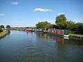 Grand Union Canal, Seabrook Moorings - geograph.org.uk - 3705823.jpg 640 × 480; 60 KB
-
 Great Gap, PYO...gooseberries - geograph.org.uk - 1446071.jpg 640 × 480; 109 KB
-
 Grounded model aircraft on Ivinghoe Beacon - geograph.org.uk - 3852804.jpg 1,579 × 1,000; 1.28 MB
-
 Grove Farm, Ivinghoe Aston - geograph.org.uk - 3559090.jpg 3,264 × 2,448; 3.22 MB
-
 Harvest time on the B489 - geograph.org.uk - 4135242.jpg 4,076 × 2,884; 3.56 MB
-
 Heath and Reach Double Arches Wind Turbine - geograph.org.uk - 4626968.jpg 4,320 × 3,240; 4.14 MB
-
 Hill (180311015).jpeg 2,048 × 1,365; 1.14 MB
-
 Hog Hall Lane - geograph.org.uk - 6799075.jpg 1,024 × 576; 139 KB
-
 House by the Reservoir - geograph.org.uk - 3265332.jpg 2,560 × 1,920; 1,005 KB
-
 House on High St - geograph.org.uk - 4858720.jpg 640 × 426; 50 KB
-
 Houses on Vicarage Lane - geograph.org.uk - 3995393.jpg 640 × 480; 132 KB
-
 Ice Flows on the Canal - geograph.org.uk - 2206516.jpg 768 × 1,024; 127 KB
-
 Icknield Way - geograph.org.uk - 2234426.jpg 768 × 1,024; 254 KB
-
 Icknield Way - geograph.org.uk - 5277147.jpg 2,560 × 1,920; 2.35 MB
-
 Incombe Hole - geograph.org.uk - 3211474.jpg 3,008 × 2,000; 1.35 MB
-
 Incombe Hole - geograph.org.uk - 5276694.jpg 2,560 × 1,920; 2.86 MB
-
 Incombe Hole - highest reaches of the dry valley - geograph.org.uk - 3852558.jpg 1,333 × 1,000; 1.16 MB
-
 Incombe Hole - main sweep of the dry valley - geograph.org.uk - 3852576.jpg 1,173 × 1,000; 1.07 MB
-
 Incombe Hole - snaking dry valley - geograph.org.uk - 3852567.jpg 1,547 × 1,000; 1.36 MB
-
 Incombe Hole below Steps Hill - geograph.org.uk - 3142975.jpg 2,048 × 1,536; 1,002 KB
-
 Incombe Hole from Steps Hill - geograph.org.uk - 3142978.jpg 2,048 × 1,536; 936 KB
-
 Incombe Hole, Ivinghoe - geograph.org.uk - 1450580.jpg 640 × 427; 96 KB
-
 Ivinghoe - geograph.org.uk - 787578.jpg 640 × 427; 49 KB
-
 Ivinghoe - Town Farm - geograph.org.uk - 5277169.jpg 2,502 × 1,840; 2.28 MB
-
 Ivinghoe Bottom Lock No 32 - geograph.org.uk - 5000847.jpg 800 × 623; 136 KB
-
 Ivinghoe Lock Bridge No 122 - geograph.org.uk - 5000855.jpg 800 × 568; 115 KB
-
 Ivinghoe Locks - geograph.org.uk - 139175.jpg 640 × 480; 69 KB
-
 Ivinghoe recreation ground - geograph.org.uk - 4528766.jpg 1,600 × 1,066; 274 KB
-

-
 Ivinghoe Top Lock, Grand Union Canal - geograph.org.uk - 5894325.jpg 640 × 425; 181 KB
-
 Ivinghoe Town Hall - geograph.org.uk - 5897287.jpg 425 × 640; 178 KB
-
 Ivinghoe Village Centre - geograph.org.uk - 5397379.jpg 1,600 × 1,200; 484 KB
-
 Ivinghoe village from Pitstone Hill - geograph.org.uk - 3797155.jpg 1,493 × 1,000; 1.16 MB
-
 Ivinghoe, Beacon Hill - geograph.org.uk - 6666662.jpg 1,600 × 1,177; 573 KB
-
 Ivinghoe, Beacon Hill Triangulation Pillar - geograph.org.uk - 6666669.jpg 1,600 × 1,200; 584 KB
-
 Ivinghoe, Dockey Wood bluebells (1) - geograph.org.uk - 5911659.jpg 1,024 × 683; 338 KB
-
 Ivinghoe, Dockey Wood bluebells (2) - geograph.org.uk - 5911661.jpg 1,024 × 683; 292 KB
-
 Ivinghoe, Gallows Hill - geograph.org.uk - 6666606.jpg 1,600 × 1,200; 715 KB
-
 Ivinghoe, May 2024 11.jpg 4,032 × 3,024; 4.25 MB
-
 King's Head, Ivinghoe - geograph.org.uk - 4528769.jpg 1,600 × 1,065; 397 KB
-
 Kings Head pub, Ivinghoe village - geograph.org.uk - 5487069.jpg 4,608 × 3,456; 4.93 MB
-
 Leaving Ivinghoe Aston - geograph.org.uk - 4443012.jpg 2,560 × 1,824; 1.25 MB
-
 Lightsky (180311115).jpeg 2,048 × 1,365; 576 KB
-
 Lightsky 2 (180311205).jpeg 2,048 × 1,365; 428 KB
-
 Lock 32, Grand Junction Canal - Ivinghoe Bottom Lock - geograph.org.uk - 2700560.jpg 4,000 × 3,000; 4.93 MB
-
 Lock 32, Grand Junction Canal - Ivinghoe Bottom Lock - geograph.org.uk - 2700567.jpg 4,000 × 3,000; 4.9 MB
-
 Lock 33, Grand Junction Canal - Ivinghoe Top Lock - geograph.org.uk - 2700681.jpg 4,000 × 3,000; 4.65 MB
-
 Lock 33, Grand Junction Canal - Ivinghoe Top Lock - geograph.org.uk - 2700691.jpg 4,000 × 3,000; 4.58 MB
-
 Lock 34, Grand Junction Canal - Seabrook Bottom Lock - geograph.org.uk - 2701498.jpg 4,000 × 3,000; 4.96 MB
-
 Lock 34, Grand Junction Canal - Seabrook Bottom Lock - geograph.org.uk - 2701513.jpg 4,000 × 3,000; 5.07 MB
-
 Lock 35, Grand Junction Canal - Seabrook Middle Lock - geograph.org.uk - 2701560.jpg 4,000 × 3,000; 5.22 MB
-
 Lock 35, Grand Junction Canal - Seabrook Middle Lock - geograph.org.uk - 2701577.jpg 4,000 × 3,000; 4.92 MB
-
 Lock 36, Grand Junction Canal - Seabrook Top Lock - geograph.org.uk - 2701588.jpg 4,000 × 3,000; 5.05 MB
-
 Lock 36, Grand Junction Canal - Seabrook Top Lock - geograph.org.uk - 2701778.jpg 4,000 × 3,000; 4.93 MB
-
 Lock and pumping station on the Grand Union Canal - geograph.org.uk - 6169366.jpg 1,600 × 1,074; 527 KB
-
 Logs in Dockey Woods, Hertfordshire - geograph.org.uk - 5358698.jpg 3,648 × 5,472; 2.78 MB
-
 Look back towards Pitstone Hill from Steps Hill - geograph.org.uk - 3142973.jpg 2,048 × 1,536; 717 KB
-
 Looking down on Incombe Hole - geograph.org.uk - 5487115.jpg 4,608 × 3,456; 4.84 MB
-
 Looking towards Gallows Hill - geograph.org.uk - 2267140.jpg 1,024 × 768; 144 KB
-
 Looking towards the car park from Gallows Hill - geograph.org.uk - 3143001.jpg 2,048 × 1,536; 550 KB
-
 Meeting of the ways in Ashridge - geograph.org.uk - 1328041.jpg 640 × 480; 249 KB
-

-
 Middle Path Farm - geograph.org.uk - 5277141.jpg 2,560 × 1,920; 2.83 MB
-
 Middle Path Farm - geograph.org.uk - 5277144.jpg 2,560 × 1,920; 2.85 MB
-
 Milestone 51 - geograph.org.uk - 4797532.jpg 640 × 480; 203 KB
-
 Milestone 52 - geograph.org.uk - 4797542.jpg 1,000 × 661; 333 KB
-

-

-
 Narrowboats moored along the Grand Union Canal - geograph.org.uk - 6169372.jpg 1,600 × 1,066; 438 KB
-
 Narrowboats moored at Horton Wharf - geograph.org.uk - 5000708.jpg 800 × 562; 99 KB
-
 No Entry^ - geograph.org.uk - 2700778.jpg 4,000 × 3,000; 4.83 MB
-
 Old chalk quarry - geograph.org.uk - 3559097.jpg 3,264 × 2,448; 3.13 MB
-
 On the Icknield Way, towards Ivinghoe Beacon - geograph.org.uk - 3143013.jpg 2,048 × 1,536; 932 KB
-
 One less of whatever it is - geograph.org.uk - 2238276.jpg 1,200 × 1,600; 695 KB
-
 Outer Aylesbury Ring - geograph.org.uk - 4781780.jpg 640 × 480; 66 KB
-
 Outer Aylesbury Ring - geograph.org.uk - 4781784.jpg 640 × 480; 42 KB
-
 Outer Aylesbury ring footpath approaching Horton Wharf - geograph.org.uk - 6120640.jpg 1,600 × 1,066; 520 KB
-

-
 Path heading towards Ivinghoe - geograph.org.uk - 6799934.jpg 1,024 × 576; 191 KB
-
 Path heading towards South End Lane - geograph.org.uk - 6799902.jpg 1,024 × 576; 196 KB
-
 Path leading to the Icknield Way from Gallows Hill - geograph.org.uk - 3143009.jpg 2,048 × 1,536; 732 KB
-
 Path nearing Beacon Road - geograph.org.uk - 6799035.jpg 1,024 × 576; 191 KB
-
 Path to Hog Hall - geograph.org.uk - 6799045.jpg 1,024 × 576; 198 KB
-
 Path to Pitstone - geograph.org.uk - 3827519.jpg 2,560 × 1,920; 2.08 MB
-
 Path up to Grove Farm - geograph.org.uk - 6799907.jpg 1,024 × 576; 150 KB
-
 Picnickers near Ivinghoe Beacon - geograph.org.uk - 2968018.jpg 2,560 × 1,920; 2.2 MB
-
 Pitstone Windmill from near Ivinghoe Beacon - geograph.org.uk - 4040776.jpg 1,000 × 750; 181 KB
-

-
 Pylon by Falcon House - geograph.org.uk - 2489823.jpg 493 × 640; 46 KB
-
 Pylon by Great Seabrook Farm - geograph.org.uk - 3884490.jpg 640 × 430; 50 KB
-
 Pylon near Falcon House - geograph.org.uk - 4348654.jpg 640 × 430; 44 KB
-
 Pylon near Falcon House - geograph.org.uk - 4769208.jpg 640 × 426; 35 KB
-
 Pylon near Falcon House - geograph.org.uk - 5373310.jpg 640 × 426; 32 KB
-
 Pylons - geograph.org.uk - 6712208.jpg 1,024 × 685; 56 KB
-
 Rape fields below Ivinghoe Beacon - geograph.org.uk - 2929789.jpg 1,333 × 1,000; 979 KB
-
 Road at the base of Ivinghoe Beacon - geograph.org.uk - 4869786.jpg 800 × 520; 111 KB
-
 Roberts memorial bench, Ivinghoe, May 2024.jpg 4,032 × 3,024; 5.18 MB
-
 Rosewood Cottage, 4 High Street, Ivinghoe, May 2024.jpg 4,032 × 3,024; 4.98 MB
-
 Rural scene east of Cheddington - geograph.org.uk - 2861695.jpg 640 × 345; 27 KB
-
 Seabrook Lock - geograph.org.uk - 6169358.jpg 1,600 × 1,069; 442 KB
-

-
 Seabrook Middle Lock 35 - geograph.org.uk - 676193.jpg 640 × 432; 72 KB
-

-

-
 Sheep and snow east of Cheddington - geograph.org.uk - 2254720.jpg 640 × 420; 50 KB
-


.jpg)
.jpg)


.jpeg)


_-_geograph.org.uk_-_5911659.jpg)
_-_geograph.org.uk_-_5911661.jpg)


.jpeg)
.jpeg)


