Category:Italian-language maps showing history of Europe
Jump to navigation
Jump to search
Subcategories
This category has only the following subcategory.
Media in category "Italian-language maps showing history of Europe"
The following 48 files are in this category, out of 48 total.
-
 Balkans850-it.svg 1,521 × 1,424; 1.67 MB
-
 Battaglia dei Campi Catalaunici.png 843 × 748; 178 KB
-
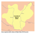 Bijelo Brdo Culture-it.svg 760 × 684; 92 KB
-

-
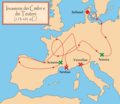 Cimbrians and Teutons - it.png 600 × 520; 80 KB
-
 Despotate of Morea 1450-it zondertekst.svg 1,303 × 1,214; 205 KB
-
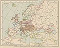
 Europa 1911.png 2,056 × 1,636; 869 KB
-
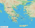 Greecemap-it.svg 993 × 793; 3.2 MB
-
 Hist-balkans-it.svg 408 × 336; 7.38 MB
-
 Map Austria and the spartitions of Poland 1928-1940 - Touring Club Italiano CART-TRC-60.jpg 6,290 × 6,846; 4.53 MB
-
 Map Austria in the napoleonic age 1928-1940 - Touring Club Italiano CART-TRC-61.jpg 5,056 × 6,579; 3.63 MB
-
 Map Europe alliances 1914-it.svg 998 × 593; 89 KB
-
 Map Europe around 560 AD - Touring Club Italiano CART-TRC-50 01.jpg 3,873 × 3,205; 1.52 MB
-
 Map Europe in 1660- Touring Club Italiano CART-TRC-51 01.jpg 3,853 × 3,195; 1.58 MB
-
 Map Europe in 1789- Touring Club Italiano CART-TRC-51 02.jpg 3,836 × 3,065; 1.53 MB
-
 Map Europe in 1810- Touring Club Italiano CART-TRC-52 01.jpg 3,787 × 3,209; 1.56 MB
-
 Map Europe in 1815- Touring Club Italiano CART-TRC-52 02.jpg 3,871 × 3,094; 1.56 MB
-
 Map Europe in 1878 1928-1940 - Touring Club Italiano CART-TRC-58 01.jpg 3,909 × 3,145; 1.6 MB
-
 Map Europe in 1914 1928-1940 - Touring Club Italiano CART-TRC-58 02.jpg 3,863 × 3,050; 1.58 MB
-
 Map Europe in 814- Touring Club Italiano CART-TRC-50 02.jpg 3,826 × 3,086; 1.51 MB
-

-
-

-
 Map Germany in 1520 1928-1940 - Touring Club Italiano CART-TRC-54 02.jpg 4,147 × 3,028; 1.63 MB
-
 Map Germany in 1815 1928-1940 - Touring Club Italiano CART-TRC-57 01.jpg 4,161 × 3,281; 1.68 MB
-
 Map Germany in 1870 1928-1940 - Touring Club Italiano CART-TRC-57 02.jpg 4,507 × 3,040; 1.75 MB
-
 Map Greece 1928-1940 - Touring Club Italiano CART-TRC-38.jpg 7,501 × 6,414; 29.05 MB
-
 Map Italy around 1300- Touring Club Italiano CART-TRC-47.jpg 6,052 × 6,640; 4.72 MB
-
 Map Italy around 500 b.C. - Touring Club Italiano CART-TRC-40.jpg 6,046 × 6,651; 4.22 MB
-
 Map Linguistic map of Europe 1928-1940 - Touring Club Italiano CART-TRC-29.jpg 7,491 × 6,356; 27.8 MB
-

-

-

-
 Map The Roman Empire under Trajan and Adrian- Touring Club Italiano CART-TRC-42.jpg 6,816 × 5,069; 4.02 MB
-
 Mappa dello Stato dei Cavalieri Teutonici 1410.jpg 1,654 × 1,449; 1.65 MB
-
 Piano Nuovo Impero italiano.jpg 1,049 × 907; 331 KB
-
 Pievi della diocesi di Brescia nel 1300 (Luca Giarelli).png 1,367 × 2,000; 364 KB
-
 Reino de los visigodos-it.svg 653 × 670; 35 KB
-
 Roman empire 14 AD (provinces) it.png 2,000 × 1,183; 485 KB
-
 Second world war europe 1943-1945 map it.gif 1,090 × 1,000; 129 KB
-
 West Mediterranean areas 201BC-it.svg 812 × 408; 1.15 MB
-
 West Mediterranean areas 226BC-it.svg 812 × 408; 1.15 MB
-
 West Mediterranean areas 237BC-it.svg 812 × 408; 1.14 MB
-
 West Mediterranean areas 279BC-it.svg 812 × 408; 1.15 MB
-
 West Mediterranean areas 306BC-it.svg 812 × 408; 1.15 MB
-
 West Mediterranean areas 348BC-it.svg 812 × 408; 1.14 MB
-
 West Mediterranean sea areas of influence 509 BC.png 1,200 × 800; 584 KB
-
 West Mediterranean sea areas of influence 509BC-it.svg 812 × 408; 1.14 MB


.svg)


.png)

_it.png)


