Category:Italian-language SVG maps showing history
Jump to navigation
Jump to search
Media in category "Italian-language SVG maps showing history"
The following 84 files are in this category, out of 84 total.
-
 1947-UN-Partition-Plan-1949-Armistice-Comparison-it.svg 500 × 1,029; 33 KB
-
 Achaemenid Empire it.svg 1,500 × 680; 2.35 MB
-
 Adams-Onís treaty map-it.svg 626 × 478; 683 KB
-
 Agilulf's Italy.svg 588 × 702; 23 KB
-
 Anaximander world map-it.svg 1,063 × 1,063; 14 KB
-
 Ancient peloponnese-it.svg 778 × 800; 84 KB
-
 AncientGreekDialects (Woodard) it.svg 660 × 555; 851 KB
-
 Attila in Gaul 451CE-it.svg 1,283 × 981; 392 KB
-
 Austria Hungary ethnic it.svg 1,381 × 1,078; 1.27 MB
-
 Barents 1942-it.svg 969 × 1,094; 158 KB
-
 Battaglia dei Campi Catalaunici.svg 840 × 745; 107 KB
-
 Battaglia del Trasimeno (217 a. C.) - Teoria Susini.svg 1,200 × 938; 384 KB
-
 Battaglia Gergovia 52ac.svg 1,700 × 1,027; 70 KB
-
 Caesar campaigns gaul.svg 755 × 784; 95 KB
-
 Cilician Armenia-it.svg 2,508 × 1,789; 671 KB
-
 Crusade of 1101 v1 IT.svg 1,039 × 726; 284 KB
-
 Czechoslovakia 1930 linguistic map - it.svg 1,281 × 778; 774 KB
-
 Dahala Khagrabari Italian.svg 695 × 444; 6 KB
-
 Deportazione assira.svg 600 × 423; 350 KB
-
 Despotate of Morea 1450-it zondertekst.svg 1,303 × 1,214; 205 KB
-
 Dispartigo de Barato 1947.svg 1,189 × 1,170; 223 KB
-
 Europe 814-it.svg 512 × 336; 910 KB
-
 Frankish Empire 481 to 814-it.svg 1,735 × 1,227; 331 KB
-
 Frankish Empire 768 to 814-it.svg 1,735 × 1,343; 274 KB
-
 Gallipolimap-it.svg 600 × 550; 34 KB
-
 Guerra di Modena.svg 1,050 × 750; 301 KB
-
 Hecataeus world map-it.svg 825 × 803; 32 KB
-
 Illyrian Tribes (Italiano).svg 1,600 × 1,600; 8.57 MB
-
 Illyrians (Italiano).svg 1,600 × 1,600; 5.11 MB
-
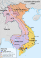 Indochina 1954 to 55 map it.svg 543 × 771; 1.01 MB
-
 Israele e Giuda.svg 2,168 × 3,300; 197 KB
-
 Italia 1600.svg 1,897 × 2,151; 777 KB
-
 Italo-Grecian War 1940 11.svg 451 × 456; 2.75 MB
-
 Italy and Illyria 1084 AD-it.svg 588 × 735; 944 KB
-
 Lelantine War-it.svg 711 × 723; 203 KB
-
 Les Micmacs (multilingual).svg 3,387 × 2,113; 455 KB
-
 Map administrative divisions of the First French Empire 1812-it.svg 2,528 × 1,892; 2.67 MB
-
 Map Almoravid empire-it.svg 546 × 702; 33 KB
-
 Map Anatolia ancient regions-it.svg 921 × 596; 276 KB
-
 Map athenian empire 431 BC-it.svg 993 × 794; 2.92 MB
-
 Map Battle of Stalingrad-it.svg 1,700 × 1,810; 137 KB
-
 Map Byzantine Empire 1025-it.svg 1,963 × 1,104; 88 KB
-
 Map Crusader states 1102-it.svg 591 × 690; 716 KB
-
 Map Crusader states 1165-it.svg 955 × 1,315; 129 KB
-
 Map Crusader states 1190-it.svg 978 × 1,330; 591 KB
-
 Map Crusader states 1197-it.svg 507 × 690; 77 KB
-
 Map Crusader states 1240-it.svg 507 × 690; 699 KB
-
 Map Europe alliances 1914-it.svg 998 × 593; 89 KB
-
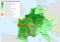
 Map Gaul divisions 481-it.svg 755 × 784; 252 KB
-
 Map Greco-Persian Wars-it.svg 993 × 795; 3.16 MB
-
 Map Greece expansion 1832-1947-it.svg 734 × 962; 88 KB
-
 Map Macedonia 336 BC-it.svg 992 × 794; 2.59 MB
-
 Map of ancient Epirus and environs (Italiano).svg 1,303 × 1,500; 383 KB
-
 Map of Eduens people-it.svg 755 × 784; 76 KB
-
 Map of Iranian Azerbaijan 1945-46 insurgency by Robert Rossow (it).svg 1,498 × 1,003; 865 KB
-
 Map of Lydia ancient times-it.svg 400 × 277; 47 KB
-
 Map Philippi campaign 42 BC-it.svg 1,800 × 730; 528 KB
-
 Mexico 1835-1846 administrative map-it.svg 1,241 × 1,138; 191 KB
-
 Norman conquest 1066 it.svg 851 × 769; 1.82 MB
-
 Pacific Area - The Imperial Powers 1939 - Map-it.svg 1,039 × 814; 2.25 MB
-
 Paolo Antiochia.svg 390 × 385; 301 KB
-
 Paolo origini.svg 390 × 385; 301 KB
-
 Paolo primi anni.svg 390 × 385; 303 KB
-
 Partition of India 1947 it.svg 1,189 × 1,170; 162 KB
-
 Plan battle of Pydna-it-Hammond version.svg 405 × 625; 155 KB
-
 Plan battle of Pydna-it-Johstono version-phase-1.svg 405 × 480; 151 KB
-
 Plan battle of Pydna-it-Johstono version-phase-2.svg 405 × 480; 145 KB
-
 Plan Bibracte-it.svg 606 × 650; 62 KB
-
 Polska 1370 - 1382-it.svg 2,962 × 2,817; 3.58 MB
-
 Pydna-it.svg 1,367 × 1,673; 134 KB
-
 Reame di Siagrio (486).svg 1,436 × 1,344; 74 KB
-
 Regno di Davide.svg 2,168 × 3,300; 162 KB
-
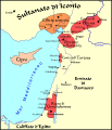
 Regno di Sicilia 1154.svg 712 × 807; 569 KB
-
 Reino de los visigodos-it.svg 653 × 670; 35 KB
-
 Ribbentrop-Molotov it.svg 1,052 × 744; 249 KB
-
 Roman East 50-it.svg 2,717 × 1,595; 857 KB
-
 Serenissima.svg 5,144 × 1,464; 1.27 MB
-
 Seven Hills of Rome-it.svg 654 × 624; 25 KB
-
 St Gotthard 1664.svg 817 × 427; 325 KB
-
 Stati presenti in Campania intorno all'anno 1000 (Gaeta).svg 650 × 415; 260 KB
-
 Stati presenti in Campania intorno all'anno 1000 (Sorrento).svg 650 × 415; 260 KB
-
 Stati presenti in Campania intorno all'anno 1000.svg 648 × 413; 252 KB
-
 Turkestan 1900-it.svg 643 × 400; 93 KB
-
 WW2 Holocaust Europe map-it.svg 1,310 × 1,090; 550 KB


_it.svg)


_-_Teoria_Susini.svg)


.svg)
.svg)


.svg)


.svg)

.svg)


.svg)


.svg)
.svg)


