Category:Isle of Ewe
Jump to navigation
Jump to search
small Scottish island on the west coast of Ross and Cromarty | |||||
| Upload media | |||||
| Instance of | |||||
|---|---|---|---|---|---|
| Part of | |||||
| Location | Highland, Scottish Highlands, Scotland | ||||
| Located in or next to body of water | |||||
| Width |
| ||||
| Length |
| ||||
| Population |
| ||||
| Area |
| ||||
 | |||||
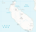
Isle of Ewe is on the west coast of Ross and Cromarty, Inner Hebrides, Scotland.
Media in category "Isle of Ewe"
The following 33 files are in this category, out of 33 total.
-
Admiralty Chart No 3146 Loch Ewe, Published 1900.jpg 10,876 × 22,418; 105.22 MB
-
Anchorage, Isle of Ewe - geograph.org.uk - 253248.jpg 500 × 375; 49 KB
-
Boats on the beach at Ormiscaig - geograph.org.uk - 1216701.jpg 640 × 480; 92 KB
-
Camas Allt Eoin Thòmais - geograph.org.uk - 1046690.jpg 800 × 600; 181 KB
-
Eileaniubhwestcoast.jpg 640 × 480; 113 KB
-
Gob na Lice - geograph.org.uk - 379200.jpg 640 × 480; 119 KB
-
Isle of Ewe - OS.png 1,467 × 1,293; 81 KB
-
Jetty Isle of Ewe - geograph.org.uk - 382135.jpg 640 × 480; 107 KB
-
Loch Ewe - panoramio (3).jpg 5,702 × 3,802; 17.64 MB
-
Loch Ewe from Drumchork.jpg 3,992 × 2,768; 3.43 MB
-
Loch Ewe Panorama - November 7th 2014.jpg 8,082 × 2,913; 16.05 MB
-
Natural harbour at Cove - geograph.org.uk - 927302.jpg 640 × 367; 45 KB
-
Next came the rain - geograph.org.uk - 829386.jpg 640 × 415; 43 KB
-
North east coast of Isle of Ewe - geograph.org.uk - 379269.jpg 640 × 480; 111 KB
-
Old Mill Isle of Ewe - geograph.org.uk - 379032.jpg 640 × 480; 138 KB
-
Pier, Aird Point, Aultbea - geograph.org.uk - 53940.jpg 640 × 480; 119 KB
-
Pier, Loch Ewe,and Isle of Ewe - geograph.org.uk - 1525742.jpg 640 × 480; 46 KB
-
Sea Mist over the loch - geograph.org.uk - 921116.jpg 640 × 361; 26 KB
-
Sgeir a' Bhuic and Sgeir an Araig - geograph.org.uk - 379095.jpg 640 × 480; 86 KB
-
Southern tip of Isle of Ewe - geograph.org.uk - 1525746.jpg 640 × 480; 49 KB
-
Southwest coast of Isle of Ewe - geograph.org.uk - 379091.jpg 640 × 480; 100 KB
-
View south east from Cove - geograph.org.uk - 601696.jpg 800 × 600; 226 KB
-
View towards Isle of Ewe - geograph.org.uk - 1167340.jpg 640 × 480; 71 KB
-
Dry stone dyke - geograph.org.uk - 382096.jpg 640 × 480; 139 KB
-
Looking towards Mellon Charles - geograph.org.uk - 236138.jpg 640 × 480; 107 KB
-
Moorland north of Rubha Thùrnaig - geograph.org.uk - 379295.jpg 640 × 480; 89 KB
-
The Square on Isle of Ewe - geograph.org.uk - 379026.jpg 640 × 480; 117 KB
-
Unnamed Lochan - geograph.org.uk - 236107.jpg 640 × 480; 89 KB
-
View from Ploc an Rubha - geograph.org.uk - 28521.jpg 640 × 480; 72 KB
-
War time relic - geograph.org.uk - 252926.jpg 640 × 480; 103 KB


