Category:Islands of Lake Michigan in Wisconsin
Jump to navigation
Jump to search
Subcategories
This category has the following 9 subcategories, out of 9 total.
Media in category "Islands of Lake Michigan in Wisconsin"
The following 46 files are in this category, out of 46 total.
-
AdventureIslandDoorCountyWisconsinFromEggHarbor.jpg 830 × 534; 150 KB
-
Aerial view of Cana Island and vicinity, Door County, Wisconsin 2020.png 9,136 × 12,482; 238.15 MB
-
Aerial view of Cana Island, Door County, Wisconsin 2020 (cropped).png 944 × 988; 1.48 MB
-
Aerial view of Fish Island and eastern Rock Island, Door County, Wisconsin 2020.png 9,119 × 12,687; 241.5 MB
-
Aerial view of Fisherman Shoal during high lake level conditions, Door County, Wisconsin 2020.png 9,126 × 12,501; 235.35 MB
-
Aerial view of Hat Island, town of Egg Harbor, Door County, Wisconsin 2020.png 9,311 × 12,514; 211.22 MB
-
Aerial view of Long Tail Point in Brown County, Wisconsin 2020.png 9,470 × 12,577; 200.38 MB
-
Aerial view of northeastern Baileys Harbor, Door County, Wisconsin 2020 (cropped).png 2,437 × 8,804; 37.89 MB
-
Aerial view of the Sister Islands, Door County, Wisconsin 2020 (cropped).png 1,217 × 757; 1.39 MB
-
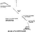
Big and Little Sister islands Door County Wisconsin diagram 1976.png 1,096 × 994; 94 KB
-
Boys building kayaks at Adventure Island Camp Wisconsin.jpg 1,222 × 607; 182 KB
-
Cana Island.jpg 4,032 × 3,024; 2.47 MB
-
Crop of Aerial view of Fish Island and eastern Rock Island, Door County, Wisconsin 2020.png 1,309 × 1,999; 3.75 MB
-
EyrarbakkiFerry.jpg 2,157 × 1,617; 538 KB
-
Fish Island Door County Wisconsin diagram.png 749 × 910; 81 KB
-
Green Island, Marinette County, Wisconsin 2020 (cropped).png 2,327 × 2,641; 8.7 MB
-
Green Island, Marinette County, Wisconsin 2020.png 9,339 × 12,712; 229.95 MB
-
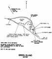
Green Island, Marinette County, Wisconsin diagram 1975-1976.png 858 × 970; 242 KB
-
Hat Island Door County Wisconsin diagram 1975-1976.png 714 × 852; 119 KB
-
Hog Island Door County Wisconsin diagram 1976.png 760 × 834; 126 KB
-
Hog Island, Door County, Wisconsin.jpg 1,818 × 1,228; 865 KB
-
Hog Island, Town of Washington, Door County, Wisconsin 1911 Survey.jpg 6,655 × 5,610; 26.59 MB
-
ISS038-E-57973 - View of Earth.jpg 6,048 × 4,032; 2.01 MB
-
ISS038-E-57974.jpg 6,048 × 4,032; 2.1 MB
-
Jack Island Door County Wisconsin diagram 1976.png 1,022 × 787; 80 KB
-
Little Strawberry Island Door County Wisconsin diagram 1975.png 1,179 × 623; 107 KB
-
Long-Tail Point Brown County Wisconsin 1976.png 718 × 953; 136 KB
-
Plum Island Wisconsin.jpg 3,674 × 2,577; 2.44 MB
-
Plum Island, Door County, Wisconsin, USFWS.png 2,048 × 649; 921 KB
-
Porte des Morts Passage.jpg 4,478 × 425; 944 KB
-
Spider Island Door County Wisconsin June 1994.png 1,211 × 811; 784 KB
-
Strawberry Islands, town of Gibraltar, Door County, Wisconsin 2020.png 9,163 × 12,693; 193.26 MB
-
StrawberryIslandsGreenBayWisconsin.jpg 1,332 × 808; 197 KB
-
Sven's Bluff Panorama - Peninsula State Park, WI.JPG 14,122 × 2,854; 19.97 MB
-
View in August from Tower in Potawatomi State Park Wisconsin.jpg 7,636 × 1,871; 12.79 MB
-
View of the Strawberry Islands from Eagle Bluff Lighthouse.jpg 1,600 × 1,200; 604 KB
-
Washington Island 1978 aerial medium resolution.tiff 3,900 × 3,523; 17.48 MB
-
West end of Green Island, Marinette County, Wisconsin 2020 (cropped).png 2,502 × 1,545; 5.4 MB
-
West end of Green Island, Marinette County, Wisconsin 2020.png 9,216 × 12,717; 189.15 MB


