Category:Irstead
Jump to navigation
Jump to search
English: Irstead is a village in The Broads National Park in the English county of Norfolk. The village is situated at Irstead Shoals, on the River Ant just south of Barton Broad, the second largest of the Norfolk Broads. The village forms part of the civil parish of Barton Turf, and the district of North Norfolk.
village in United Kingdom  | |||||
| Upload media | |||||
| Instance of |
| ||||
|---|---|---|---|---|---|
| Location | Barton Turf, North Norfolk, Norfolk, East of England, England | ||||
 | |||||
Subcategories
This category has the following 2 subcategories, out of 2 total.
C
M
Media in category "Irstead"
The following 11 files are in this category, out of 11 total.
-
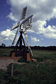
 Clayrack Drainage Mill - geograph.org.uk - 48077.jpg 640 × 480; 58 KB
-

-
 Irstead Shoals - geograph.org.uk - 44997.jpg 640 × 480; 106 KB
-
 Moorings, How Hill - geograph.org.uk - 192346.jpg 640 × 479; 83 KB
-
 River Ant at Irstead - geograph.org.uk - 44996.jpg 640 × 480; 114 KB
-
 Sailing on the Ant, How Hill - geograph.org.uk - 400040.jpg 640 × 493; 31 KB
-
 The Ice House, Irstead - geograph.org.uk - 362078.jpg 640 × 480; 121 KB
-
 Barton Broad with fish enclosure - geograph.org.uk - 275397.jpg 640 × 480; 127 KB
-
 Boardman's Drainage Mill - geograph.org.uk - 48078.jpg 640 × 480; 80 KB
-
 Clayrack Drainage Windmill.jpg 429 × 640; 70 KB
-
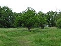 Oak in grazed fen, How Hill - geograph.org.uk - 192348.jpg 640 × 479; 226 KB

,_RP-F-2001-7-1162-44.jpg)


