Category:Irredentist maps incorporating flags
Jump to navigation
Jump to search
English: Note: There is a reason why irredentist movements are using flag maps to show annexed territories or wannabe-annexations: Covering any area with a symbol means: "This area belongs to <symbol>, or it should at least. If that symbol is a national flag, the claim is that the territory belongs to the nation in question.
Subcategories
This category has only the following subcategory.
Media in category "Irredentist maps incorporating flags"
The following 34 files are in this category, out of 34 total.
-
 (Upscaled) Flag map of Israel (including Palestinian territories and Golan Heights).png 1,600 × 2,414; 263 KB
-
 Ahwaz Map Original.png 676 × 600; 38 KB
-
 Flag map of Greater Canada.png 2,586 × 1,697; 198 KB
-
 Flag map of Falkland Islands (Argentina).png 1,812 × 1,114; 86 KB
-
 Flag map of Greater China.png 777 × 553; 28 KB
-
 Flag map of greater Palestine.png 1,493 × 1,691; 165 KB
-
 Flag map of Greater Romania (with Transnistria).png 2,446 × 1,767; 193 KB
-
 Flag Map of Greater Russia.png 1,280 × 1,331; 46 KB
-
 Flag map of Israel (including occupied territories).png 1,334 × 4,012; 46 KB
-
 Flag map of Israel (including Palestinian territories and Golan Heights).png 800 × 1,207; 68 KB
-
 Flag map of Kurdistan.png 3,238 × 2,504; 572 KB
-
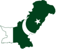 Flag map of Pakistan.png 1,249 × 1,041; 120 KB
-
 Flag map of Palestine (with Israel).png 244 × 571; 5 KB
-
 Flag-map of Srivijaya Empire.png 559 × 424; 32 KB
-
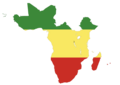 Flag-map of Sub-Saharan Africa.png 592 × 421; 34 KB
-
 FlagMapOfGeorgia.png 1,100 × 762; 91 KB
-
 Flag map of Gibraltar (Spain).png 1,000 × 1,992; 237 KB
-
 Grande France.png 800 × 800; 60 KB
-
 Great Palestine.png 1,010 × 506; 13 KB
-
 Greater Hungary transfer picture.JPG 2,048 × 1,536; 769 KB
-
 Greater israel map.png 2,040 × 1,232; 117 KB
-
 Greater Russia.png 7,030 × 3,542; 166 KB
-
 Greater Ukraine flag map.png 2,459 × 1,705; 154 KB
-
 Flag map of Greater Guyana.png 2,120 × 1,708; 72 KB
-
 Kurdistan Flag Map Medal.png 374 × 456; 110 KB
-
 LGBT map of Kurdistan.svg 572 × 482; 6 KB
-
 Map of the Turkish Republic as claimed by the Armenian Revolutionary Federation.png 1,200 × 1,000; 59 KB
-
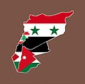 Negara Syam (Levant).jpg 1,600 × 1,591; 76 KB
-
 PAKISTAN2.GIF 1,024 × 768; 296 KB
-
 Pakistanmapwithafgnland20230628112209.png 435 × 459; 42 KB
-
 Flag map of Greater Spain.png 2,000 × 1,716; 162 KB
-
 Flag Map of the United States (Canada).png 2,006 × 1,259; 31 KB
-
 Flag map of Greater Vietnam.png 2,000 × 3,049; 92 KB
-
 VMRO à Varna.jpg 2,560 × 1,920; 861 KB
_Flag_map_of_Israel_(including_Palestinian_territories_and_Golan_Heights).png)


.png)


.png)


.png)


.png)


.jpg)


.png)


.svg)
.png)
.png)