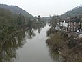
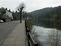
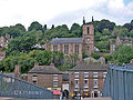
Category:Ironbridge
Jump to navigation
Jump to search
town in Shropshire, England  | |||||
| Upload media | |||||
| Instance of | |||||
|---|---|---|---|---|---|
| Location | The Gorge, Telford and Wrekin, Shropshire, West Midlands, England | ||||
| Located in or next to body of water | |||||
 | |||||
Subcategories
This category has the following 9 subcategories, out of 9 total.
2
B
C
- Coalbrookdale by Night (4 F)
I
- Ironbridge war memorial (29 F)
M
- Merrythought (14 F)
- Museum of the Gorge, Ironbridge (29 F)
S
Media in category "Ironbridge"
The following 200 files are in this category, out of 329 total.
(previous page) (next page)-
 -i---i- (5589383081).jpg 3,168 × 4,752; 4.67 MB
-
 20a at The Wharfage - geograph.org.uk - 1462641.jpg 480 × 640; 83 KB
-
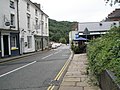
 39 bus in The Wharfage - geograph.org.uk - 1462596.jpg 640 × 480; 83 KB
-
 96 bus pulling in at Ironbridge - geograph.org.uk - 1463251.jpg 640 × 480; 80 KB
-
 99 bus to Telford on Tontine Hill - geograph.org.uk - 1463241.jpg 640 × 480; 86 KB
-
 A dull August day in The Wharfage - geograph.org.uk - 1462657.jpg 640 × 480; 78 KB
-
 A dull summer's day in Church Hill - geograph.org.uk - 1467032.jpg 640 × 480; 95 KB
-
 A gentle stroll along The Wharfage - geograph.org.uk - 1462606.jpg 640 × 480; 75 KB
-
 A street called Paradise - geograph.org.uk - 688776.jpg 640 × 480; 77 KB
-
 Access road from Woodside - geograph.org.uk - 1462219.jpg 640 × 480; 83 KB
-
 Aftab in Ironbridge High Street - geograph.org.uk - 1463323.jpg 640 × 475; 71 KB
-
 Allotments in Woodside - geograph.org.uk - 1462249.jpg 640 × 480; 149 KB
-
 An old mill - geograph.org.uk - 1746044.jpg 640 × 480; 514 KB
-
 Another Ironbridge Cottage - geograph.org.uk - 1243221.jpg 640 × 427; 78 KB
-

-

-

-

-

-

-

-
 At the bottom of Cherry Tree Hill - geograph.org.uk - 1238107.jpg 640 × 427; 71 KB
-
 Beer garden at The Crown - geograph.org.uk - 1467095.jpg 640 × 480; 112 KB
-
 Beer kegs outside The Crown - geograph.org.uk - 1467094.jpg 640 × 480; 60 KB
-
 Bend in Bridge Bank - geograph.org.uk - 1466918.jpg 640 × 480; 108 KB
-
 Bikes at the Ironbridge - geograph.org.uk - 1237550.jpg 640 × 480; 78 KB
-

-
 Brick Facade with Gate Spires - Ironbridge - Shropshire - England (28098127302).jpg 3,648 × 2,736; 7.09 MB
-
 Bridge and town, Ironbridge - geograph.org.uk - 1086094.jpg 640 × 521; 200 KB
-
 Bridge over Severn Valley Way - geograph.org.uk - 875009.jpg 640 × 480; 151 KB
-
 Bridge View Guest House, Ironbridge, Shropshire - geograph.org.uk - 2395690.jpg 1,024 × 768; 152 KB
-
 Bungalow in Waterloo Street - geograph.org.uk - 1466970.jpg 640 × 480; 76 KB
-
 Bus in Dale Road - geograph.org.uk - 1462399.jpg 640 × 480; 104 KB
-
 Bus shelter in Dale Road - geograph.org.uk - 1462400.jpg 640 × 480; 102 KB
-
 Bus stop in The Wharfage - geograph.org.uk - 1462529.jpg 480 × 640; 68 KB
-
 Bus stop in Wellington Road - geograph.org.uk - 1462211.jpg 480 × 640; 75 KB
-
 Canoeing near Ironbridge, Shropshire - geograph.org.uk - 1086089.jpg 608 × 640; 155 KB
-
 Canoeists on the Severn at Ironbridge - geograph.org.uk - 1463368.jpg 640 × 480; 139 KB
-
 Car park at The Crown - geograph.org.uk - 1467105.jpg 640 × 480; 93 KB
-
 Car park at The Toll House - geograph.org.uk - 1466963.jpg 640 × 480; 107 KB
-

-

-
-
-
 Christmas lights at Ironbridge - geograph.org.uk - 2221956.jpg 3,008 × 2,000; 1.39 MB
-

-
 Church Hill, Ironbridge - geograph.org.uk - 1629189.jpg 640 × 480; 127 KB
-
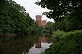
 Coalbrookdale and the River Severn - geograph.org.uk - 882657.jpg 640 × 408; 94 KB
-
 Communications Mast, Ironbridge - geograph.org.uk - 1215098.jpg 480 × 640; 137 KB
-
 Confluence - geograph.org.uk - 1746021.jpg 640 × 480; 511 KB
-
 Cooling Towers in Ironbridge - geograph.org.uk - 3146846.jpg 4,592 × 3,056; 5.34 MB
-
 Cottage suffering from subsidence - geograph.org.uk - 680977.jpg 640 × 480; 84 KB
-
 Cottages at Ironbridge - geograph.org.uk - 690320.jpg 640 × 426; 60 KB
-
 Cottages in Church Hill - geograph.org.uk - 1467051.jpg 640 × 480; 80 KB
-
 Cottages in Hodge Bowers - geograph.org.uk - 1467096.jpg 640 × 480; 80 KB
-
 Cottages in The Wharfage - geograph.org.uk - 1463369.jpg 640 × 480; 88 KB
-
 Cottages on the riverside at Ironbridge - geograph.org.uk - 1013916.jpg 640 × 480; 115 KB
-
 Crossing The Wharfage - geograph.org.uk - 1463199.jpg 640 × 480; 103 KB
-
 D'arcys at The Station - geograph.org.uk - 2637548.jpg 600 × 400; 181 KB
-
 Dale End Park in the summertime - geograph.org.uk - 1462465.jpg 640 × 480; 132 KB
-
 Dale Road - geograph.org.uk - 1462381.jpg 640 × 480; 127 KB
-
 Dale View - geograph.org.uk - 1462402.jpg 640 × 480; 113 KB
-
 Demountable flood barriers, 2014 - geograph.org.uk - 3850046.jpg 1,142 × 857; 440 KB
-
 Downstream from the ironbridge - geograph.org.uk - 267024.jpg 640 × 480; 269 KB
-
 Easily missed - geograph.org.uk - 660559.jpg 640 × 426; 106 KB
-
 Eastern end of Church Hill - geograph.org.uk - 1463348.jpg 480 × 640; 99 KB
-
 Elegant house in The Wharfage - geograph.org.uk - 1462646.jpg 640 × 480; 85 KB
-

-
 Feeling "piggy" in The Wharfage - geograph.org.uk - 1463355.jpg 480 × 640; 95 KB
-
 Fire engine in The Wharfdale - geograph.org.uk - 1463196.jpg 640 × 480; 94 KB
-
 First amongst equals - geograph.org.uk - 739750.jpg 431 × 640; 70 KB
-
 Fishing on The Severn at Ironbridge - geograph.org.uk - 1462588.jpg 640 × 480; 111 KB
-
 Flood barriers in Ironbridge.jpg 6,000 × 4,000; 13.88 MB
-
 Flowers in Ironbridge (8535).jpg 4,288 × 2,848; 6.19 MB
-

-
 Footpath through the woods - geograph.org.uk - 688783.jpg 640 × 480; 116 KB
-
 Footpath view at Ironbridge - geograph.org.uk - 1013900.jpg 480 × 640; 121 KB
-

-
 Further up Severn Bank - geograph.org.uk - 267040.jpg 480 × 640; 288 KB
-
 Gorge View Terrace - geograph.org.uk - 1467089.jpg 640 × 480; 86 KB
-

-
 Handsomely restored buildings opposite the 'Northern' end of the bridge. - panoramio.jpg 3,264 × 2,448; 3.2 MB
-
 Houses in Church Hill - geograph.org.uk - 1467022.jpg 640 × 480; 83 KB
-
 Houses in Madeley Road - geograph.org.uk - 1466982.jpg 640 × 480; 97 KB
-

-
 Impressive house in Ladywood - geograph.org.uk - 1466920.jpg 640 × 480; 90 KB
-
 In the shadow of Ironbridge - geograph.org.uk - 1013905.jpg 640 × 480; 144 KB
-
 Information Board Tollhouse and Ironbridge - geograph.org.uk - 2395679.jpg 1,024 × 768; 172 KB
-

-
 Inside the Toll House - geograph.org.uk - 1466911.jpg 640 × 480; 53 KB
-
 Iron Bridge - panoramio (3).jpg 3,216 × 2,136; 2.52 MB
-
 Iron Bridge - panoramio (4).jpg 3,216 × 2,136; 3.09 MB
-
 Iron Bridge - panoramio - Tanya Dedyukhina.jpg 1,408 × 1,056; 358 KB
-
 Iron Bridge View (7166708876).jpg 5,184 × 3,456; 7.15 MB
-
 Iron Bridge, river Severn - panoramio.jpg 1,408 × 1,056; 317 KB
-
 And^8539,-milestone - geograph.org.uk - 636259.jpg 640 × 480; 90 KB
-
-
 Ironbridge - geograph.org.uk - 2262612.jpg 1,800 × 2,400; 730 KB
-
 Ironbridge - geograph.org.uk - 2552100.jpg 640 × 853; 351 KB
-
 Ironbridge - geograph.org.uk - 2747183.jpg 4,355 × 1,276; 789 KB
-
 Ironbridge - geograph.org.uk - 571000.jpg 640 × 480; 76 KB
-
 Ironbridge - panoramio (1).jpg 2,048 × 1,360; 2.2 MB
-
 Ironbridge - panoramio (3).jpg 2,048 × 1,360; 2.39 MB
-
 Ironbridge - panoramio (4).jpg 2,048 × 1,360; 2.68 MB
-
 Ironbridge - panoramio (6).jpg 2,048 × 1,360; 1.82 MB
-
 Ironbridge - panoramio - ian freeman (1).jpg 3,072 × 2,304; 2.95 MB
-
 Ironbridge - panoramio - Tanya Dedyukhina (2).jpg 1,408 × 1,056; 386 KB
-
 Ironbridge - panoramio - Tanya Dedyukhina (4).jpg 1,408 × 1,056; 346 KB
-
 Ironbridge - panoramio - Tanya Dedyukhina.jpg 1,408 × 1,056; 489 KB
-
 Ironbridge - St. Luke's Church - geograph.org.uk - 1303651.jpg 640 × 486; 99 KB
-
 Ironbridge alive at night - geograph.org.uk - 1128467.jpg 480 × 640; 46 KB
-
 Ironbridge and flood defences - geograph.org.uk - 292032.jpg 640 × 480; 68 KB
-
 Ironbridge and St Luke's - geograph.org.uk - 292363.jpg 640 × 480; 55 KB
-
 Ironbridge Brewery - geograph.org.uk - 1746032.jpg 640 × 480; 484 KB
-
 Ironbridge Cenotaph - geograph.org.uk - 2037003.jpg 600 × 800; 198 KB
-
 Ironbridge Church from near The Malthouse - geograph.org.uk - 690193.jpg 640 × 480; 117 KB
-
 Ironbridge flood defences - geograph.org.uk - 292033.jpg 640 × 480; 71 KB
-
 Ironbridge from The Iron Bridge - geograph.org.uk - 2749679.jpg 640 × 480; 86 KB
-
 Ironbridge from the south - geograph.org.uk - 690323.jpg 640 × 426; 92 KB
-
 Ironbridge from Tontine Hill - geograph.org.uk - 2933564.jpg 1,600 × 1,128; 562 KB
-
 Ironbridge High Street - geograph.org.uk - 1463331.jpg 640 × 480; 90 KB
-
 Ironbridge in 1986 - geograph.org.uk - 2296670.jpg 1,208 × 873; 171 KB
-
 Ironbridge information sign - geograph.org.uk - 2933632.jpg 1,600 × 1,065; 502 KB
-

-
 Ironbridge pathway on the bridge UK.jpg 4,120 × 2,676; 8.07 MB
-
 Ironbridge Pharmacy - geograph.org.uk - 3040610.jpg 1,024 × 768; 144 KB
-
 Ironbridge river bank - geograph.org.uk - 2933796.jpg 1,063 × 1,600; 447 KB
-
 Ironbridge taken from The Iron Bridge - geograph.org.uk - 2588641.jpg 640 × 480; 116 KB
-
 Ironbridge Town - geograph.org.uk - 1637666.jpg 640 × 480; 101 KB
-
 Ironbridge town and church - geograph.org.uk - 267014.jpg 640 × 480; 285 KB
-
 Ironbridge view down the river - geograph.org.uk - 2933816.jpg 1,600 × 711; 409 KB
-
 Ironbridge Village - geograph.org.uk - 2574986.jpg 1,024 × 683; 507 KB
-
 Ironbridge, Bridge House, 1990 - geograph.org.uk - 4150636.jpg 2,336 × 1,512; 4.29 MB
-
 Ironbridge, Madeley Road Junction - geograph.org.uk - 4355591.jpg 640 × 480; 112 KB
-
 Ironbridge, River Severn - geograph.org.uk - 1239701.jpg 640 × 480; 51 KB
-
 Ironbridge, Shropshire - geograph.org.uk - 2538750.jpg 3,888 × 2,592; 5.02 MB
-
 Ironbridge, St. Luke's Road - geograph.org.uk - 636252.jpg 480 × 640; 61 KB
-
 Ironbridge, steps into the river - geograph.org.uk - 636256.jpg 480 × 640; 101 KB
-
 Ironbridge, the Severn - geograph.org.uk - 636246.jpg 640 × 480; 56 KB
-
 Ironbridge, The Wharfage - geograph.org.uk - 1239636.jpg 640 × 480; 61 KB
-
 Ironbridge, tree on The Wharfage - geograph.org.uk - 636258.jpg 480 × 640; 63 KB
-
 Ironbridge.JPG 1,120 × 840; 670 KB
-

-
 Junction of Buildwas and Strethill Roads - geograph.org.uk - 1462521.jpg 640 × 480; 112 KB
-
 Junction of New Road with Wharfage, Ironbridge - geograph.org.uk - 2960808.jpg 1,024 × 679; 226 KB
-

-
 Large house in Church Hill - geograph.org.uk - 1467023.jpg 480 × 640; 56 KB
-
 Lincoln Hill meets The Wharfage - geograph.org.uk - 1467115.jpg 640 × 480; 112 KB
-
 Looking 'North' across the bridge. - panoramio.jpg 3,264 × 2,448; 3.29 MB
-

-
 Looking along Church Hill - geograph.org.uk - 1463285.jpg 480 × 640; 69 KB
-

-

-
 Looking down Church Hill - geograph.org.uk - 1463287.jpg 480 × 640; 76 KB
-
 Looking down New Road - geograph.org.uk - 1467025.jpg 480 × 640; 120 KB
-

-

-

-

-

-

-

-
-

-

-

-

-

-

-

-
-

-

-

-
 Looking north-east up Lincoln Hill - geograph.org.uk - 1462551.jpg 480 × 640; 100 KB
-

-
 Looking northwards up Paradise - geograph.org.uk - 1462544.jpg 480 × 640; 94 KB
-
 Looking northwards up Wharfage Steps - geograph.org.uk - 1463360.jpg 480 × 640; 92 KB
-

-

-
 Looking up Madeley Road - geograph.org.uk - 1466986.jpg 640 × 480; 77 KB
-
 Looking upstream. - geograph.org.uk - 1746029.jpg 640 × 480; 447 KB
-

-

-
 Main Street, Ironbridge, Shropshire - geograph.org.uk - 2395695.jpg 1,024 × 768; 171 KB
-
 Mid section of Church Hill - geograph.org.uk - 1467029.jpg 640 × 480; 102 KB
-
 Mid section of Hodge Bowers - geograph.org.uk - 1467074.jpg 640 × 480; 68 KB
-
 Mid section of Lincoln Hill - geograph.org.uk - 1467112.jpg 640 × 480; 114 KB
-
 Mid section of The Wharfage - geograph.org.uk - 1462549.jpg 640 × 480; 85 KB
-
 Mid section of Waterloo Street - geograph.org.uk - 1466968.jpg 640 × 480; 77 KB
-
 My sort of place - geograph.org.uk - 1463253.jpg 480 × 640; 112 KB
-
 Narrow street in Ironbridge - geograph.org.uk - 3096934.jpg 640 × 480; 100 KB
-
 New building going on in Church Hill - geograph.org.uk - 1467045.jpg 640 × 480; 85 KB
-
 Nine Men of Madeley 1864 - former police station and court house.jpg 1,500 × 2,000; 778 KB
-

-
 Old industrial remains, Wharfage, Ironbridge - geograph.org.uk - 2960710.jpg 1,024 × 683; 268 KB
-
 Old Police Station, Ironbridge - geograph.org.uk - 1243188.jpg 640 × 502; 74 KB
-
 Old Salt House - geograph.org.uk - 570997.jpg 640 × 480; 134 KB
-
 Ordnance Survey Drawings - Ironbridge, Telford and Wrekin (OSD 213).jpg 5,840 × 4,175; 3.86 MB
-
 Ordnance Survey One-Inch Sheet 61 Wolverhampton, Published 1921.jpg 12,074 × 8,387; 11.95 MB
.jpg)


.jpg)


.jpg)


.jpg)
.jpg)

.jpg)


.jpg)
.jpg)
.jpg)
.jpg)
.jpg)
.jpg)
.jpg)


_-_B1975.4.1563_-_Yale_Center_for_British_Art.jpg)


.jpg)
