Category:Ireneturm
Jump to navigation
Jump to search
| Object location | | View all coordinates using: OpenStreetMap |
|---|
This is the category of the Hessian Kulturdenkmal (cultural monument) with the ID 55385 (Wikidata)
|
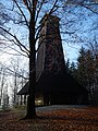
observation tower on Tromm mountain near Zotzenbach  | |||||
| Upload media | |||||
| Instance of | |||||
|---|---|---|---|---|---|
| Named after | |||||
| Made from material | |||||
| Location | |||||
| Street address |
| ||||
| Heritage designation | |||||
 | |||||
Media in category "Ireneturm"
The following 19 files are in this category, out of 19 total.
-
 2022TrommUIreneTurm.jpg 2,630 × 1,753; 2.19 MB
-
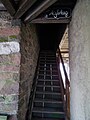 Aufstieg Ireneturm 2011.JPG 2,736 × 3,648; 1.4 MB
-
 Geopunkt Ireneturm 2011.JPG 2,736 × 3,648; 4.21 MB
-
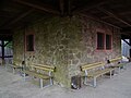
 Hölzerne Sitzgarnituren Ireneturm Tromm.JPG 3,648 × 2,736; 2.41 MB
-
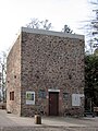
 Ireneturm Mauerwerkssockel.jpg 3,681 × 2,761; 4.53 MB
-
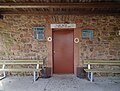 Ireneturm Metalltür 2011.JPG 3,453 × 2,626; 1.8 MB
-
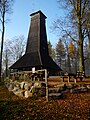 Ireneturm Tromm 2011.JPG 2,736 × 3,648; 4.35 MB
-
 Ireneturm-01.jpg 4,320 × 3,240; 5.99 MB
-
 Ireneturm-02.jpg 4,320 × 3,240; 5.49 MB
-
 Ireneturm-03.jpg 3,240 × 4,320; 4.69 MB
-
 Ireneturm-04.jpg 2,926 × 3,901; 6.62 MB
-
 Ireneturm.jpg 2,115 × 3,173; 3.91 MB
-
 IreneturmSockel.jpg 2,271 × 3,025; 2.52 MB
-
 Steinerner Unterbau Ireneturm Tromm.JPG 3,648 × 2,736; 1.53 MB
-
 Tromm 2011 Ireneturm.JPG 2,736 × 3,648; 4.18 MB
-
 Tromm Wegweiser im Wald.JPG 2,736 × 3,648; 4.24 MB
-
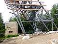 Trommturm-03.jpg 4,031 × 3,024; 5.45 MB
-
 Trusday Ireneturm.JPG 2,592 × 3,456; 4.26 MB
-
 Vergitterte Fenster Ireneturm Tromm.JPG 3,648 × 2,736; 2.01 MB


Categories:
- Observation towers in Kreis Bergstraße
- Tromm (Hessen)
- Buildings in Rimbach (Odenwald)
- Zotzenbach
- Cultural heritage monuments in Rimbach (Odenwald)
- Built in Hesse in 1910
- Demolished buildings in Hesse
- Destroyed in Hesse in 2020
- Wooden observation towers in Hesse
- Tetragonal towers in Hesse
- 27-meter-tall buildings in Germany
- Odenwaldklub