Category:Inveresk
Jump to navigation
Jump to search
village in East Lothian, Scotland, UK  | |||||
| Upload media | |||||
| Instance of | |||||
|---|---|---|---|---|---|
| Location |
| ||||
 | |||||
English: Inveresk ( Gaelic: Inbhir Easg) was formerly a village and now forms the southern part of Musselburgh. It is situated on slightly elevated ground at the south of Musselburgh in East Lothian, Scotland. This ridge of ground, 20 to 25 metres above sea level, was used by the Romans as the location for a Flavian fort in the first century AD which was later rebuilt during Antonine occupation in the second century AD Burnet,JEM (1999) A reason for Inveresk. Courtyard Press, Inveresk. ISBN 0 9537450 0 7
Subcategories
This category has the following 2 subcategories, out of 2 total.
I
- Inveresk Lodge Garden (18 F)
M
Media in category "Inveresk"
The following 17 files are in this category, out of 17 total.
-

-

-

-

-

-
 Angel at Inveresk - geograph.org.uk - 3277739.jpg 3,264 × 2,448; 3.76 MB
-
 Cape Lily, Inveresk Lodge Garden - geograph.org.uk - 936997.jpg 640 × 501; 42 KB
-
 Carberry Road heading to Inveresk. - geograph.org.uk - 992404.jpg 640 × 480; 57 KB
-
 Inveresk geograph-3803353-by-Ben-Brooksbank.jpg 2,394 × 1,577; 4.12 MB
-
 Major William Norman Ramsay's grave, Inveresk.JPG 3,088 × 2,056; 1.48 MB
-
 Roman artifacts - Museum of Scotland.jpg 4,272 × 2,848; 2.94 MB
-
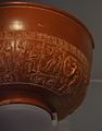 Samian bowl from Inveresk - Museum of Scotland.jpg 1,100 × 1,400; 331 KB
-
 Sir David Rae's grave, Inveresk.JPG 2,056 × 3,088; 3.61 MB
-
 The east end of Inveresk Village.JPG 3,088 × 2,056; 893 KB
-
 The Manor House at Inveresk (geograph 2358518).jpg 640 × 484; 105 KB
-
 The Mansion House Inveresk.JPG 3,088 × 2,056; 1.95 MB
-
 Western section of Inveresk Village.JPG 3,088 × 2,056; 1.76 MB


.jpg)

