Category:Invalid SVG created with QGIS:Maps
Jump to navigation
Jump to search
Subcategories
This category has only the following subcategory.
Media in category "Invalid SVG created with QGIS:Maps"
The following 46 files are in this category, out of 46 total.
-
 CAN QC 01 Communauté maritime des Îles-de-la-Madeleine.svg 1,026 × 1,072; 1.53 MB
-
 Tula - Likhvin railway 1940 openstreetmap v3.svg 2,976 × 709; 19.27 MB
-
 Tumskaya railway map 1990 openstreetmap.svg 1,488 × 1,052; 24.33 MB
-
 USSR location map.svg 512 × 171; 1.76 MB
-
 Bölöni Farkas journey 1831.svg 521 × 397; 918 KB
-
 Nanjing Metro Line 1.svg 1,052 × 1,530; 1.4 MB
-
 Ahupuaa of Oahu (4-color).svg 512 × 405; 181 KB
-
 Ahupuaa of Oahu.svg 512 × 405; 181 KB
-
 Qinling-Huaihe-line.svg 1,000 × 1,000; 242 KB
-
 MNSen1890.svg 666 × 747; 1.01 MB
-
 Cluse de Chambéry - Carte des infrastructures de transport.svg 1,898 × 2,050; 6.59 MB
-
 2012 Presidential Election in Massachusetts By Municipality.svg 810 × 502; 182 KB
-

-
 Yug1.svg 512 × 286; 665 KB
-
 Cluse de Chambéry - Carte du relief.svg 1,898 × 2,050; 7.48 MB
-
 Hyde Park.svg 889 × 710; 2.47 MB
-
 CTS ancien réseau 1, 1878-1886.svg 1,093 × 1,073; 3.37 MB
-
 CTS ancien réseau 2, 1895-1899.svg 1,093 × 1,073; 3.37 MB
-
 China, Vietnam, Korea and Japan in 1100 AD.svg 512 × 465; 127 KB
-
 Cuenca-109-B.svg 1,379 × 1,608; 4.63 MB
-
 Cuenca-122-B.svg 1,167 × 905; 4.13 MB
-
 2010 U.S. House elections in Oklahoma.svg 487 × 234; 70 KB
-
 Cuenca-114-B.svg 1,884 × 1,692; 13.35 MB
-
 Cuenca-125-B.svg 2,204 × 1,078; 2.46 MB
-
 Cuenca-106-B.svg 631 × 875; 4.26 MB
-
 Cuenca-110-B.svg 2,140 × 1,319; 9.57 MB
-
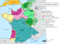 France (1429)-fr-yug.svg 1,003 × 744; 1.4 MB
-
 Linia tramwajowa nr 8 w Szczecinie.svg 2,238 × 1,866; 338 KB
-
 Linia tramwajowa nr 9 w Szczecinie.svg 2,238 × 1,866; 337 KB
-
 The Rhodopes on The Paths Of Orpheus And Eurydice Project Map.svg 1,247 × 1,630; 28.95 MB
-
 Cluse de Chambéry - Carte de l'occupation des sols (CORINE).svg 1,898 × 2,050; 12.71 MB
-
 CTS ancien réseau 5, 1915-1927.svg 1,093 × 1,073; 3.44 MB
-
 CTS ancien réseau 6, 1937-1947.svg 1,093 × 1,073; 3.43 MB
-
 Cuenca-112-B.svg 1,307 × 1,484; 2.16 MB
-
 Mapa físico de Navarra.svg 930 × 1,018; 7.56 MB
-
 Blakely Island locator map.svg 1,052 × 744; 232 KB
-
 CTS ancien réseau 4, 1908-1914.svg 1,093 × 1,073; 3.42 MB
-
 Geographical distribution of Lynx lynx martinoi in Macedonia.svg 1,052 × 744; 6.78 MB
-
 Makedonija sr.svg 1,052 × 744; 6.57 MB
-
 Map of the Republic of Macedonia-mk.svg 1,052 × 744; 7.64 MB
-
 Pereslavl narrow gauge railway 1990.svg 2,980 × 1,223; 5.57 MB
-
 Pyrenees topographic map-eu.svg 3,200 × 1,900; 6.26 MB
-
 Pyrenees topographic map-fr.svg 3,200 × 1,900; 6.3 MB
-
 R.o.Macedonia topography.svg 1,052 × 744; 6.59 MB
-
 Celtic Sea and Bay of Biscay bathymetric map-fr.svg 3,478 × 3,804; 4.93 MB
-
 CTS ancien réseau 3, 1899-1907.svg 1,093 × 1,073; 3.39 MB


.svg)


-fr-yug.svg)


.svg)


