Category:Interstate 84 in Oregon
Jump to navigation
Jump to search
States of the United States: Connecticut · Idaho · Massachusetts · New York · Oregon · Pennsylvania · Utah
| 74 · 78 · 82 · 84 · 86 · 99 |
| I-5 · I-82 · I-84 · I-105 · I-205 · I-305 · I-405 · I-505 |
| US-20 · US-26 · US-30 · US-95 · US-97 · US-101 · US-197 · US-199 · US-395 · US-730 |
English: This category should contain files related to Interstate 84 in Oregon.
section of Interstate Highway in Oregon, United States .svg)  | |||||
| Upload media | |||||
| Instance of | |||||
|---|---|---|---|---|---|
| Part of | |||||
| Location | Oregon | ||||
| Transport network | |||||
| Owned by | |||||
| Maintained by | |||||
| Inception |
| ||||
| Length |
| ||||
| Replaces | |||||
| |||||
English: Media related to Interstate 84 in Oregon, a section of Interstate 84 (Oregon–Utah) in Oregon, United States.
Subcategories
This category has the following 4 subcategories, out of 4 total.
B
- Baker Valley, Oregon (14 F)
I
- Interstate 80N in Oregon (1 F)
Media in category "Interstate 84 in Oregon"
The following 200 files are in this category, out of 232 total.
(previous page) (next page)-
 I-84 (OR).svg 601 × 601; 22 KB
-
 2017 09 08-10.51.53.859-CDT.jpg 1,632 × 1,224; 226 KB
-
 2017 09 08-10.53.23.547-CDT.jpg 1,632 × 1,224; 233 KB
-
 2017 09 08-10.55.04.523-CDT.jpg 3,264 × 2,448; 649 KB
-
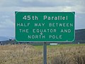 45th parallel sign , Baker County, OR, Apr 17.jpg 2,592 × 1,944; 2.35 MB
-
 45th parallel sign - Baker County, Oregon.jpg 1,280 × 960; 117 KB
-
 A temporary river runs through it (51806607343).jpg 3,000 × 2,250; 2.75 MB
-
 A transmission tower catches fire (53878654776).jpg 3,077 × 1,731; 3.03 MB
-
 A view Mt Hood and John Day Dam at I84.jpg 4,080 × 3,072; 2.07 MB
-
 A view Mt Hood and John Day Dam, Oregon.jpg 4,080 × 3,072; 1.82 MB
-
 A view Mt Hood off Highway 84.jpg 3,072 × 4,080; 1.36 MB
-
 Aerial view of the work site (49521717452).jpg 5,472 × 3,648; 7.99 MB
-
 Aftermath of the Durkee Fire from I-84 1.jpg 4,032 × 3,024; 7.07 MB
-
 Aftermath of the Durkee Fire from I-84 2.jpg 4,032 × 3,024; 9.73 MB
-
 Aftermath of the Durkee Fire from I-84 3.jpg 4,032 × 3,024; 7.25 MB
-
 Aftermath of the Durkee Fire from I-84 4.jpg 4,032 × 3,024; 5.96 MB
-
 Aftermath of the Durkee Fire from I-84 5.jpg 3,024 × 4,032; 7.39 MB
-
 Aftermath of the Durkee Fire from I-84 6.jpg 4,032 × 3,024; 5.98 MB
-
 Aftermath of the Durkee Fire from I-84 7.jpg 3,239 × 2,429; 3.55 MB
-
 America's Highways 1776–1976 - page 483b.jpg 2,318 × 1,731; 3.37 MB
-
 Amtrak pioneer leaving portland.jpg 458 × 700; 78 KB
-
 Arata Creek flows onto I-84 east of Portland (6733255599).jpg 1,600 × 1,200; 298 KB
-
 Assessing the damage (50836194696).jpg 5,472 × 3,648; 9.89 MB
-
 Assisting motorists (32146119757).jpg 1,024 × 768; 181 KB
-
 Attenuator truck (37022051676).jpg 3,680 × 2,456; 1.75 MB
-
 Attenuator Truck (48832686068).jpg 7,360 × 4,912; 10.84 MB
-
 B210 gantry cranes with steel (11073984084).jpg 400 × 399; 55 KB
-
 B210 pedestrian tunnel forms (6629554655).jpg 400 × 400; 64 KB
-
 Banfield Expressway westbound near Lloyd District in Portland, OR.jpg 3,430 × 2,264; 2.32 MB
-
 Biggs Junction (28258189214).jpg 3,641 × 2,427; 2.28 MB
-
 Biggs Junction morning concrete pour (28844055486).jpg 2,592 × 1,936; 2.45 MB
-
 Blowing snow on I-84 (32071605096).jpg 4,032 × 3,024; 1.29 MB
-
 Bluff 2272.jpg 4,608 × 2,592; 2.46 MB
-
 Blumenauer Bridge under construction October 2021 - from Grand Ave.jpg 4,780 × 2,789; 2.45 MB
-
 Chain Check west of La Grande (33346067348).jpg 3,024 × 4,032; 2.67 MB
-
 Clean up work on I-84 in eastern Oregon (46370621234).jpg 3,673 × 2,624; 3.81 MB
-
 Clearing the Gorge (50951094811).jpg 800 × 574; 109 KB
-
 Columbia Gorge burn along Interstate 84.jpg 3,648 × 2,736; 7.53 MB
-
 COLUMBIA RIVER GORGE BETWEEN THE DALLES AND THE HOOD RIVER - NARA - 548144.jpg 3,000 × 2,031; 918 KB
-
 Columbia River Highway 2.svg 1,152 × 640; 1.04 MB
-
 Completed Sandy River Bridge (14648779553).jpg 1,024 × 681; 114 KB
-
 Don't pass on the right (32547140101).jpg 1,200 × 900; 364 KB
-
 Durkee Fire along I-84 (53879793207).jpg 4,032 × 3,024; 2.17 MB
-
 Durkee Fire along I-84 (53879793487).jpg 4,032 × 3,024; 2.68 MB
-
 Durkee Fire along I-84 (53880668086).jpg 4,032 × 3,024; 2.06 MB
-
 Durkee Fire along I-84 (53880668121).jpg 4,032 × 3,024; 2.39 MB
-
 Durkee Fire along I-84 (53880693781).jpg 4,032 × 3,024; 1.74 MB
-
 Durkee Fire along I-84 (53880694061).jpg 4,032 × 3,024; 4.84 MB
-
 Durkee Fire along I-84 (53880903908).jpg 4,032 × 3,024; 1.79 MB
-
 Durkee Fire along I-84 (53880930963).jpg 8,466 × 3,850; 11.49 MB
-
 Durkee Fire along I-84 (53881008919).jpg 4,032 × 3,024; 2.96 MB
-
 Durkee Fire along I-84 (53881008924).jpg 4,032 × 3,024; 1.49 MB
-
 Durkee Fire along I-84 (53881034844).jpg 4,032 × 3,024; 1.94 MB
-
 Durkee Fire along I-84 (53881035129).jpg 2,048 × 1,536; 696 KB
-
 Durkee Fire along I-84 (53881108690).jpg 4,032 × 3,024; 4.36 MB
-
 Durkee Fire along I-84 (53881801687).jpg 1,924 × 1,283; 1.61 MB
-
 Durkee Fire along I-84 (53881801697).jpg 1,974 × 1,316; 1.4 MB
-
 Durkee Fire along I-84 (53883038179).jpg 2,016 × 1,512; 1.53 MB
-
 Durkee Fire along I-84 (53883038199).jpg 2,016 × 1,134; 1,008 KB
-
 Durkee Fire along I-84 (53883038214).jpg 1,974 × 1,111; 981 KB
-
 Durkee Fire along I-84 (53883120645).jpg 2,016 × 1,344; 1.16 MB
-
 Durkee Fire along I-84 (53883132325).jpg 4,032 × 3,024; 3.43 MB
-
 Durkee Fire along I-84 (53883132340).jpg 4,032 × 3,024; 3.46 MB
-
 Durkee Fire approaches I-84 (53876774108).jpg 1,600 × 1,200; 164 KB
-
 Durkee Fire I-84 road closure (53878379427).png 640 × 480; 501 KB
-
 Durkee Fire I-84 road closure (53878379487).png 640 × 480; 667 KB
-
 Durkee Fire I-84 road closure (53878379537).png 640 × 480; 372 KB
-
 Durkee Fire I-84 road closure (53878379547).png 640 × 480; 335 KB
-
 Durkee Fire I-84 road closure (53879520023).png 640 × 480; 492 KB
-
 Durkee Fire I-84 road closure (53879619619).png 640 × 480; 432 KB
-
 Durkee Fire I-84 road closure (53879619624).png 640 × 480; 392 KB
-
 Durkee Fire I-84 road closure (53879619769).png 640 × 480; 536 KB
-
 Durkee Fire I-84 road closure (53879619774).png 640 × 480; 495 KB
-
 Durkee Fire I-84 road closure (53879692430).png 640 × 480; 570 KB
-
 Durkee Fire I-84 road closure (53879692465).png 640 × 480; 474 KB
-
 Durkee Fire I-84 road closure (53879692515).png 640 × 480; 518 KB
-
 Durkee Fire in Eastern Oregon (53879494009).jpg 4,032 × 3,024; 3.05 MB
-
 Durkee Fire lights the sky (53878654766).jpg 3,918 × 2,204; 2.62 MB
-
 Durkee Fire near I-84 (53875228042).jpg 3,024 × 4,032; 3.4 MB
-
 Durkee Fire near MP 328 on I-84 (53876886134).jpg 1,280 × 960; 143 KB
-
 Exit 209 Pendleton OR.jpg 1,600 × 1,200; 583 KB
-
 Fire in eastern Oregon (53876774128).jpg 768 × 1,024; 248 KB
-
 Flats 2270.jpg 4,608 × 2,592; 2.54 MB
-
 FreewayMoon.jpg 1,792 × 1,449; 426 KB
-
 Gilliam County, OR, USA - panoramio.jpg 3,579 × 2,645; 835 KB
-
 HAER HCRH OR-36-67.jpg 5,000 × 3,594; 2.2 MB
-
 HAER HCRH OR-36-71.jpg 5,000 × 3,563; 2.33 MB
-
 HAER HCRH OR-36-T-2.jpg 3,982 × 5,000; 2.17 MB
-
 HAER HCRH OR-49-10.jpg 5,228 × 4,240; 1.98 MB
-
 HAER HCRH OR-49-2.jpg 5,000 × 3,592; 2.54 MB
-
 HAER HCRH OR-49-3.jpg 5,227 × 4,215; 1.94 MB
-
 HAER HCRH OR-49-7.jpg 5,189 × 4,178; 2.33 MB
-
 HAER HCRH OR-49-8.jpg 5,159 × 4,165; 2.08 MB
-
 High Fire Danger - Use Caution - Oregon (51263384669).jpg 3,442 × 2,372; 3.95 MB
-
 Highway84Clouds.jpg 1,280 × 989; 227 KB
-
 Hole on I- 84 from below (17675007466).jpg 2,048 × 1,536; 1.38 MB
-
 Hole on Interstate 84 Tony George (23747413466).jpg 2,048 × 1,536; 1.5 MB
-
 Hollywood Exit (Banfield East).jpg 5,007 × 3,338; 1.59 MB
-
 Hollywood Exit (Banfield West).jpg 4,974 × 3,316; 1.82 MB
-
 Hollywood MAX station.jpg 2,048 × 1,360; 1.06 MB
-
 HospitalStreet.jpg 1,022 × 921; 224 KB
-
 I-205 northbound at I-84 and US 30 in Portland, OR.jpg 3,444 × 2,286; 1.95 MB
-
 I-5 Northbound junction with I-84 Eastbound.jpg 1,255 × 975; 260 KB
-
I-84 10-45 p.m. January 17.webm 55 s, 404 × 720; 3.63 MB
-
 I-84 and I-5 interchange.jpg 1,200 × 1,600; 637 KB
-
 I-84 between Troutdale and The Dalles is closed (51797231778).jpg 600 × 450; 67 KB
-
 I-84 bridge (49526573711).jpg 4,032 × 3,024; 5.83 MB
-
 I-84 crash (16140951617).jpg 1,600 × 1,200; 210 KB
-
 I-84 crash involves multiple vehicles (16140952407).png 1,600 × 1,200; 1.8 MB
-
 I-84 damage assessment (49534434953).jpg 6,000 × 4,000; 19.81 MB
-
 I-84 Eastbound along the Columbia River.png 2,208 × 1,242; 3.56 MB
-
 I-84 Eastbound near Hood River County, Oregon.png 2,208 × 1,242; 3.38 MB
-
 I-84 EB closure (50949852258).jpg 1,616 × 1,080; 393 KB
-
 I-84 has intermittent closures (53878997469).jpg 3,839 × 2,159; 2.48 MB
-
 I-84 hole in the concrete (17513786100).jpg 2,048 × 1,536; 1.48 MB
-
 I-84 Hood River.jpg 3,413 × 2,314; 1.47 MB
-
 I-84 packed tight (51802451434).jpg 2,000 × 900; 655 KB
-
 I-84 Sandy River Bridge Wing Wall 1 (14067235317).jpg 400 × 300; 238 KB
-
 I-84 Sandy River Bridge Wing Wall 2 (14067235257).jpg 400 × 300; 237 KB
-
 I-84 Sandy River Bridge Wing Wall 3 (14253811495).jpg 400 × 300; 200 KB
-
 I-84 Sandy River Bridge Wing Wall 4 (14067155928).jpg 400 × 300; 241 KB
-
 I-84 Sandy River Bridge Wing Wall 5 (14230663776).jpg 400 × 300; 247 KB
-
 I-84 Sandy River Bridge Wing Wall 6 (14067234997).jpg 400 × 300; 216 KB
-
 I-84 Sandy River Bridge Wing Wall 7 (14067196620).jpg 3,264 × 2,448; 3.64 MB
-
I-84 Saturday morning.webm 16 s, 1,920 × 1,080; 16.2 MB
-
I-84 sees freezing rain.webm 4.5 s, 1,920 × 1,080; 3.17 MB
-
 I-84 shoulder repair work (49534904201).jpg 2,048 × 1,365; 612 KB
-
 I-84 Slide (12523443174).jpg 2,560 × 1,920; 2.91 MB
-
 I-84 snowdrift (32391193025).jpg 4,032 × 3,024; 1.88 MB
-
 I-84 stopped (51802083256).jpg 3,024 × 2,160; 2.12 MB
-
 I-84 traffic queue as highway shuts down.jpg 800 × 600; 124 KB
-
 I-84 Troutdale to Hood River (31548655534).jpg 4,032 × 3,024; 2.21 MB
-
 I-84 westbound closure (52000744049).jpg 3,024 × 4,032; 3.4 MB
-
 I-84 westbound shutdown (33336489318).jpg 960 × 686; 335 KB
-
 I-84.jpg 1,411 × 990; 237 KB
-
 Ice on Cabbage Hill (49390669626).jpg 3,000 × 2,250; 2.16 MB
-
 Ice storm causes closure of I-84.jpg 1,447 × 814; 504 KB
-
 Improved pedestrian and cyclist safety (50626509717).jpg 3,408 × 2,272; 990 KB
-
 Incident responder keeps an eye on Microwave Fire (53883647423).jpg 4,000 × 6,000; 2.49 MB
-
 Incident response vehicle alerts travelers to wildfire activity (53883409451).jpg 3,000 × 2,000; 1.77 MB
-
 Intersate Bridge 2104.jpg 4,608 × 3,072; 2.92 MB
-
 Interstate 5 Northbound junction with I-405 south of Downtown Portland.jpg 1,141 × 966; 204 KB
-
 Interstate 84 (19722467496).jpg 4,617 × 3,027; 7.94 MB
-
 Interstate 84 (6722237151).jpg 640 × 480; 153 KB
-
 Interstate 84 (Oregon) exit 17.jpg 2,592 × 1,944; 1.03 MB
-
 Interstate 84 - Blue Mountains Oregon.jpg 4,000 × 3,000; 5.05 MB
-
 Interstate 84 at Interstate 205 looking west - Portland, Oregon.JPG 3,872 × 2,592; 3.8 MB
-
 Interstate 84 near La Grande Jan. 08 (2672741020).jpg 1,600 × 1,200; 462 KB
-
 Interstate 84 Near La Grande, Oregon (265596008).jpg 1,280 × 960; 95 KB
-
 Interstate 84 traffic travels under new Biggs Junction overpass (18870507986).jpg 3,047 × 2,031; 889 KB
-
 Junction I-84 and I-82.jpg 4,032 × 3,024; 1,012 KB
-
 Lloyd District, Portland, OR, USA - panoramio.jpg 4,000 × 3,000; 2.5 MB
-
 MAX single track over I-84, February 2018.JPG 4,796 × 3,004; 2.04 MB
-
 Microwave Tower Fire near Interstate 84 July 28, 2024 (53887246213).jpg 3,790 × 2,363; 1.84 MB
-
 MP 270 0445.jpg 4,608 × 2,592; 2.84 MB
-
 MP 271 0446.jpg 4,608 × 2,592; 1.86 MB
-
 MP 275 0447.jpg 4,608 × 2,592; 2.06 MB
-
 MP 287 0448.jpg 4,608 × 3,072; 2.87 MB
-
 MP 356 Oregon 2019-03-01 082.jpg 4,506 × 2,955; 1.33 MB
-
 MP 359 2019-03-01 078.jpg 4,474 × 2,468; 917 KB
-
 MP 359 2019-03-01 079.jpg 4,491 × 2,468; 980 KB
-
 MP 359 2019-03-01 080.jpg 4,608 × 2,592; 1.97 MB
-
 MP 362 Moore's Hollow 3934.jpg 6,000 × 4,000; 6.06 MB
-
 MP 70 0444.jpg 4,608 × 2,592; 2.9 MB
-
 Mt. Hood National Forest mountainside smokes from Microwave Fire (53883441026).jpg 4,032 × 2,268; 2.48 MB
-
 Near the Malheur Baker county line (53876541261).jpg 1,024 × 768; 225 KB
-
 New Bridges (50626510037).jpg 3,445 × 2,285; 912 KB
-
 Old Oregon Trail Highway 6.svg 1,152 × 640; 1.04 MB
-

-

-
-

-
 OntarioExit.jpg 2,272 × 1,704; 1.34 MB
-
 OR 18 I84 FHWA 1966 195.jpg 2,737 × 2,106; 1,009 KB
-
 OR 19 I84 FHWA 1968 53.jpg 2,259 × 2,482; 1.19 MB
-
 OR 20 I84 FHWA 1968 54.jpg 2,835 × 1,837; 1.15 MB
-
 OR 22 I84 FHWA 1968 44.jpg 2,860 × 1,954; 1.03 MB
-
 OR 24 I84 FHWA 1968 47.jpg 2,847 × 2,013; 872 KB
-
 OR 25 I84 FHWA 1968 48.jpg 2,881 × 2,047; 670 KB
-
 OR 27 I84 FHWA 1968 50.jpg 2,304 × 2,464; 1.08 MB
-
 OR 37 I84 FHWA 1967 1031.jpg 2,136 × 2,752; 1.32 MB
-
 OR 40 I84 FHWA 1967 1022.jpg 2,656 × 2,060; 1.38 MB
-
 OR 45 I84 FHWA 1964 564.jpg 2,864 × 2,254; 1.02 MB
-
 OR 54 I84 FHWA 1966 310.jpg 2,582 × 2,018; 700 KB
-
 OR 56 I84 FHWA 1966 311.jpg 2,048 × 2,710; 702 KB
-
 OR 62 I84 FHWA 1966 196.jpg 2,244 × 2,746; 922 KB
-
 OR 63 I84 FHWA 1966 198.jpg 2,704 × 2,195; 842 KB
-
 OR 64 I84 FHWA 1966 197.jpg 2,228 × 2,675; 926 KB
-
 OR 65 I80 FHWA 1964 21.jpg 2,759 × 2,228; 771 KB
-
 OR I-84 near Pendleton.png 3,872 × 2,592; 13.94 MB
-
 Oregon DOT works to clear rockfall (5244701060).jpg 640 × 480; 157 KB
-
 Oregon Interstate 84.svg 1,152 × 640; 1.04 MB
-
 Oversize Load on the Road.jpg 3,004 × 2,003; 1.82 MB
-
 Oversize load, Jack Barrie (6501983007).jpg 1,800 × 1,200; 1.02 MB
-
 PDX US 30 Ghost Ramp.jpeg 2,462 × 1,773; 1.24 MB
-
 Plowing I-84 near The Dalles (6722411183).jpg 640 × 480; 288 KB
-
 Portland, Oregon 1955 Yellow Book.jpg 800 × 1,136; 321 KB
-
 PortlandMAX-I84.jpg 1,739 × 1,613; 1,002 KB
-
 Queue of trucks on I-84 (50980023218).jpg 4,032 × 3,024; 4.41 MB
-
 Railroad along I-84 keeps Durkee Fire contained (53882447807).jpg 4,032 × 3,024; 4.64 MB


.jpg)


.jpg)


.jpg)
.jpg)
.jpg)
.jpg)
.jpg)
.jpg)
.jpg)

.jpg)
.jpg)
.jpg)


.jpg)
.jpg)


.jpg)
.jpg)
.jpg)
.jpg)
.jpg)
.jpg)
.jpg)
.jpg)
.jpg)
.jpg)
.jpg)
.jpg)
.jpg)
.jpg)
.jpg)
.jpg)
.jpg)
.jpg)
.jpg)
.jpg)
.jpg)
.jpg)
.jpg)
.jpg)
.png)
.png)
.png)
.png)
.png)
.png)
.png)
.png)
.png)
.png)
.png)
.png)
.jpg)
.jpg)
.jpg)
.jpg)

.jpg)


.jpg)

.jpg)
.jpg)
.jpg)
.jpg)


.jpg)
.jpg)
.jpg)
.png)
.jpg)


.jpg)
.jpg)
.jpg)

.jpg)
.jpg)
.jpg)
.jpg)
.jpg)
.jpg)
.jpg)
.jpg)
.jpg)
.jpg)
.jpg)
.jpg)

.jpg)
.jpg)
.jpg)

.jpg)

.jpg)
.jpg)
.jpg)


.jpg)
.jpg)
_exit_17.jpg)


.jpg)
.jpg)
.jpg)


.jpg)


.jpg)
.jpg)
.jpg)

.jpg)
.jpg)
.jpg)
.jpg)


.jpg)

.jpg)


.jpg)
.jpg)
.jpg)
.jpg)
.jpg)