Category:Interstate 19
Jump to navigation
Jump to search
 | number: | (nineteen) |
|---|---|---|
| Interstate Highways: | 1 · 2 · 3 · 4 · 5 · 7 · 8 · 9 · 10 · 11 · 12 · 14 · 15 · 16 · 17 · 19 · 20 · 22 · 24 · 25 · 26 · 27 · 29 · 30 · 35 · 37 · 39 |
Interstate Highway in Santa Cruz and Pima counties in Arizona, United States .svg)  | |||||
| Upload media | |||||
| Instance of | |||||
|---|---|---|---|---|---|
| Location |
| ||||
| Transport network | |||||
| Owned by | |||||
| Maintained by | |||||
| Length |
| ||||
| Terminus | |||||
 | |||||
English: Media related to Interstate 19, a 63.43-mile (102.08 km) Interstate Highway in Santa Cruz and Pima counties in Arizona, United States, that connects the Mexican border in Nogales with I-10 in Tucson.
Subcategories
This category has the following 2 subcategories, out of 2 total.
S
- Interstate 19 shields (10 F)
Media in category "Interstate 19"
The following 10 files are in this category, out of 10 total.
-
 America's Highways 1776–1976 - page 200.jpg 1,045 × 975; 994 KB
-
 Arizona State Route 289 map.svg 1,001 × 586; 68 KB
-
 I-19 northbound at I-10 junction.jpg 3,648 × 2,736; 3.11 MB
-
 I-19 southern terminus.jpg 3,968 × 2,666; 1.96 MB
-
 Interstate 19 map.png 2,205 × 1,239; 52 KB
-
 Interstate 19 map.svg 1,021 × 617; 337 KB
-
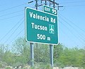 Metric Interstate 19 cropped.jpg 450 × 367; 51 KB
-
 Metric Interstate 19.jpg 1,024 × 768; 344 KB
-
 Saguaro National Park-situation map.png 1,143 × 650; 616 KB
-
 Tucson, Arizona 1955 Yellow Book.jpg 800 × 1,154; 196 KB


