Category:Interstate 15 in Idaho
Appearance
section of Interstate Highway in Idaho, United States | |||||
| Upload media | |||||
| Instance of | |||||
|---|---|---|---|---|---|
| Part of | |||||
| Location | |||||
| Transport network | |||||
| Owned by | |||||
| Maintained by | |||||
| Inception |
| ||||
| Length |
| ||||
| Terminus | |||||
| Partially coincident with | |||||
| |||||
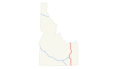
English: Media related to Interstate 15 in Idaho (I-15), a 196.000-mile (315.431 km) section of Interstate Highway in Idaho, United States, that connects I-15 in Utah with I-15 in Montana.
Subcategories
This category has the following 8 subcategories, out of 8 total.
Media in category "Interstate 15 in Idaho"
The following 3 files are in this category, out of 3 total.
-
I-15 (ID) map.svg 1,475 × 860; 37 KB
-
NPS craters-of-the-moon-regional-map.pdf 370 × 393; 752 KB
-
Pocatello, Idaho 1955 Yellow Book.jpg 800 × 1,017; 83 KB


