Category:Innerwick Church
Jump to navigation
Jump to search
| Object location | | View all coordinates using: OpenStreetMap |
|---|
Media in category "Innerwick Church"
The following 2 files are in this category, out of 2 total.
-
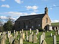
 Innerwick Church - geograph.org.uk - 1764320.jpg 640 × 426; 162 KB
-
 Innerwick Kirk - geograph.org.uk - 1229778.jpg 640 × 480; 77 KB

