Category:Ingham, Norfolk
Jump to navigation
Jump to search
English: Ingham is a small village and civil parish in the English county of Norfolk. It lies close to the village of Stalham, and is about 2 miles from Sea Palling on the North Sea coast.
village and civil parish in Norfolk, United Kingdom  | |||||
| Upload media | |||||
| Instance of | |||||
|---|---|---|---|---|---|
| Location | North Norfolk, Norfolk, East of England, England | ||||
| Population |
| ||||
| Area |
| ||||
 | |||||
Subcategories
This category has the following 4 subcategories, out of 4 total.
Media in category "Ingham, Norfolk"
The following 88 files are in this category, out of 88 total.
-
 Berkshire pigs - geograph.org.uk - 578139.jpg 640 × 480; 100 KB
-
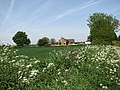
 Boundary Farm - geograph.org.uk - 2685784.jpg 2,848 × 2,144; 1.5 MB
-
 Boundary Farm - geograph.org.uk - 4966947.jpg 640 × 480; 57 KB
-
 Brick building - geograph.org.uk - 798367.jpg 640 × 447; 176 KB
-
 Brickyard Farm - geograph.org.uk - 798368.jpg 640 × 457; 163 KB
-
 Close up, Elizabeth II postbox, Manor House Farm - geograph.org.uk - 4971751.jpg 1,463 × 2,761; 924 KB
-
 Cottages at Ingham Corner - geograph.org.uk - 4558304.jpg 1,024 × 768; 363 KB
-
 Crop boundary by Town Road - geograph.org.uk - 6190544.jpg 1,600 × 1,067; 309 KB
-
 Daffodils on the verge beside the pond in Calthorpe Street - geograph.org.uk - 6085088.jpg 3,264 × 2,448; 2.94 MB
-
 Ditch beside High Road - geograph.org.uk - 798456.jpg 480 × 640; 192 KB
-
 Drain beside Water Lane - geograph.org.uk - 4966931.jpg 640 × 480; 91 KB
-

-
 Field near Boundary Farm - geograph.org.uk - 4966944.jpg 640 × 480; 85 KB
-
 Field west of Goose Lane - geograph.org.uk - 798358.jpg 640 × 480; 193 KB
-
 Fields by Calthorpe Broad - geograph.org.uk - 6191386.jpg 1,600 × 1,067; 305 KB
-
 Flint wall and barn at Grange Farm, Ingham - geograph.org.uk - 4558273.jpg 1,024 × 768; 338 KB
-
 Footpath from Palling Road - geograph.org.uk - 6190575.jpg 1,600 × 1,067; 402 KB
-
 Fox Barn, Ingham - geograph.org.uk - 6190558.jpg 1,600 × 1,067; 333 KB
-
 Frontier Agriculture, Ingham - geograph.org.uk - 6190568.jpg 1,600 × 1,067; 247 KB
-
 Goose Lane meets Church Road - geograph.org.uk - 798353.jpg 640 × 480; 144 KB
-
 Goose Lane meets the B1159 (Town Road) - geograph.org.uk - 798375.jpg 480 × 640; 188 KB
-
 Grange Farm, Ingham - geograph.org.uk - 6190560.jpg 1,600 × 1,067; 471 KB
-
 Graves and fields at Ingham Church - geograph.org.uk - 4194688.jpg 1,600 × 1,200; 573 KB
-
 Grazing off Palling Road - geograph.org.uk - 4966939.jpg 640 × 480; 67 KB
-
 Grazing off Water Lane - geograph.org.uk - 4966935.jpg 640 × 480; 57 KB
-
 Hall Farm - geograph.org.uk - 798361.jpg 640 × 480; 165 KB
-
 Hanging sign for the 'Ingham Swan' - geograph.org.uk - 5330148.jpg 2,592 × 3,456; 2.76 MB
-
 Harveys Farm - geograph.org.uk - 3004993.jpg 2,272 × 1,704; 1.88 MB
-
 Harveys Farm off Calthorpe Street - geograph.org.uk - 5977800.jpg 1,600 × 1,064; 712 KB
-
 Harveys Farm off Calthorpe Street - geograph.org.uk - 5977841.jpg 1,600 × 1,064; 665 KB
-
 Ingham church - geograph.org.uk - 5051293.jpg 2,187 × 3,182; 3.55 MB
-
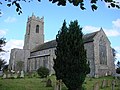 Ingham Holy Trinity church - geograph.org.uk - 2199835.jpg 640 × 480; 172 KB
-
 Ingham Road, Stalham - geograph.org.uk - 4558242.jpg 1,024 × 768; 281 KB
-
 Ingham Roll of Honour and War Memorial - geograph.org.uk - 4774604.jpg 3,456 × 2,592; 2.18 MB
-
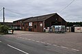
 Ingham Village Hall, Mill Road, Ingham - geograph.org.uk - 5969189.jpg 1,600 × 1,064; 894 KB
-
 Ingham village sign - geograph.org.uk - 6674258.jpg 2,956 × 2,956; 3.48 MB
-
 Ingham village sign - geograph.org.uk - 6674260.jpg 3,072 × 4,608; 6.31 MB
-
 Interior of Ingham Church - geograph.org.uk - 3591001.jpg 1,944 × 2,592; 1.27 MB
-
 Lessingham Methodist Church - geograph.org.uk - 4966929.jpg 640 × 480; 72 KB
-
 Maize crop by Mill Road - geograph.org.uk - 6190570.jpg 1,600 × 1,067; 384 KB
-
 Manor House Farm - geograph.org.uk - 4966936.jpg 640 × 480; 61 KB
-
 Memorial to 2nd Lt. C.W.S. Littlewood M.C. Royal Engineers - geograph.org.uk - 4774605.jpg 3,456 × 2,592; 2.03 MB
-
 Moat hidden by trees - geograph.org.uk - 798448.jpg 480 × 640; 187 KB
-
 Moat viewed from the north - geograph.org.uk - 798451.jpg 640 × 449; 126 KB
-
 Old Hall, Ingham - geograph.org.uk - 6085082.jpg 1,806 × 1,563; 1.13 MB
-
 Palling Road - geograph.org.uk - 4966938.jpg 640 × 480; 61 KB
-
 Palling Road - geograph.org.uk - 4966940.jpg 640 × 480; 71 KB
-
 Palling Road - geograph.org.uk - 4966946.jpg 640 × 480; 62 KB
-
 Palling Road - geograph.org.uk - 6190572.jpg 1,600 × 1,067; 452 KB
-
 Palling Road by Boundary Farm - geograph.org.uk - 6191393.jpg 1,600 × 1,032; 255 KB
-
 Palling Road, Ingham - geograph.org.uk - 5853797.jpg 3,456 × 2,592; 3.84 MB
-
 Palling Road, Manor House Farm - geograph.org.uk - 4971758.jpg 640 × 480; 73 KB
-
 Prince of Wales Sea Training Hostel Memorial - geograph.org.uk - 4774602.jpg 2,592 × 3,456; 3.15 MB
-
 Road junction at Ingham - geograph.org.uk - 3320196.jpg 2,566 × 1,910; 1.94 MB
-
 Roses hanging onto cottages at Ingham - geograph.org.uk - 4558301.jpg 1,024 × 768; 351 KB
-
 Sea Palling Tower Mill - geograph.org.uk - 5417411.jpg 640 × 480; 53 KB
-
 Standing wheat - geograph.org.uk - 5853795.jpg 3,456 × 2,592; 3.99 MB
-
 Stonebridge Farm - geograph.org.uk - 798458.jpg 640 × 460; 138 KB
-
 Sydney Street at Calthorpe Road - geograph.org.uk - 5977796.jpg 1,600 × 1,064; 932 KB
-
 Sydney Street, Ingham - geograph.org.uk - 6085072.jpg 3,264 × 2,328; 1.66 MB
-
 Thatched house, Ingham - geograph.org.uk - 3320204.jpg 2,274 × 1,652; 1.82 MB
-
 The 'Ingham Swan' public house - geograph.org.uk - 5330147.jpg 3,456 × 2,592; 3.84 MB
-
 The Causeway - geograph.org.uk - 6191382.jpg 1,600 × 1,067; 292 KB
-
 The Church and Pub at Ingham.jpg 640 × 480; 75 KB
-
 The church of Holy Trinity in Ingham - geograph.org.uk - 1963341.jpg 640 × 480; 55 KB
-
 The Ingham Swan - geograph.org.uk - 5051399.jpg 2,730 × 2,183; 3.28 MB
-
 The Ingham Swan public house - geograph.org.uk - 4194698.jpg 1,600 × 1,094; 361 KB
-
 The Ingham Swan, Ingham - geograph.org.uk - 5969155.jpg 1,600 × 1,064; 604 KB
-
 The Ingham Swan, Ingham - geograph.org.uk - 5969157.jpg 1,349 × 1,600; 537 KB
-
 The Old Chapel House - geograph.org.uk - 798399.jpg 640 × 480; 170 KB
-
 Town Road towards Ingham - geograph.org.uk - 6190543.jpg 1,600 × 1,067; 279 KB
-
 Town Road, Ingham - geograph.org.uk - 5051303.jpg 3,648 × 2,432; 2.53 MB
-
 Trees surrounding a moat - geograph.org.uk - 798441.jpg 640 × 480; 182 KB
-
 View north along Grove Road - geograph.org.uk - 798381.jpg 640 × 449; 140 KB
-
 View south towards Bluebell Wood - geograph.org.uk - 578117.jpg 640 × 480; 65 KB
-
 View to Mill House - geograph.org.uk - 3006686.jpg 2,272 × 1,704; 2.01 MB
-
 View towards Mill House and windmill - geograph.org.uk - 4966948.jpg 640 × 480; 66 KB
-
 View towards windmill along hedgerow - geograph.org.uk - 564471.jpg 640 × 480; 114 KB
-
 Walls at Grange Farm, Ingham - geograph.org.uk - 4558275.jpg 1,024 × 768; 429 KB
-
 Water Lane - geograph.org.uk - 4966933.jpg 640 × 480; 79 KB
-
 Wet ground east of High Road - geograph.org.uk - 798466.jpg 480 × 640; 188 KB
-
 Whinmere Farm - geograph.org.uk - 578072.jpg 640 × 480; 64 KB
-
 Woodland by New Hall - geograph.org.uk - 798453.jpg 480 × 640; 168 KB
-
 Wrought iron and wickerwork fence - geograph.org.uk - 798423.jpg 640 × 480; 201 KB
-
 WW1 ^ 2 war memorial - geograph.org.uk - 5970563.jpg 1,064 × 1,600; 1.06 MB
-
 WW1 ^ 2 war memorial - geograph.org.uk - 5970566.jpg 1,256 × 1,600; 926 KB
-
 Entrance to Mill Farm - geograph.org.uk - 564479.jpg 640 × 480; 49 KB
-
 Grove Road past The Grange, Ingham - geograph.org.uk - 522074.jpg 640 × 480; 89 KB


_-_geograph.org.uk_-_798375.jpg)


