Category:Information boards in Subcarpathian Voivodeship
Jump to navigation
Jump to search
Voivodeships of Poland: Greater Poland · Kuyavian-Pomeranian · Lesser Poland · Łódź · Lower Silesian · Lublin · Lubusz · Masovian · Opole · Podlaskie · Pomeranian · Silesian · Subcarpathian · Świętokrzyskie · Warmian-Masurian · West Pomeranian ·
Subcategories
This category has the following 2 subcategories, out of 2 total.
I
S
Media in category "Information boards in Subcarpathian Voivodeship"
The following 34 files are in this category, out of 34 total.
-
 2014 Tarnobrzeg, ul. Pawłowskiego 14, muzeum 16.JPG 3,662 × 2,619; 6.15 MB
-
 2014 Tarnobrzeg, Zamek Tarnowskich 15.JPG 4,135 × 3,016; 8.39 MB
-
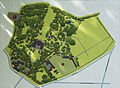
 2014 Tarnobrzeg, Zamek Tarnowskich, park, 12.JPG 4,038 × 3,117; 6.27 MB
-
 2018 Powiat niżański, Krzeszów, Kościół Narodzenia NMP, Tablica informacyjna.jpg 3,283 × 4,925; 6.73 MB
-
 2018 Powiat niżański, Ulanów, Cmentarz rzymskokatolicki 03.jpg 3,283 × 4,925; 9.77 MB
-
 Baranów Sandomierski (kościół) - tablica przy pomniku przyrody.jpg 3,472 × 4,640; 7.21 MB
-
 Baranów Sandomierski (Rynek) - tablica przy ławce.jpg 4,640 × 3,472; 7.74 MB
-
 Baranów Sandomierski (skwer pom. ul. Krakowską i ul. Fabryczną) - tablica informacyjna.jpg 4,640 × 3,472; 7.35 MB
-
 Baranów Sandomierski (ul. Mickiewicza) - tablica przy figurze Jana Nepomucena.jpg 4,640 × 3,472; 7.17 MB
-
 Board Zagorz Monastery.jpg 2,879 × 3,145; 3.35 MB
-
 BPN Carynska szlak 2.jpg 4,000 × 6,000; 5.12 MB
-
 Czermin (kościół) - tablica 01.jpg 4,640 × 3,472; 6.19 MB
-
 Czermin (kościół) - tablica 02.jpg 4,640 × 3,472; 6.14 MB
-
 Jaroslaw Old Town Board.jpg 3,072 × 4,080; 2.86 MB
-
 Jaroslaw Orthodox Church Board 2.jpg 2,866 × 2,971; 2.89 MB
-
 Jaroslaw Orthodox Church Board.jpg 1,700 × 1,338; 402 KB
-
 Mielec (Rynek Rzochowski) - tablica.jpg 1,280 × 960; 270 KB
-
 Nowa Dęba (plac majora Jana Gryczmana) - tablica Szlaku Centralnego Okręgu Przemysłowego.jpg 3,072 × 4,096; 5.09 MB
-
 Nowa Dęba (plac majora Jana Gryczmana) - tablica.jpg 3,072 × 4,096; 5.24 MB
-
 Przecław (rynek) - tablica.jpg 4,640 × 3,472; 8.39 MB
-
 Rzeszów (plac Farny) - tablica informacyjna i drogowskaz PTTK.jpg 4,096 × 3,072; 3.66 MB
-
 Rzeszów (plac Farny) - tablica informacyjna w Białym Ogrodzie 02.jpg 4,096 × 3,072; 3.96 MB
-
 Rzeszów (plac Farny) - tablica informacyjna w Białym Ogrodzie.jpg 4,096 × 3,072; 3.65 MB
-
 Rzeszów (rondo Dmowskiego) - tablica.jpg 4,096 × 3,072; 5.52 MB
-
 Rzeszów (skwer św. Jana z Dukli) - tablica.jpg 3,072 × 4,096; 3.81 MB
-
 Rzeszów (ul. Jałowego 33) - tabliczka.jpg 3,072 × 4,096; 2.99 MB
-
 Skopanie (al. Władysława Sikorskiego) - tablica informacyjna.jpg 3,472 × 4,640; 4.81 MB
-
 Skopanie (ul. Włókniarzy) - tablica.jpg 4,640 × 3,472; 5.79 MB
-
 Sędziszów Małopolski (klasztor i kościół) - tablica.jpg 4,096 × 3,072; 3.9 MB
-
 Sędziszów Małopolski (ul. 3 Maja) - tablica.jpg 3,072 × 4,096; 2.68 MB
-
 Łańcut (dawny kościół i klasztor Dominikanów) - tablica informacyjna.jpg 4,096 × 3,072; 2.89 MB
-
 Łańcut (kościół św. Stanisława Biskupa) - tablica informacyjna.jpg 4,096 × 3,072; 2.88 MB
-
 Łańcut (siedziba Stowarzyszenia Mieszczan Gwiazda) - tablica informacyjna.jpg 4,096 × 3,072; 4.11 MB
-
 Łańcut (ul. Wałowa) - tablica informacyjna.jpg 4,096 × 3,072; 4.3 MB


_-_tablica_przy_pomniku_przyrody.jpg)
_-_tablica_przy_%C5%82awce.jpg)
_-_tablica_informacyjna.jpg)
_-_tablica_przy_figurze_Jana_Nepomucena.jpg)


_-_tablica_01.jpg)
_-_tablica_02.jpg)


_-_tablica.jpg)
_-_tablica_Szlaku_Centralnego_Okr%C4%99gu_Przemys%C5%82owego.jpg)
_-_tablica.jpg)
_-_tablica.jpg)
_-_tablica_informacyjna_i_drogowskaz_PTTK.jpg)
_-_tablica_informacyjna_w_Bia%C5%82ym_Ogrodzie_02.jpg)
_-_tablica_informacyjna_w_Bia%C5%82ym_Ogrodzie.jpg)
_-_tablica.jpg)
_-_tablica.jpg)
_-_tabliczka.jpg)
_-_tablica_informacyjna.jpg)
_-_tablica.jpg)
_-_tablica.jpg)
_-_tablica.jpg)
_-_tablica_informacyjna.jpg)
_-_tablica_informacyjna.jpg)
_-_tablica_informacyjna.jpg)
_-_tablica_informacyjna.jpg)