Category:Information boards in Queensland
Jump to navigation
Jump to search
States of Australia: New South Wales · Queensland · South Australia · Victoria · Western Australia
Internal territories of Australia: Northern Territory
External territories of Australia:
Internal territories of Australia: Northern Territory
External territories of Australia:
Subcategories
This category has only the following subcategory.
Media in category "Information boards in Queensland"
The following 44 files are in this category, out of 44 total.
-
 Brisbane Valley rail trail signange at the former Moore railway station, 2023.jpg 4,032 × 3,024; 6.37 MB
-
 Cape Hillsborough National Park.jpg 4,032 × 3,024; 9.49 MB
-
 Chauvel Street named after General Harry Chauvel, El Arish, Queensland.jpg 1,080 × 1,920; 450 KB
-
 Christ Church, Anglican church, Boonah, 2020 01.jpg 4,032 × 3,024; 4.13 MB
-
 Christ Church, Anglican church, Boonah, 2020 02.jpg 4,032 × 3,024; 3.69 MB
-
 Coolest school in Queensland sign, Applethorpe State School, 2015.JPG 1,920 × 1,080; 479 KB
-

-
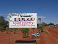 Entry to Eulo.jpg 2,272 × 1,704; 943 KB
-
 Fishing information for tourists, Theodore, 2014.JPG 1,920 × 1,080; 479 KB
-
 Georgetown - Savannah Way sign.jpg 4,032 × 3,024; 4.48 MB
-

-
-
-

-

-
 History of Emerald, Emerald Visitors Centre, 2017.jpg 5,184 × 3,456; 7.06 MB
-
 History of the Hazeldean Union Church, now the Kilcoy Hall of Memories, 2020 01.jpg 1,080 × 1,920; 475 KB
-
 Information board about the Cherry Venture, Rainbow Beach 2016.jpg 1,920 × 1,080; 478 KB
-
 Information board about the Warwick Egg Throwing Incident, 2015.JPG 1,080 × 1,920; 482 KB
-
 Information board, Peace Lutheran Church, Kumbia, 2023 02.jpg 4,032 × 3,024; 4.89 MB
-
 Information board, Peace Lutheran Church, Kumbia, 2023.jpg 3,024 × 4,032; 4.93 MB
-
 Information board, The Summit, 2015.JPG 1,920 × 1,080; 487 KB
-
 Information sign, Barrine Court Park, Caravonica, 2018.jpg 1,080 × 1,920; 482 KB
-
 Information sign, Boer War Memorial, Allora, 2015.JPG 1,920 × 1,080; 490 KB
-
 Information sign, Kewarra Beach, 2018.jpg 1,080 × 1,920; 489 KB
-
 Mackay area tourist drives.jpg 4,032 × 3,024; 4.46 MB
-
 Map of Joseph Brady Park, Barellan Point, 2021.jpg 1,080 × 1,920; 484 KB
-
 Mill Point Settlement Site, 2008.jpg 1,000 × 671; 209 KB
-
 Peace Lutheran Church, Kumbia, 2023 01.jpg 4,032 × 3,024; 5.59 MB
-
 Pikedale soldier settlement information board, Amiens, 2015.JPG 1,920 × 1,080; 480 KB
-
 Plaque, Kerosene street lamp replica, Maryland Street, Stanthorpe, 2015.JPG 1,920 × 1,080; 492 KB
-
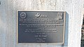
 Plaque, Stanthorpe Post Office, 2015.JPG 1,920 × 1,080; 471 KB
-
 Sign outside St Mary's Presbytery, Warwick, 2015.JPG 1,920 × 1,080; 489 KB
-
 Signage, Kumbia Uniting Church, formerly Methodist, 2023.jpg 4,032 × 3,024; 1.16 MB
-
 Signage, Our Lady of Peace Catholic Church, Kumbia, 2023 01.jpg 3,024 × 4,032; 6.05 MB
-
 Signs, boat ramp into the Logan River, northern end of Alberton Road, Alberton, 2022.jpg 3,024 × 4,032; 3.79 MB
-
 St Andrew's Anglican Church, Toogoolawah, 2005 02.JPG 1,024 × 768; 276 KB
-
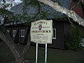
 St John's Catholic Church, Peak Crossing, 2020 01.jpg 4,032 × 3,024; 5.09 MB
-
 St John's Catholic Church, Peak Crossing, 2020 02.jpg 4,032 × 3,024; 2.59 MB
-
 St Joseph's Catholic Church, Somerset Dam, 2020 03.jpg 1,920 × 1,080; 486 KB
-
 Tourist information for the Shire of Taroom, 2014.JPG 1,920 × 1,080; 480 KB
-

-
-
 William Mitchner shelter, Warwick General Cemetery, 2015 03.JPG 1,920 × 1,080; 500 KB


