Category:Information boards in Norfolk, England
Jump to navigation
Jump to search
Ceremonial counties of England: Berkshire · Cambridgeshire · Cornwall · Cumbria · Devon · East Riding of Yorkshire · East Sussex · Gloucestershire · Greater London · Hampshire · Hertfordshire · Isle of Wight · Kent · Norfolk · North Yorkshire · Oxfordshire · Shropshire · Warwickshire · West Sussex · West Yorkshire ·
City-counties:
Former historic counties:
Other former counties:
City-counties:
Former historic counties:
Other former counties:
Subcategories
This category has the following 2 subcategories, out of 2 total.
Media in category "Information boards in Norfolk, England"
The following 67 files are in this category, out of 67 total.
-
 -2018-12-09 Footpath information board, Front Street, Trunch.JPG 3,864 × 5,152; 4.82 MB
-
 -2019-01-04 Information sign, Overstrand flag pole.JPG 5,152 × 3,864; 4.04 MB
-
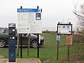
 -2019-01-04 Information, Pauls Lane Car Park, Overstrand.JPG 3,864 × 5,152; 4.88 MB
-
 -2019-01-04 Pay and display meter, Pauls Lane Car Park, Overstrand.JPG 5,152 × 3,864; 4.37 MB
-
 -2019-01-21 Information board, Happy valley, Cromer.JPG 5,152 × 3,864; 6.02 MB
-
 -2019-02-12 The common, Lower Southrepps.JPG 5,152 × 3,864; 11.58 MB
-
 -2019-02-25 Information board, High street Stalham.JPG 5,152 × 3,864; 5.44 MB
-
 -2019-02-26 Interpretation information board, Honing railway station.JPG 4,827 × 3,619; 2.99 MB
-
 -2019-03-02 Sheltered Information Board, Bacton Woods, Norfolk.JPG 5,152 × 3,864; 8.34 MB
-
 -2019-05-09 Information Board, High Street, Stalham.JPG 5,152 × 3,864; 8.76 MB
-
 -2019-10-10 Deep History Coast point, Overstrand.JPG 5,152 × 3,864; 3.4 MB
-
 -2019-10-13 Deep History Coast point, Overstrand (1).JPG 5,152 × 3,864; 9 MB
-
 -2019-10-13 Deep History Coast point, Overstrand (2).JPG 5,152 × 3,864; 8.78 MB
-
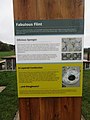
 -2019-10-13 Information displays, Deep History Coast point, Overstrand (1).JPG 3,864 × 5,152; 9.32 MB
-
 -2019-10-13 Information displays, Deep History Coast point, Overstrand (2).JPG 3,864 × 5,152; 8.43 MB
-
 -2019-10-13 Information displays, Deep History Coast point, Overstrand (3).JPG 3,864 × 5,152; 8.59 MB
-
 -2019-10-13 Information displays, Deep History Coast point, Overstrand (4).JPG 3,864 × 5,152; 8.51 MB
-
 -2019-10-13 Information displays, Deep History Coast point, Overstrand (5).JPG 3,864 × 5,152; 9.37 MB
-
 -2019-10-13 Picnic area, Deep History Coast point, Overstrand.JPG 5,152 × 3,864; 3.91 MB
-
 -2019-10-13 Project logo, Deep History Coast point, Overstrand.JPG 3,864 × 5,152; 9.51 MB
-
 -2019-10-13 Route map, Deep History Coast point, Overstrand.JPG 5,152 × 3,864; 4.98 MB
-
 -2019-10-18 Deep History Point, Mundesley (1).JPG 5,152 × 3,864; 9.48 MB
-
 -2019-10-18 Deep History Point, Mundesley (2).JPG 5,152 × 3,864; 7.95 MB
-
 -2019-10-18 Deep History Point, Mundesley (3).JPG 5,152 × 3,864; 8.23 MB
-
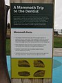
 -2019-10-18 Information displays, Deep History Point, Mundesley (1).JPG 3,864 × 5,152; 7.55 MB
-
 -2019-10-18 Information displays, Deep History Point, Mundesley (3).JPG 3,864 × 5,152; 7.16 MB
-
 -2019-10-18 Information displays, Deep History Point, Mundesley (4).JPG 3,864 × 5,152; 8.18 MB
-
 -2019-10-18 Information displays, Deep History Point, Mundesley (5).JPG 3,864 × 5,152; 10.01 MB
-
 -2019-10-18 Information displays, Deep History Point, Mundesley (6).JPG 3,864 × 5,152; 7.88 MB
-
 -2019-10-18 Mammoth bone and Information displays, Deep History Point, Mundesley.JPG 3,864 × 5,152; 8.59 MB
-
 -2019-10-19 Deep History Point, East Runton (1).JPG 5,152 × 3,864; 8.58 MB
-
 -2019-10-19 Deep History Point, East Runton (2).JPG 5,152 × 3,864; 9.6 MB
-
 -2019-10-19 Deep History Point, East Runton.JPG 5,152 × 3,864; 8.93 MB
-
 -2019-10-19 Information displays, Deep History Point, East Runton (1).JPG 5,152 × 3,864; 7.72 MB
-
 -2019-10-19 Information displays, Deep History Point, East Runton (2).JPG 3,864 × 5,152; 8.43 MB
-
 -2019-10-19 Information displays, Deep History Point, East Runton (3).JPG 3,864 × 5,152; 7.88 MB
-
 -2019-11-05 Route map, Deep History Coast point, Trimingham.JPG 5,152 × 3,864; 9.99 MB
-
 -2019-11-25 Deep History Coast point, Beach Lane, Weybourne (1).JPG 5,152 × 3,864; 3.04 MB
-
 -2019-11-25 Deep History Coast point, Beach Lane, Weybourne (2).JPG 3,864 × 5,152; 8.42 MB
-
 -2019-11-25 Deep History Coast point, Beach Lane, Weybourne (3).JPG 3,864 × 5,152; 7.21 MB
-
 -2019-11-25 Deep History Coast point, Beach Lane, Weybourne (4).JPG 3,864 × 5,152; 7.1 MB
-
 -2019-11-25 Deep History Coast point, Beach Lane, Weybourne (5).JPG 5,152 × 3,864; 2.95 MB
-
 -2019-11-25 Deep History Coast point, Beach Lane, Weybourne (6).JPG 3,864 × 5,152; 7.38 MB
-
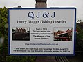 2018-04-27 Crab boat, YH232 QJ & J (ship 1915), Cromer (1).JPG 5,152 × 3,864; 4.29 MB
-
 2018-05-10 Town information board, Cadogan Road Car Park, Cromer.JPG 5,152 × 3,864; 5.19 MB
-
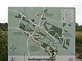 2018-07-11 Information and map board, Southrepps common.JPG 5,152 × 3,864; 5.27 MB
-
 2018-07-11 Information map board, Southrepps common.JPG 5,152 × 3,864; 4.63 MB
-
 Cromer Prospect Interpretation Board.JPG 2,304 × 1,728; 1.7 MB
-
 -2020-12-20 Deep History Coast point, Happisburgh (1).JPG 5,152 × 3,864; 5.95 MB
-
 -2020-12-20 Deep History Coast point, Happisburgh (2).JPG 5,152 × 3,864; 7.7 MB
-
 Information Board, West Cliff, Cromer, Norfolk - geograph.org.uk - 2098339.jpg 681 × 1,024; 213 KB
-

-
 Overstrand Village History Sign.JPG 2,304 × 1,728; 1.78 MB
-

-
 Scrobysands04.11.2005.c.jpg 2,288 × 1,712; 786 KB
-
 -2019-11-04 Parish map of local footpaths, Mundesley Road, Trimingham.JPG 5,152 × 3,864; 5.4 MB
-
 -2019-11-05 Deep History Coast , Trimingham.JPG 5,152 × 3,864; 10.38 MB
-
 -2019-11-05 Deep History Coast point, Trimingham (1).JPG 5,152 × 3,864; 10.95 MB
-
 -2019-11-05 Deep History Coast point, Trimingham (2).JPG 5,152 × 3,864; 12.71 MB
-
 -2019-11-05 Information display, Deep History Coast point, Trimingham (1).JPG 5,152 × 3,864; 8.62 MB
-
 -2019-11-05 Information display, Deep History Coast point, Trimingham (2).JPG 5,152 × 3,864; 9.57 MB
-
 -2019-11-05 Information display, Deep History Coast point, Trimingham (3).JPG 5,152 × 3,864; 8.85 MB
-
 -2019-11-05 Information display, Deep History Coast point, Trimingham (4).JPG 3,864 × 5,152; 8.82 MB
-
 -2019-11-05 Mobile phone app access point, Deep History Coast , Trimingham.JPG 3,864 × 5,152; 9.79 MB
-
 -2019-11-05 Project logo, Deep History Coast point, Trimingham.JPG 5,152 × 3,864; 10.53 MB
-
 -2020-08-21 Deep History Point, Trimingham.JPG 5,152 × 3,864; 7.28 MB
-
 -2019-11-25 Information board, Augustinian priory ruin, All Saints church, Weybourne.JPG 5,152 × 3,864; 3.21 MB


.JPG)
.JPG)
.JPG)
.JPG)
.JPG)
.JPG)
.JPG)


.JPG)
.JPG)
.JPG)
.JPG)
.JPG)
.JPG)
.JPG)
.JPG)

.JPG)
.JPG)

.JPG)
.JPG)
.JPG)

.JPG)
.JPG)
.JPG)
.JPG)
.JPG)
.JPG)
,_Cromer_(1).JPG)


.JPG)
.JPG)


.JPG)
.JPG)
.JPG)
.JPG)
.JPG)
.JPG)


