Category:Information boards in Brandenburg
Jump to navigation
Jump to search
Federal states of Germany:
Deutsch: Informationstafeln in Brandenburg
Subcategories
This category has the following 14 subcategories, out of 14 total.
B
D
O
P
T
Media in category "Information boards in Brandenburg"
The following 200 files are in this category, out of 239 total.
(previous page) (next page)-
 'Weisser Strand' am Flakensee in Woltersdorf Juni 2014 - 02.JPG 4,608 × 3,072; 4.61 MB
-
 Abies alba in Wensickendorf.jpg 3,456 × 4,608; 5.61 MB
-
 Am Mellensee Moke-Notte-Rundweg Infotafeln (1).JPG 2,592 × 1,944; 2.42 MB
-
 Am Mellensee Moke-Notte-Rundweg Infotafeln (2).JPG 2,592 × 1,944; 2.2 MB
-
 Am Mellensee Moke-Notte-Rundweg Infotafeln (3).JPG 1,944 × 2,592; 1.72 MB
-
 Am Mellensee Moke-Notte-Rundweg Infotafeln (4).JPG 2,592 × 1,944; 2.58 MB
-
 Am Mellensee Nottekanal Schleuse Infotafel.JPG 2,592 × 1,944; 2.34 MB
-
 Aussichtsturm Baumkronenpfad Beelitz-Heilstätten-03-Infotafel.jpg 3,100 × 2,325; 3.71 MB
-
 Aussichtsturm Baumkronenpfad Beelitz-Heilstätten-04-Plattform.jpg 4,320 × 3,240; 4.92 MB
-
 Aussichtsturm Blumenthal Daten zum Turmbau.JPG 1,944 × 2,592; 1.56 MB
-
 Aussichtsturm Blumenthal Infotafel Bischofs-Tour.JPG 2,592 × 1,944; 1.95 MB
-
 Aussichtsturm Blumenthal Infotafel Blutstein bei Wutike.JPG 2,592 × 1,944; 1.96 MB
-
 Aussichtsturm Blumenthal Infotafel Burgruine Horst.JPG 2,592 × 1,944; 1.97 MB
-
 Aussichtsturm Blumenthal Infotafel Feldsteine in der Prignitz.JPG 2,592 × 1,944; 2 MB
-
 Aussichtsturm Blumenthal Infotafel Kattenstieg-Mühle.JPG 2,592 × 1,944; 2.21 MB
-
 Aussichtsturm Blumenthal Infotafel Kloster Stift Heiligengrabe.JPG 2,592 × 1,944; 1.84 MB
-
 Aussichtsturm Blumenthal Infotafel Kyritz und Umgebung.JPG 2,592 × 1,944; 1.72 MB
-
 Aussichtsturm Blumenthal Infotafel Plattenburg.JPG 2,592 × 1,944; 2.05 MB
-
 Aussichtsturm Blumenthal Infotafel Radwegekarte Prignitz.JPG 2,592 × 1,944; 1.98 MB
-
 Aussichtsturm Blumenthal Infotafel Rohstofflieferant Endmoräne.JPG 2,592 × 1,944; 1.9 MB
-
 Aussichtsturm Blumenthal Infotafel Sehenswürdigkeiten.JPG 2,592 × 1,944; 1.75 MB
-
 Aussichtsturm Blumenthal Infotafel Turmbau.JPG 2,592 × 1,944; 1.89 MB
-
 Aussichtsturm Blumenthal Infotafel Wittstock und Umgebung.JPG 2,592 × 1,944; 1.9 MB
-
 Aussichtsturm Merzdorf-03-Infotafel.jpg 4,320 × 3,240; 5.2 MB
-
 Aussichtsturm Selchow-03-Infotafel Aussichtsturm.jpg 3,240 × 4,320; 4.52 MB
-
 Aussichtsturm Teichland-04-Impressum.jpg 3,039 × 4,053; 3.14 MB
-
 Aussichtsturm Wehlaberg-04-Infotafel.jpg 3,240 × 4,320; 4.59 MB
-
 Aussichtsturm Wietkiekenberg-04-Tafel.jpg 3,240 × 4,320; 4.72 MB
-
 Aussichtsturm Wietkiekenberg-05-Tafel.jpg 4,320 × 3,240; 5.42 MB
-
 Aussichtsturm Wussegk-02-Infotafel.jpg 4,320 × 3,240; 5.56 MB
-
 Bad Belzig Hagelberg Infotafel Kolbenschlacht Detail 1.JPG 2,592 × 1,944; 2.78 MB
-
 Bad Belzig Hagelberg Infotafel Kolbenschlacht Detail 2.JPG 2,592 × 1,944; 3.08 MB
-
 Bad Belzig Hagelberg Infotafel Kolbenschlacht Detail 3.JPG 1,944 × 2,592; 2.26 MB
-
 Bad Belzig Hagelberg Infotafel Kolbenschlacht.JPG 2,592 × 1,944; 3.71 MB
-
 Bad Belzig, Kursächsische Distanzsäule (5) Informationstafel.jpg 4,000 × 3,000; 2.87 MB
-
 Barnimer Dörferweg Infotafel Schönlinder Straße.JPG 2,068 × 1,264; 1.09 MB
-
 Beelitz, Alte Posthalterei (6) Informationstafel.jpg 4,000 × 3,000; 2.57 MB
-
 Beelitz-Busendorf Infotafel Spargelstraße am Dorfanger.jpg 3,024 × 4,032; 3.33 MB
-
 Beelitz-Zauchwitz Infotafel.JPG 2,592 × 1,944; 2.11 MB
-
 Belvedere auf dem Pfingstberg-08-Infotafel.jpg 4,320 × 3,240; 3.8 MB
-
 Belzig,St.Bricciuskirche,Informationstafel an der Kirche.JPG 1,600 × 1,200; 406 KB
-
 Bergamotte (Werder)-02-Infotafel.jpg 3,240 × 4,320; 4.59 MB
-
 Berkenbruck Church (Oder Spree) (3).jpg 3,456 × 4,608; 1.3 MB
-
 Biesenthal Infotafel Albrecht der Bär.JPG 1,944 × 2,592; 2.19 MB
-
 Biesenthal Infotafel Die Burgen von Biesenthal.JPG 2,592 × 1,944; 2.81 MB
-
 Biesenthal Infotafel Lageplan Schlossberg.JPG 2,592 × 1,944; 2.71 MB
-
 Biesenthal Infotafel Schlossberg.JPG 1,944 × 2,592; 1.68 MB
-
 Biesenthal Infotafel Sueben.JPG 1,944 × 2,592; 2.05 MB
-
 Biesenthal Jubiläumseiche Infotafel.JPG 2,592 × 1,944; 3.21 MB
-
 Brama Łukowska w Bezkowie (2).jpg 3,401 × 3,028; 2.17 MB
-
 Briesen (Mark) inf. board Jakobsweg.jpg 4,608 × 3,456; 1.84 MB
-
 Briesen (Mark) school (2).jpg 4,608 × 3,456; 1.13 MB
-
 Brunnen am Marktplatz Jörg Engelhardt Bernau bei Berlin Brandenburg Deutschland 18.jpg 3,528 × 4,264; 2.67 MB
-
 Buckower Kleinbahn plaques (1).jpg 3,456 × 4,608; 2.16 MB
-
 Buckower Kleinbahn plaques (2).jpg 3,456 × 4,608; 1.44 MB
-
 Buckower Kleinbahn plaques (3).jpg 4,608 × 3,456; 1.71 MB
-
 Buckower Kleinbahn plaques (4).jpg 4,608 × 3,456; 1.63 MB
-
 Bukowka tablica.jpg 3,456 × 4,608; 576 KB
-
 Burg Eisenhardt-04-Infotafel Torhaus.jpg 4,320 × 3,240; 5.35 MB
-
 Burg Eisenhardt-06-Infotafel Bergfried.jpg 4,320 × 3,240; 4.07 MB
-
 Calau Witzerundweg Tafel Röhrkasten.jpg 1,373 × 1,984; 314 KB
-
 Calau Witzerundweg Tafel Stadtkirche.jpg 1,536 × 2,048; 375 KB
-
 Calau Witzerundweg Tafel Wandgemälde Schusterjunge Cottbuser Straße 38.jpg 1,152 × 1,613; 278 KB
-
 City church Bad Freienwalde (17).jpg 2,428 × 1,669; 394 KB
-
 Dahme-Radweg Infotafel bei Hammer.jpg 3,024 × 4,032; 3.12 MB
-
 Spreeaue 04.JPG 5,472 × 3,648; 17.49 MB
-
 Spreeauen Teiche 02.JPG 5,472 × 3,648; 18.22 MB
-
 Dorfkirche Bahnitz Infotafel Westseite.jpg 3,024 × 4,032; 1.79 MB
-
 Dorfkirche Bötzow Epitaph Grabe Infotafel.jpg 3,024 × 4,032; 5.26 MB
-
 Dorfkirche Falkenhagen Infotafel FoP-Germany (4).jpg 3,024 × 4,032; 2.35 MB
-
 Dorfkirche Glienick Infotafel.jpg 3,024 × 4,032; 4.13 MB
-
 Dorfkirche Groß Leine Infotafel Gräberfeld.jpg 3,024 × 4,032; 3.76 MB
-
 Dorfkirche Groß Leine Infotafel Kirche.jpg 3,024 × 4,032; 3.81 MB
-
 Dorfkirche Gutengermendorf Infotafel Friedhofsmauer.jpg 2,592 × 1,944; 2.39 MB
-
 Dorfkirche Niederjesar Infotafel (FoP-Germany).jpg 3,456 × 4,608; 4.31 MB
-
 Eda Rastplatz Kraupa Sep 12a.jpg 5,184 × 3,456; 3.29 MB
-
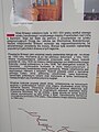
 Ein-Blick in die Ausstellung.jpg 3,008 × 1,688; 1.91 MB
-
 Erkner-Bretterscher Graben Infotafel Buchhorster Straße.jpg 4,032 × 3,024; 3.46 MB
-
 Erkner-Karutzsee Infotafel zum See.jpg 3,024 × 4,032; 3.1 MB
-
 Erkner-Neu Mönchwinkel Heimatmuseum Infotafel.jpg 3,024 × 4,032; 3.6 MB
-
 Felgentreu Infotafel Rundwanderweg.jpg 4,032 × 3,024; 2.49 MB
-
 Frankenförde Rundwanderweg Stiftungsfläche Juterbog (1).jpg 4,032 × 3,024; 3.19 MB
-
 Frankenförde Rundwanderweg Stiftungsfläche Juterbog (4).jpg 4,032 × 3,024; 2.89 MB
-
 Frankenförde Rundwanderweg Stiftungsfläche Juterbog (5).jpg 4,032 × 3,024; 3.15 MB
-
 Frankenförde Rundwanderweg Stiftungsfläche Juterbog (8).jpg 4,032 × 3,024; 2.94 MB
-
 Gedenkstele für die ermordeten Juden von Luckenwalde.jpg 1,782 × 4,526; 2.64 MB
-
 German KL Sachsenhausen 2022 (3).jpg 1,773 × 1,463; 266 KB
-
 German KL Sachsenhausen in Oranienburg (11).jpg 4,608 × 3,456; 4.18 MB
-
 German KL Sachsenhausen in Oranienburg (3).jpg 3,456 × 4,608; 1.63 MB
-
 2011-06-02-rbu-by-RalfR-052.jpg 4,288 × 2,848; 4.85 MB
-
 2011-06-02-rbu-by-RalfR-043.jpg 4,288 × 2,848; 5.62 MB
-
 Glashuette Bosdorfs Eiche 05.JPG 3,562 × 5,343; 13.25 MB
-
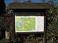
 Gosen map of the Bergpark (28811181114).jpg 3,072 × 2,304; 1.52 MB
-
 Prämonstratenserkloster Tafel I.JPG 1,024 × 768; 258 KB
-
 Groß Köris Klein Köris Chausseestraße Drachenbaum Infotafel.JPG 2,592 × 1,944; 2.38 MB
-
 Großmachnower Weinberg Infotafel am Gipfel.jpg 4,032 × 3,024; 4.61 MB
-
 Gräbendorfer See 04.jpg 3,644 × 2,268; 1.3 MB
-
 Götzer Berg-Infotafel-Ausschnitt.jpg 4,320 × 3,240; 4.15 MB
-
 Götzer Berg-Infotafel.jpg 4,320 × 3,240; 5.02 MB
-
 Hermsdorf (Łużyce) (3).jpg 4,608 × 3,456; 3.58 MB
-
 Hobrechtsfelde Aussichtspunkt.jpg 2,960 × 2,200; 1.35 MB
-
 Hoffnungskirche Rüdersdorf Infotafel vor Bauwerk.jpg 4,032 × 3,024; 2.85 MB
-
 Informationsschild Rathaus Bernau bei Berlin Brandenburg Deutschland.jpg 2,768 × 3,752; 2.05 MB
-
 Infotafel "Städebauförderung von Bund, Ländern und Gemeinden" Rathaus Bernau bei Berlin.jpg 2,848 × 3,616; 1.21 MB
-
 Infotafel Külzpark Bernau bei Berlin 02.jpg 3,176 × 3,904; 2.12 MB
-
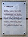 Infotafel Marktplatz Bernau bei Berlin Brandenburg Deutschland.jpg 3,632 × 4,792; 3.05 MB
-
 Infotafel Ostkirchhof Ahrensfelde Brandenburg 06.jpg 3,380 × 2,440; 1.3 MB
-
 Jakobsweg Tempelberger Forst.jpg 4,608 × 3,456; 5.93 MB
-
 Tauersche Eichen 5.jpg 960 × 1,360; 1.22 MB
-
 Jüterbog Heilig-Geist-Kapelle Infotafel Die verschwundenen Heiligen.JPG 1,944 × 2,592; 2 MB
-
 Jüterbog Heilig-Geist-Kapelle Infotafel.JPG 1,944 × 2,592; 1.75 MB
-
 Jüterbog Spitzbubenweg Blanker Blick Infotafel.JPG 1,303 × 1,294; 725 KB
-
 Jüterbog Spitzbubenweg ehemaliger Kleinbahnhof Infotafel.JPG 1,485 × 1,480; 980 KB
-
 Jüterbog Spitzbubenweg Grüner Blick Infotafel.JPG 1,439 × 1,445; 920 KB
-
 Jüterbog Spitzbubenweg Wilhelm-Kempff-Weg Infotafel.JPG 1,264 × 1,276; 756 KB
-
 Kalksee-Strand in der Richard-Wagner-Strasse in Woltersdorf Juni 2014 - 01.JPG 4,608 × 3,072; 3.94 MB
-
 Kirchberg (Neu Fahrland) Infotafel.jpg 4,032 × 3,024; 4.96 MB
-
 Kirchmöser-Informationstafel Wasserturm.jpg 3,187 × 4,249; 4.54 MB
-
 Kleeblatt (Telegrafenberg)-Infotafel.jpg 4,204 × 3,153; 4.4 MB
-
 Klein Briesen Info Tafel Grenzstein.jpg 1,824 × 1,368; 1.27 MB
-
 Kloster Stift zum Heiligengrabe Taubenturm Infotafel.JPG 2,592 × 1,944; 2.12 MB
-
 Kopie von Temmen-Ringenwalde Park Ringenwalde Infotafel.JPG 1,258 × 1,030; 594 KB
-
 Kurparkstraße 17 (Burg (Spreewald)) 04.jpg 2,063 × 3,954; 1.1 MB
-
 Lebus Oderhänge Mallnow Hinweis Großlandschaft.JPG 1,600 × 1,200; 641 KB
-
 Lebus Oderhänge Mallnow Hinweis Lebensraum Steppenrasen.JPG 1,592 × 1,190; 613 KB
-
 Lebus Oderhänge Mallnow Hinweis Sage.JPG 1,586 × 1,182; 859 KB
-
 Liebaetz Infotafel 01.jpg 2,592 × 1,944; 2.88 MB
-
 Liebaetz Infotafel 02.jpg 2,592 × 1,944; 2.24 MB
-
 Lubwartturm Infotafel Norden.JPG 2,592 × 1,944; 1.62 MB
-
 Lubwartturm Infotafel Osten.JPG 2,592 × 1,944; 1.57 MB
-
 Lubwartturm Infotafel Süden.JPG 2,592 × 1,944; 1.39 MB
-
 Lubwartturm Infotafel Westen.JPG 2,592 × 1,944; 1.47 MB
-
 Mallnow Adonisquelle Roland Rother Hinweistafel.JPG 1,576 × 1,168; 917 KB
-
 Mallnow Dorfkirche Infotafel.JPG 1,198 × 1,598; 838 KB
-
 Michendorf-Fresdorf Weinschmiede Infotafel.jpg 4,032 × 3,024; 3.46 MB
-
 Märkisch Buchholz Lesefährten Waldweisen Infotafel Naturagebiet.jpg 3,264 × 2,448; 2.71 MB
-
 Märkisch Buchholz Lesefährten Waldweisen Trockenrasen Infotafel.jpg 3,264 × 2,448; 2.4 MB
-
 Naturpark Nuthe Nieplitz NSG Forst Zinna Jüterbog-Keilberg Infotafel Fauna.JPG 1,617 × 1,626; 1.12 MB
-
 Naturpark Nuthe Nieplitz NSG Forst Zinna Jüterbog-Keilberg Infotafel Wildnis.JPG 1,706 × 1,738; 873 KB
-
 Neuruppin Ruppiner Klinikum Wasserturm-04.jpg 3,825 × 5,100; 6.86 MB
-
 Kloster Neuzelle 11.jpg 5,325 × 2,782; 9.4 MB
-
 Kloster Neuzelle 16.jpg 3,504 × 5,266; 12.23 MB
-
 Niedergörsdorf Altes Lager Kriegerdenkmal 1871 Infotafel.jpg 4,032 × 3,024; 2.56 MB
-
 Niemegk, Kursächsische Distanzsäule (6) Informationstafel.jpg 4,000 × 3,000; 2.87 MB
-
 Niemegk, Kursächsische Distanzsäule (7) Informationstafel.jpg 4,000 × 3,000; 2.92 MB
-
 Niemegk, Rathaus (2) Informationstafel.jpg 4,000 × 3,000; 2.66 MB
-
 Norbertuskapelle (Monschau) Infotafel am Aufgang.jpg 4,032 × 3,024; 5.68 MB
-
 NU-Hennickendorf Infotafel Fledermausweg.jpg 4,032 × 3,024; 3.03 MB
-
 Nuthe-Urstromtal Holbeck Infotafel FlämingWalk.jpg 4,032 × 3,024; 3.36 MB
-
 Nuthe-Urstromtal-Dümde Infotafel FlämingWalk.jpg 4,032 × 3,024; 3.62 MB
-
 Oberkirche St. Nikolai-03-Infotafel.jpg 4,320 × 3,240; 5.55 MB
-
 Oderaue Zäckericker Loose Zollbrücke Deichscharte Infotafel.JPG 2,184 × 1,443; 1.31 MB
-
 Old Tanklager in Fürstenwalde Spree (3).jpg 3,456 × 4,608; 1.99 MB
-
 Dorfkirche Petershagen 05.JPG 3,072 × 4,608; 5.19 MB
-
 Kirchenruine Podelzig 7.JPG 3,072 × 4,608; 5.83 MB
-
 Protestant Church (Briesen) (1).jpg 3,456 × 4,608; 3.96 MB
-
 Protestant Church (Briesen) (2).jpg 3,456 × 4,608; 1.62 MB
-
 Putlitz Willkomen, Welcome.JPG 2,048 × 1,360; 738 KB
-
 Quitzöbel Landesgrenze BB SA.jpg 4,000 × 3,000; 2.9 MB
-
 Rathaus Angermünde Prangeresel Infotafel.JPG 1,944 × 2,592; 2.71 MB
-
 Rauen Rauensche Berge Markgrafensteine Der steinerne Tisch Infotafel.JPG 1,600 × 1,200; 930 KB
-
 Rauen Rauensche Berge Markgrafensteine Infotafel.JPG 1,600 × 1,200; 1,012 KB
-
 Rauhes Luch Infotafel Wanderweg.jpg 3,024 × 4,032; 2.05 MB
-
 Rauhes Luch Infotafel.jpg 4,032 × 3,024; 5.18 MB
-
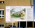 Reinhard-Lakomy-Grundschule (information board).png 2,429 × 1,930; 6.27 MB
-
 Ruinenberg-04-Infotafel.jpg 3,240 × 4,320; 3.9 MB
-
 Dorfkirche Saarmund 2019 Infotafel.jpg 3,648 × 4,864; 4.33 MB
-
 Schermützelsee 27.jpg 3,533 × 2,650; 3.01 MB
-
 Schild Wüstung Golm.JPG 420 × 560; 83 KB
-
 Schipkau-Drochow Drochower See Infotafel.jpg 4,032 × 3,024; 2.26 MB
-
 Schlepzig-Puhlstrom 03.jpg 4,032 × 3,024; 3.63 MB
-
 Schlepzig-Puhlstrom 05.jpg 4,032 × 3,024; 4.4 MB
-
 Schlepzig-Schiwanstron 07.jpg 4,032 × 3,024; 4.31 MB
-
 Schlepzig-Zerniasfließ Infotafel.jpg 4,032 × 3,024; 4.24 MB
-
 Schwedeneiche Himmelpfort Brandenburg 03.JPG 2,736 × 3,648; 4.64 MB
-
 Schweinert 08.JPG 3,168 × 4,752; 6.14 MB
-
 Schwielochsee 2022 Swieten Berg 04.jpg 4,608 × 3,456; 2.63 MB
-
 Grabkammer Seddin.jpg 3,264 × 2,448; 1.55 MB
-
 Seddin Königsggrab Infotafel Ende.jpg 3,264 × 2,448; 1.47 MB
-
 Seddin Königsggrab Infotafel Mitte.jpg 3,264 × 2,448; 1.54 MB
-
 Seddin Königsgrab Beigaben.jpg 2,577 × 2,237; 1.24 MB
-
 Seddin Königsgrab Infotafel Kammer Hügel Funde.jpg 3,264 × 2,448; 1.47 MB
-
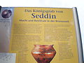
 Seddin Königsgrab Infotafel Maße.jpg 3,264 × 2,448; 1.75 MB
-
 Seddin Königsgrab Infotafel neue Recherche.jpg 3,264 × 2,448; 1.55 MB
-
 Seddin Königsgrab Infotafel unten.jpg 3,264 × 2,448; 1.55 MB
-
 Seddin Königsgrab Wer wurde bestattet Beigaben.jpg 3,264 × 2,448; 1.52 MB
-
 Seddin Königsgrab Infotafel oben.jpg 3,264 × 2,448; 1.7 MB
-
 Sommerswalde Schloss Informationstafel.jpg 3,658 × 4,877; 7.87 MB
-
 Sperenberg Boden-Geo-Pfad Klausdorfer Tongruben Station 1.jpg 2,592 × 1,944; 2.37 MB
-
 Sperenberg Boden-Geo-Pfad Klausdorfer Tongruben Station 2.jpg 2,592 × 1,944; 2.44 MB
-
 Sperenberg Boden-Geo-Pfad Klausdorfer Tongruben Station 5.jpg 2,592 × 1,944; 2.45 MB
-
 Sperenberg Boden-Geo-Pfad Sperenberger Gipsbrüche Station 5.JPG 2,592 × 1,944; 2.46 MB
-
 Sperenberg NSG Boden-Geo-Pfad Informationstafel Sperenberg 1.JPG 1,600 × 1,200; 930 KB
-
 Sperenberg NSG Boden-Geo-Pfad Informationstafel Sperenberg 2.JPG 1,600 × 1,200; 1.03 MB
-
 Sperenberg NSG Boden-Geo-Pfad Übersichtskarte.JPG 1,042 × 1,516; 850 KB
-
 Spremberg Stadtpark Infotafel.JPG 2,592 × 1,944; 2.12 MB
-
 Spurensuche Landhaus Labes (Stechlin ).jpg 3,061 × 3,983; 3.25 MB
-
 Steinhöfel-Behlendorf 2012 (FoP-Germany).jpg 2,644 × 2,786; 1.3 MB
-
 Stele Geschichte der Jüdischen Gemeinde Luckenwalde 2.jpg 1,680 × 4,765; 2.58 MB
-
 Stobber 12.jpg 2,650 × 3,533; 3.06 MB


.JPG)
.JPG)
.JPG)
.JPG)


_Informationstafel.jpg)

_Informationstafel.jpg)


-02-Infotafel.jpg)
_(3).jpg)


.jpg)
_inf._board_Jakobsweg.jpg)
_school_(2).jpg)

.jpg)
.jpg)
.jpg)
.jpg)


.jpg)


.jpg)


.jpg)


.jpg)
.jpg)
.jpg)
.jpg)
.jpg)
.jpg)
.jpg)


.jpg)


_(3).jpg)


_Infotafel.jpg)

-Infotafel.jpg)


)_04.jpg)


_Informationstafel.jpg)
_Informationstafel.jpg)
_Informationstafel.jpg)
_Infotafel_am_Aufgang.jpg)


.jpg)


_(1).jpg)
_(2).jpg)


.png)


.jpg)
.jpg)
