Category:Information boards in Bexhill-on-Sea
Jump to navigation
Jump to search
Media in category "Information boards in Bexhill-on-Sea"
The following 64 files are in this category, out of 64 total.
-
 1066 Country Walk - Bexhill Link Signpost, Bexhill-on-Sea.jpg 4,608 × 2,592; 4.11 MB
-
 Adenstar sign - geograph.org.uk - 4101600.jpg 1,024 × 768; 136 KB
-
 Adizone information board, Egerton Park, Bexhill-on-Sea.jpg 4,238 × 2,655; 697 KB
-
 Advisory sign - geograph.org.uk - 4435314.jpg 2,000 × 1,333; 1.01 MB
-
 Alders Information Board, Highwoods, Bexhill-on-Sea.jpg 2,900 × 1,900; 829 KB
-
 Art in the Park - Crawling information board, Bexhill-on-Sea.jpg 2,900 × 2,100; 703 KB
-
 Art in the Park - Dinosaurs information board, Bexhill-on-Sea.jpg 2,900 × 2,100; 622 KB
-
 Art in the Park - Metamorphosis information board, Bexhill-on-Sea.jpg 2,900 × 2,100; 627 KB
-
 Beach information, Normans Bay - geograph.org.uk - 4239873.jpg 640 × 430; 70 KB
-
 Beech Trees Information Board, Highwoods, Bexhill-on-Sea.jpg 2,100 × 2,900; 941 KB
-
 Bexhill Beach, Warning Sign - geograph.org.uk - 3938413.jpg 4,896 × 3,672; 7.05 MB
-
 Bexhill Cemetery Map Board (2022).jpg 3,754 × 2,856; 1.43 MB
-
 Bexhill Cemetery Map Board.jpg 4,969 × 3,596; 2.05 MB
-
 Bexhill Down Horse Riding Trail Sign, Bexhill.jpg 3,985 × 2,904; 1.16 MB
-
 Bexhill town limit sign, Barnhorn Road.jpg 4,608 × 2,592; 2.09 MB
-
 Bexhill town limit sign, Bexhill Road.jpg 4,608 × 2,592; 637 KB
-
 Bexhill town limit sign, Ninfield Road.jpg 4,451 × 2,504; 2.36 MB
-
 Bexhill-on-Sea Boundary Sign East Sussex - geograph.org.uk - 111352.jpg 640 × 480; 138 KB
-
 Broad Oak Park Horse Riding Trail Sign, Bexhill.jpg 4,000 × 2,248; 1.72 MB
-
 Bulverhythe Coastal Link, Information Panel, Bulverhythe.jpg 8,700 × 2,050; 1.43 MB
-
 Changing Coastline Information Panel, Bulverhythe.jpg 5,258 × 1,194; 1.53 MB
-
 Charcoal Burning Information Board, Highwoods, Bexhill-on-Sea.jpg 2,900 × 2,100; 1.14 MB
-
 Cliffs are dangerous... (10456760715).jpg 3,608 × 2,680; 4.7 MB
-
 Dragonflies & Damselflies Information Board, Highwoods, Bexhill-on-Sea.jpg 2,900 × 2,100; 889 KB
-
 East Parade Interpretation Board, East Parade, Bexhill 2.jpg 4,608 × 3,456; 1.9 MB
-
 East Parade Interpretation Board, East Parade, Bexhill.jpg 4,020 × 2,854; 1.63 MB
-
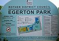 Egerton Park information board, Bexhill-on-Sea.jpg 3,890 × 2,677; 634 KB
-
 Footbridge Gallery, Bexhill-on-Sea.jpg 2,412 × 1,762; 615 KB
-
 Fungi Information Board, Highwoods, Bexhill-on-Sea.jpg 2,900 × 2,100; 589 KB
-
 General Election 2017 Posters in Bexhill on Sea - geograph.org.uk - 5397826.jpg 4,896 × 3,672; 5.41 MB
-
 Groyne 77 sign, Bexhill.jpg 4,319 × 3,239; 1.98 MB
-
 Heathland Information Board, Highwoods, Bexhill-on-Sea.jpg 2,900 × 2,100; 784 KB
-
 Highwoods information board, Bexhill-on-Sea.jpg 2,613 × 2,433; 592 KB
-
 Humphry Smith Information Board, Highwoods, Bexhill-on-Sea.jpg 2,900 × 2,100; 855 KB
-
 Information board Bexhill in War Time at Little Galley Hill.png 1,834 × 1,282; 3.62 MB
-
 Information sign by an entry onto the Pevensey Levels - geograph.org.uk - 3568771.jpg 3,264 × 2,448; 3.57 MB
-
 King Offa Wood plaque, Bexhill Down.jpg 3,796 × 2,847; 1.86 MB
-
 Max Faulkner Plaque, Sutton Place, Bexhill (full).jpg 2,800 × 3,700; 1.43 MB
-
 Motor Racing Heritage Centre sign, Bexhill.jpg 4,608 × 3,456; 2.23 MB
-
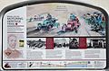
 Motoring Heritage Trail Information Panel 1, Bexhill-on-Sea.jpg 3,500 × 2,300; 951 KB
-
 Motoring Heritage Trail Information Panel 2, Bexhill-on-Sea.jpg 3,500 × 2,300; 1 MB
-
 Motoring Heritage Trail Information Panel 3, Bexhill-on-Sea.jpg 3,500 × 2,300; 1,003 KB
-
 Motoring Heritage Trail Information Panel 4, Bexhill-on-Sea.jpg 3,500 × 2,300; 1,005 KB
-
 Motoring Heritage Trail Information Panel 5, Bexhill-on-Sea.jpg 3,500 × 2,300; 938 KB
-
 No. 48 Tourist Information, Devonshire Road, Bexhill.jpg 4,161 × 2,341; 530 KB
-
 Pages Gap Interpretation Board, South Cliff, Bexhill (2).jpg 4,235 × 3,176; 2.01 MB
-
 Pages Gap Interpretation Board, South Cliff, Bexhill.jpg 6,024 × 4,843; 3.7 MB
-
 Pevensey Levels Nature Reserve Information Board, Sluice Lane, Bexhill.jpg 2,808 × 3,270; 1.13 MB
-
 Polegrove Interpretation Board, Polegrove, Bexhill.jpg 5,026 × 3,567; 2.68 MB
-
 Sawpits Information Board, Highwoods, Bexhill-on-Sea.jpg 2,100 × 3,049; 658 KB
-
 Site Safety sign - geograph.org.uk - 3824580.jpg 640 × 480; 128 KB
-
 Sweet Chestnut Coppice Information Board, Highwoods, Bexhill-on-Sea.jpg 2,900 × 2,100; 1.18 MB
-
 Swimming Pool Information Board, Highwoods, Bexhill-on-Sea.jpg 3,726 × 2,731; 1.4 MB
-
 The Elfin Artist Information Board, Highwoods, Bexhill-on-Sea.jpg 2,900 × 2,100; 1.49 MB
-
 The Smuggling Trail Information Panel 1, Bexhill-on-Sea.jpg 2,900 × 2,050; 678 KB
-
 The Smuggling Trail Information Panel 2, Bexhill-on-Sea.jpg 2,900 × 2,050; 844 KB
-
 The Smuggling Trail Information Panel 3, Bexhill-on-Sea.jpg 2,900 × 2,050; 740 KB
-
 The Smuggling Trail Information Panel 4, Bexhill-on-Sea.jpg 2,900 × 2,050; 964 KB
-
 The Smuggling Trail Information Panel 5, Bexhill-on-Sea.jpg 2,900 × 2,050; 807 KB
-
 The Smuggling Trail Information Panel 6, Bexhill-on-Sea.jpg 2,900 × 2,050; 786 KB
-
 Under the Wires Information Board, Highwoods, Bexhill-on-Sea.jpg 2,900 × 2,100; 837 KB
-
 Warning Notice, Bexhill-on-Sea - geograph.org.uk - 637875.jpg 640 × 480; 65 KB
-
 Warning Notice, Bexhill-on-Sea - geograph.org.uk - 678215.jpg 640 × 480; 80 KB
-
 World War 2 Information Panel, Bexhill-on-Sea.jpg 2,900 × 2,050; 895 KB


.jpg)


.jpg)


.jpg)


.jpg)


