Category:Industry buildings in Huddersfield
Jump to navigation
Jump to search
Subcategories
This category has the following 9 subcategories, out of 9 total.
A
- Albert Mills, Huddersfield (6 F)
D
- Deighton Mills (7 F)
F
- Factory chimneys in Huddersfield (13 F)
- Folly Hall Mills (11 F)
G
H
K
- Kirklees Incinerator (4 F)
S
- Syngenta works, Huddersfield (4 F)
T
- Thomas Broadbent Works (3 F)
Media in category "Industry buildings in Huddersfield"
The following 28 files are in this category, out of 28 total.
-
 A gable-end with datestone on Park Gear Works - geograph.org.uk - 4403655.jpg 2,000 × 1,471; 1,022 KB
-
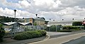
 Acre Mill from the car park of Huddersfield Royal Infirmary - geograph.org.uk - 5411347.jpg 2,284 × 1,700; 1.21 MB
-
 Acre Mill ^ Offices from HRI Car Park - geograph.org.uk - 1829898.jpg 2,560 × 1,920; 1.05 MB
-
 Ashbrow Mills seen from Bradford Road - geograph.org.uk - 6378164.jpg 2,000 × 1,475; 1.09 MB
-
 Barge Street - St Thomas Road - geograph.org.uk - 4813079.jpg 640 × 480; 57 KB
-
 Bay Hall Mills, Bay Hall - geograph.org.uk - 4457108.jpg 2,481 × 1,875; 958 KB
-
 Behind Huddersfield station (2121136746).jpg 2,345 × 1,563; 1.38 MB
-
 Birkhouse Boiler Works - geograph.org.uk - 4610993.jpg 640 × 420; 85 KB
-
 Brook Crompton, Huddersfield - geograph.org.uk - 5604889.jpg 640 × 480; 76 KB
-
 Canal scene at Milnsbridge - geograph.org.uk - 3137867.jpg 2,418 × 2,169; 1.3 MB
-
-
 Chapel Street - geograph.org.uk - 3429181.jpg 1,600 × 1,200; 286 KB
-
 Crosland's Mill, Blackmoorfoot Road - geograph.org.uk - 499088.jpg 640 × 423; 67 KB
-
 Cummins Turbo Technologies - geograph.org.uk - 3574256.jpg 3,884 × 2,014; 3.88 MB
-

-
 Fairfield Mills, Queen Street South - geograph.org.uk - 3429170.jpg 1,600 × 1,200; 311 KB
-
 Fearnley Mill, Bradley - geograph.org.uk - 6442871.jpg 2,000 × 1,268; 3.75 MB
-
 Gasholder - geograph.org.uk - 4630442.jpg 640 × 426; 42 KB
-
 Huddersfield - mills on Queen Street South - geograph.org.uk - 1845080.jpg 1,600 × 1,200; 407 KB
-
 Marsh Mill on Luck Lane, Huddersfield - geograph.org.uk - 5054150.jpg 1,200 × 799; 313 KB
-
 Milford Street - Queen Street South - geograph.org.uk - 2157409.jpg 640 × 480; 61 KB
-
 Mill and canal, Paddock - geograph.org.uk - 1886162.jpg 1,024 × 768; 178 KB
-
 P Conacher ^ Co - Water Street - geograph.org.uk - 4812762.jpg 480 × 640; 68 KB
-
 Paddock - Spring Mill from Lock 8E - geograph.org.uk - 1906597.jpg 1,600 × 1,200; 455 KB
-
 River Calder at Cooper Bridge Flood Gate - geograph.org.uk - 6203464.jpg 2,000 × 1,682; 2.84 MB
-
 Tanks and graffiti - geograph.org.uk - 6378170.jpg 2,000 × 1,227; 859 KB
-
 Tanyard Road, Milnsbridge - geograph.org.uk - 6360484.jpg 2,000 × 1,246; 850 KB
-
 Union Mills, Milnsbridge - geograph.org.uk - 2624380.jpg 422 × 640; 51 KB


.jpg)


