Category:Industrial Canal
Jump to navigation
Jump to search
canal in Louisiana, United States of America  | |||||
| Upload media | |||||
| Instance of | |||||
|---|---|---|---|---|---|
| Location | New Orleans, Orleans Parish, Louisiana | ||||
| Length |
| ||||
| Terminus |
| ||||
 | |||||
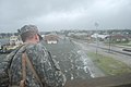
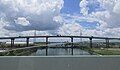
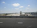
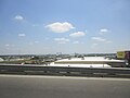
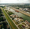
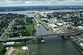
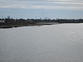
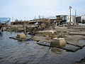
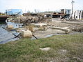
The Industrial Canal is a canal in New Orleans, Louisiana.
Subcategories
This category has only the following subcategory.
Pages in category "Industrial Canal"
This category contains only the following page.
Media in category "Industrial Canal"
The following 200 files are in this category, out of 280 total.
(previous page) (next page)-
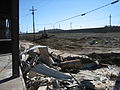
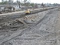
 14Dec05Low9JourdanLeveeBreachWorkBulldozer.jpg 2,592 × 1,944; 1.82 MB
-
 14Dec05Low9JourdanLeveelookersING.jpg 2,592 × 1,944; 1.95 MB
-
 14Dec05Low9JourdanOldLeveeHoleBreachEnd.jpg 2,592 × 1,944; 2.01 MB
-
 14Dec05Low9JourdnICanalBulldozerN.jpg 2,592 × 1,944; 1.88 MB
-
 24Ap06ICanalOldGentillyBargeA.jpg 2,592 × 1,383; 1.19 MB
-
 4Feb06EastNOICanalLeveeOverWallPebblesAtop.jpg 2,592 × 1,944; 1.15 MB
-
 4Feb06EastNOICanalLeveeOverWallPebblesCraneCanal.jpg 2,592 × 1,603; 1.25 MB
-
 4Feb06EastNOICanalScourA.jpg 2,592 × 1,944; 1.58 MB
-
 4Feb06EastNOICanalScourC.jpg 2,592 × 1,944; 1.29 MB
-
 4Feb06EastNOICanalScourD.jpg 2,592 × 1,944; 2.25 MB
-
 4Feb06EastNOICanalScourDownB.jpg 2,592 × 1,944; 1.42 MB
-
 4Feb06EastNOICanalScourE.jpg 2,592 × 1,944; 2.35 MB
-
 4Feb06EastNOICanalScourF.jpg 2,592 × 1,751; 1.66 MB
-
 4Feb06EastNOICanalScourG.jpg 2,592 × 1,944; 965 KB
-
 4Feb06EastNOICanalScourHShovel.jpg 2,592 × 1,944; 1.33 MB
-
 4Feb06EastNOICanalScourLetterMarks.jpg 2,592 × 1,944; 1.16 MB
-
 4Feb06EastNOICanalScourLookDown.jpg 2,592 × 1,944; 1.65 MB
-
 4Feb06EastNOICanalShovelLeveeOvertopScourNorthwards.jpg 2,592 × 1,944; 1.07 MB
-
 4Feb06EastNOICanalShovelLeveeRepair1.jpg 2,592 × 1,944; 1.38 MB
-
 4Feb06EastNOICanalShovelLeveeRepair2.jpg 2,592 × 1,944; 1.52 MB
-
 4Feb06EastNOICanalShovelLeveeWallPebblesAtop.jpg 2,592 × 1,944; 1.17 MB
-
 9Dec05FloridaAvWharfAcrossICanal.jpg 2,592 × 1,781; 1.16 MB
-
 Banksy Graffiti in New Orleans 05.jpg 2,592 × 1,944; 2.33 MB
-
 Banksy Graffiti in New Orleans 06.jpg 2,592 × 1,944; 2.05 MB
-
 Banksy Levy New Orleans 2010.jpg 3,648 × 2,736; 4.69 MB
-
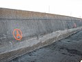
 Banksy Umbrella Industrial Canal.jpg 3,264 × 2,448; 2.11 MB
-
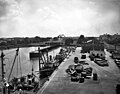
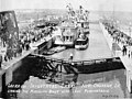
 Barges in locks New Orleans-2 10-29-41.jpg 2,067 × 1,707; 734 KB
-
 Building the Lake Entrance Industrial Canal New Orleans 1921.jpg 665 × 470; 77 KB
-
 Building the Lock New Orleans 1921.jpg 665 × 401; 170 KB
-
 ClaiborneBrLow9Levee.jpg 2,592 × 1,944; 1.46 MB
-
 ClaiborneIndustrialBreechZoom.jpg 2,579 × 631; 672 KB
-
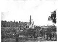 Dredging Industrial Canal 1919.jpg 665 × 498; 71 KB
-
 EastNO10Ap06IcanalJourdan.jpg 2,592 × 1,944; 1.45 MB
-
 EastNO10Ap06IcanalJourdan4.jpg 2,592 × 1,944; 1.59 MB
-
 EastNO10Ap06IcanalJourdanBentfence.jpg 2,592 × 1,944; 1.64 MB
-
 EastNO10Ap06IcanalJourdanBoat1.jpg 2,592 × 1,944; 1.67 MB
-
 EastNO10Ap06IcanalJourdanBoat2.jpg 2,592 × 1,944; 1.53 MB
-
 EastNO10Ap06IcanalJourdanBoat3.jpg 2,592 × 1,944; 1.24 MB
-
 EastNO10Ap06IcanalJourdanHalliburton.jpg 2,592 × 1,944; 1.68 MB
-
 EastNO10Ap06IcanalJourdanHalliburtonNotice.jpg 2,592 × 1,516; 1.4 MB
-
 EastNO10Ap06IcanalJourdanMarsec1.jpg 1,636 × 1,603; 1.03 MB
-
 EastNO10Ap06IcanalJourdanMorrisonAcrossSilos.jpg 2,592 × 1,944; 1.45 MB
-
 EastNO10Ap06IcanalJourdanMorrisonRoadWharf.jpg 1,998 × 1,645; 1.14 MB
-
 EastNO10Ap06IcanalJourdanMorrisonSilos.jpg 2,592 × 1,555; 1.61 MB
-
 EastNO10Ap06IcanalJourdanRRGateScour.jpg 2,592 × 1,944; 1.22 MB
-
 EastNO10Ap06IcanalJourdanSEndLeveeRepair.jpg 2,592 × 1,944; 1.24 MB
-
 EastNO10Ap06IcanalJourdanSlip.jpg 2,592 × 1,522; 1.63 MB
-
 EastNO10Ap06IcanalJourdanSlip2.jpg 2,592 × 1,404; 1.51 MB
-
 EastNO10Ap06IcanalJourdanSlip3.jpg 2,592 × 1,944; 1.51 MB
-
 EastNO10Ap06IcanalJourdanSlip6.jpg 2,592 × 1,944; 1.41 MB
-
 EastNO10Ap06IcanalJourdanWarehouses1.jpg 2,592 × 1,944; 1.25 MB
-
 EastNO10Ap06IcanalJourdanWarehouses2.jpg 2,592 × 1,944; 1.46 MB
-
 EastNO10Ap06IcanalJourdanWarehouses5.jpg 2,592 × 1,944; 1.58 MB
-
 EastNO10Ap06IcanalJourdanWarehouses7.jpg 2,592 × 1,944; 1.45 MB
-
 EastNO10Ap06IcanalJourdanWarehouses8.jpg 2,592 × 1,944; 1.65 MB
-
 EastNO10Ap06IcanalJourdanWarehouses9.jpg 2,592 × 1,944; 1.43 MB
-
 FEMA - 15080 - Photograph by Jocelyn Augustino taken on 09-06-2005 in Louisiana.jpg 2,848 × 4,288; 1.52 MB
-
 FEMA - 15869 - Photograph by Marvin Nauman taken on 09-17-2005 in Louisiana.jpg 3,008 × 2,000; 2.4 MB
-
 FEMA - 17747 - Photograph by Jocelyn Augustino taken on 09-06-2005 in Louisiana.jpg 4,253 × 2,531; 5.27 MB
-
 FEMA - 18177 - Photograph by Jocelyn Augustino taken on 08-30-2005 in Louisiana.jpg 4,288 × 2,848; 2.94 MB
-
 FEMA - 23228 - Photograph by Marvin Nauman taken on 03-31-2006 in Louisiana.jpg 2,896 × 1,944; 3.86 MB
-
 FEMA - 25720 - Photograph by Ed Edahl taken on 08-15-2006 in Louisiana.jpg 3,000 × 2,000; 4.09 MB
-
 FEMA - 37937 - New Orleans Industrial Canal.jpg 2,848 × 2,134; 1.25 MB
-
 FloridaAvFloodgateLow99Dec05.jpg 2,592 × 1,944; 978 KB
-
 GustavIndustrialCanalOvertoppingNewOrleans.jpg 3,872 × 2,592; 1.92 MB
-
 GustavNOLAFloodGateLeakPoint.jpg 800 × 536; 166 KB
-
 GWBushRayNaginFloodwallConstruction2006.jpg 515 × 727; 130 KB
-
 Higgins PT Boats at New Orleans Industrial Canal 28 June 1943 NH 44483.jpg 5,636 × 4,412; 8.2 MB
-
 HigginsViaUSCG239266.jpg 1,596 × 1,040; 580 KB
-
 HolyCross28Dec06ICanal.jpg 2,816 × 2,112; 1.47 MB
-
 I-10 Bridge from Chef Danziger Bridge Industrial Canal New Orleans July 2017.jpg 4,400 × 2,551; 2.48 MB
-
 I-10 over the Industrial Canal New Orleans.jpg 5,184 × 3,888; 4.77 MB
-
 I-11 over the Industrial Canal New Orleans.jpg 5,184 × 3,888; 4.75 MB
-
 I-12 over the Industrial Canal New Orleans.jpg 4,570 × 2,469; 2.67 MB
-
 I-13 over the Industrial Canal New Orleans.jpg 5,184 × 3,888; 4.34 MB
-
 I-14 over the Industrial Canal New Orleans.jpg 4,296 × 3,296; 4.01 MB
-
 I-15 over the Industrial Canal New Orleans.jpg 4,721 × 3,295; 4.32 MB
-
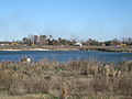
 ICanal11NovSkyline.jpg 2,592 × 1,944; 1.23 MB
-
 Icanal13JanUptoLow9C.jpg 2,592 × 1,666; 1.99 MB
-
 Icanal13JanUptoLow9TugBargeClaiborneBrSilt2.jpg 2,592 × 1,944; 1.31 MB
-
 ICanal18NovClaiborneToFlaBridgeCableCrossing.jpg 2,592 × 1,944; 1.43 MB
-
 ICanal1997AQ08.jpg 1,976 × 1,260; 273 KB
-
 ICanal27Feb06ClaiborneUpSideToFloridaBarge.jpg 1,971 × 722; 506 KB
-
 ICanal4JanNEast1.jpg 2,592 × 1,944; 971 KB
-
 ICanal9thWardBarge.jpg 2,584 × 925; 1.02 MB
-
 ICanalBargesFromUpClaiborne18NovNovlooknorth.jpg 2,592 × 1,944; 1.23 MB
-
 ICanalClaiborne18Nov05RailtracksFlaBridge.jpg 2,592 × 1,428; 1.53 MB
-
 ICanalClaiborneBr18Nov05Boat.jpg 2,592 × 1,944; 1.49 MB
-
 ICanalClaiborneBr18Nov05FloodwallCCC.jpg 2,592 × 1,944; 1.4 MB
-
 ICanalClaiborneBr18NovLockA.jpg 1,944 × 2,034; 1.68 MB
-
 ICanalClaiborneBrFromFlorida10Dec07.jpg 2,816 × 1,853; 1.31 MB
-
 ICanalClaiborneMidToFlorida27Feb06PortcranesLeveeConstruction.jpg 2,592 × 1,944; 940 KB
-
 ICanalClaiborneToFloridaLow9Side.jpg 2,592 × 1,944; 1.18 MB
-
 ICanalCranesFromLow9th9Dec.jpg 2,592 × 1,838; 1.63 MB
-
 ICanalEAstHayne4Feb06EteriorFloodgate.jpg 1,944 × 2,592; 2.37 MB
-
 ICanalEAstHayne4Feb06ExtFloodwallScourWater.jpg 1,944 × 2,592; 1.5 MB
-
 ICanalEAstHayne4Feb06FloodgatetoJourdanOpen.jpg 2,592 × 1,944; 1.43 MB
-
 ICanalEAstJourdan4Feb06RockpilesDebrisfence.jpg 2,592 × 1,944; 1.46 MB
-
 ICanalEAstJourdan4Feb06RockpilesDebrisfenceHaliburton.jpg 2,592 × 1,603; 1.53 MB
-
 ICanalEAstJourdan4Feb06RockpilesDebrisfenceHalliburton2.jpg 2,592 × 1,944; 1.53 MB
-
 ICanalEAstJourdan4Feb06RockpilesHalliburton3.jpg 2,592 × 1,944; 1.42 MB
-
 ICanalEJourdanPallets5Nov05.jpg 1,944 × 2,592; 2.9 MB
-
 ICanalFranceroadPortcranes5June06.jpg 2,592 × 1,717; 1.65 MB
-
 ICanalI10ToFloridaJuly07.jpg 2,816 × 1,031; 755 KB
-
 ICanalI10ToFloridaJuly07B.jpg 2,816 × 910; 697 KB
-
 ICanalI10ToFloridaJuly07MRGO.jpg 2,816 × 972; 691 KB
-
 ICanalI10ToFloridaJuly07MRGO2.jpg 2,816 × 975; 754 KB
-
 ICanalI10ToFloridaJuly07MRGO3.jpg 2,816 × 1,057; 830 KB
-
 ICanalLeveeClaiborneNorthWetLow9LeveeworkCranes.jpg 2,592 × 1,868; 1.72 MB
-
 ICanalLeveeClaiborneNorthWetLow9LeveeworkCranes2.jpg 2,592 × 1,944; 1.19 MB
-
 ICanalLeveeClaiborneToFlrodiaWetLow9.jpg 2,592 × 1,944; 1.26 MB
-
 ICanalLeveeClaiborneToFlrodiaWetLow9tBARGE.jpg 2,592 × 1,624; 1.58 MB
-
 ICanalLeveeUnderClaiborneCrack.jpg 1,944 × 2,592; 2.99 MB
-
 ICanalLeveeUnderClaiborneCrack3.jpg 1,944 × 2,592; 3.2 MB
-
 ICanalLockStClaude1.jpg 2,816 × 2,112; 1.56 MB
-
 ICanalLockStClaude11.jpg 2,816 × 2,112; 1.52 MB
-
 ICanalLow9Fire13Jan06.jpg 2,592 × 1,817; 1.56 MB
-
 ICanalLow9Fire13Jan06B.jpg 2,592 × 1,944; 1.35 MB
-
 ICanalLow9Fire13Jan06SmokeB.jpg 2,592 × 1,944; 1.26 MB
-
 ICanalMRGOBasinSkyline5Nov.jpg 1,944 × 2,592; 1.54 MB
-
 ICanalNE2.jpg 2,592 × 1,944; 1.46 MB
-
 ICanalNEastJourdanCrane5NovWeeds.jpg 2,592 × 1,944; 1.67 MB
-
 ICanalNELeveeShovel.jpg 2,592 × 1,944; 1.38 MB
-
 ICanalNELeveeSilt.jpg 2,592 × 1,944; 1.14 MB
-
 ICanalNEndLevBreach.jpg 2,592 × 1,944; 1.62 MB
-
 ICanalNEWork1.jpg 2,592 × 1,944; 1.39 MB
-
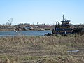
 ICanalSouthernScrapBarge9Dec05.jpg 2,592 × 1,944; 1.35 MB
-
 ICanalUptoLow913Jan06.jpg 2,592 × 1,944; 1.56 MB
-
 ICanalUptoLow913Jan06E.jpg 2,378 × 1,365; 1.61 MB
-
 ICanalUptoLow913Jan06F.jpg 2,592 × 1,944; 1.77 MB
-
 ICanalUptoLow913Jan06TugING4727.jpg 2,592 × 1,944; 1.47 MB
-
 ICanalWarehouseRow1.jpg 2,592 × 1,944; 1.26 MB
-
 IHNC Canal - River to Right 1957.jpg 3,577 × 2,345; 1.62 MB
-
 IHNC Canal Construction - Vu to River 1914.jpg 2,726 × 1,800; 1.3 MB
-
 IHNC construction - Building the entrance at Lakefront 1918.jpg 2,476 × 1,501; 1.01 MB
-
 IHNC Lock & Vicinity 1920.jpg 4,509 × 3,034; 4.55 MB
-
 IHNC Lock 1957.jpg 3,617 × 2,827; 2.37 MB
-
 IHNC Lock 1998 lrg.jpg 800 × 528; 353 KB
-
 IHNC Lock construction 1921 Page 81.jpg 2,471 × 3,372; 4.13 MB
-
 IHNC Lock construction Vu North 1-20-1921.jpg 2,485 × 1,944; 2.31 MB
-
 IHNC- MR to Lake 1929 Franck.jpg 1,186 × 900; 455 KB
-
 Ihnc-01.jpg 788 × 773; 67 KB
-
 Ihnc-02.jpg 822 × 740; 69 KB
-
 Ihnc-03.jpg 820 × 731; 72 KB
-
 Ihnc-04.jpg 787 × 775; 93 KB
-
 Ihnc-05.jpg 874 × 683; 87 KB
-
 Ihnc-07.jpg 766 × 778; 90 KB
-
 Ihnc-12.jpg 888 × 684; 103 KB
-
 IHNCconfluence.png 403 × 420; 9 KB
-
 IHNCconfluence.svg 350 × 370; 11 KB
-
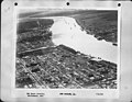
 Industrial Canal - Poss - Vic Lake 3-6-1925.jpg 1,115 × 747; 316 KB
-
 Industrial Canal aerial view.jpg 1,500 × 999; 322 KB
-
 Industrial Canal and Claiborne Bridge.jpg 1,500 × 1,000; 676 KB
-

-
 Industrial Canal by Percy Viosca JR-2 3-6-1925.jpg 747 × 558; 247 KB
-
 Industrial Canal ca 1950 NOLA.jpg 2,483 × 1,967; 1.27 MB
-
 Industrial Canal New Orleans Katrina levee.jpg 1,600 × 1,200; 593 KB
-
 Industrial Canal New Orleans Ship 2006.jpg 2,592 × 1,944; 2.07 MB
-
 Industrial canal post-katrina.JPG 3,264 × 2,448; 2.85 MB
-
 Industrial Canal,-a tow entering from the River 1953.jpg 3,750 × 3,000; 2.22 MB
-
 Industrial canal.png 402 × 502; 392 KB
-
 Industrial-Canal-2005 between Katrina and Rita.jpg 2,400 × 1,564; 1.69 MB
-
 Industrial-Canal-Lock-215.jpg 1,564 × 2,400; 2.05 MB
-
 IndustrialCanal9thWardClaiborneBreech.jpg 2,588 × 557; 543 KB
-
 IndustrialCanalClaibornBrRiverward1.jpg 2,592 × 1,944; 1.3 MB
-
 IndustrialCanalFromEast4Feb06.jpg 2,592 × 1,166; 933 KB
-
 IndustrialCanalLock3.jpg 2,592 × 1,944; 1.46 MB
-
 IndustrialCanalMissEntrance1.jpg 2,579 × 1,688; 1.99 MB
-
 IndustrialCanalNearRiver2.jpg 999 × 558; 364 KB
-
 IndustrialCanalNearRiverToLock3.jpg 2,582 × 1,612; 2 MB
-
 IndustrialCanalSeabrook4Jan061.jpg 2,592 × 1,314; 1 MB
-
 ING27Feb06FromUnderClaiborneBrLeveeCranes.jpg 2,592 × 1,570; 1.34 MB
-
 ING4727fromBreachfill14Dec.jpg 2,592 × 1,074; 1.1 MB
-
 Inner Harbor Navigation Canal, general map LOC 89697257.jpg 6,235 × 3,773; 3.35 MB
-
 Inner Harbor Navigation Canal, general map LOC 89697257.tif 6,235 × 3,773; 67.3 MB
-
 ISS015-E-29570 - View of Louisiana.jpg 3,024 × 2,064; 1.29 MB
-
 ISS017-E-5702 - View of Louisiana.jpg 3,072 × 2,040; 1.49 MB
-
 Katrina NOLA levee break FEMA.jpg 4,288 × 2,848; 2.97 MB
-
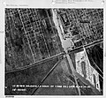
 L9W1997AQ07.jpg 2,020 × 1,280; 299 KB
-
 Leaving New Orleans by Train July 2019 Industrial Canal.jpg 4,831 × 3,114; 936 KB
-
 LIHNC Lock dedication May 1923.jpg 720 × 540; 201 KB
-
 Louisiana - New Orleans - NARA - 23940581.jpg 4,364 × 3,400; 2.24 MB
-
 Louisiana - New Orleans - NARA - 23940589.jpg 4,391 × 3,384; 7.16 MB
-
 Louisiana - New Orleans - NARA - 23940619.jpg 3,663 × 3,382; 3.54 MB
-
 Louisiana - New Orleans - NARA - 23940623.jpg 3,482 × 3,382; 2.94 MB
-
 Louisiana - New Orleans - NARA - 23940625.jpg 3,529 × 3,382; 3.88 MB
-
 Louisiana - New Orleans - NARA - 23940657.jpg 4,385 × 3,382; 2.76 MB
-
 Low99DecFloridaBreachBentPilings1.jpg 2,592 × 1,944; 2 MB
-
 Low99DecFloridaLeveeWorkers.jpg 2,592 × 1,944; 1.06 MB
-
 Low99DecICanalLeveeFromFlaBr.jpg 2,592 × 1,944; 1,020 KB
-
 Low99DecICanalNFla2.jpg 2,592 × 1,944; 1.27 MB
-
 Low99DecICanalNofFla.jpg 2,592 × 1,944; 1.78 MB
-
 Low9Buick8Back.jpg 1,944 × 2,057; 1.77 MB
-
 Low9t9DecIcanalPortcraneBlack.jpg 1,944 × 2,592; 1.35 MB
-
 Low9t9DecICanalPortcranes.jpg 2,592 × 1,696; 1.17 MB
-
 Low9t9DecLeveeICanalAcrossFlaAvWharf.jpg 2,592 × 1,944; 1.17 MB
-
 Low9t9DecLeveeICanalAcrossSkyline.jpg 2,592 × 1,663; 1.42 MB
-
 Low9t9DecLeveeICanalAcrossSkylineB.jpg 2,592 × 1,736; 1.54 MB
-
 Low9t9DecLeveeICanalIWallCCC.jpg 2,592 × 1,509; 1.47 MB
-
 Low9th14DecICanalInBreachNEnd.jpg 2,592 × 1,944; 1.68 MB


