Category:Images of a site of community importance with code ES6200002 from Wiki Loves Earth 2015 in Spain
Jump to navigation
Jump to search
Site of Community Importance: Carrascoy y El Valle (ES6200002)
Media in category "Images of a site of community importance with code ES6200002 from Wiki Loves Earth 2015 in Spain"
The following 43 files are in this category, out of 43 total.
-
 Antenas en el Pico Relojero.jpg 2,560 × 1,920; 2.67 MB
-
 Autovía A-30 en el puerto de La Cadena bajo el castillo de La Asomada.jpg 2,560 × 1,920; 1.68 MB
-
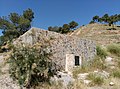
 Camino de la Mina del Cerrillar.jpg 3,120 × 4,208; 7.03 MB
-
 Carrascoy desde el Pico del Águiala.jpg 2,560 × 1,920; 1.72 MB
-
 Castillo de la Asomada desde el castillo del Portazgo.jpg 2,560 × 1,920; 1.68 MB
-
 Depósito de agua para extinción de incendios.jpg 4,208 × 3,120; 6.5 MB
-
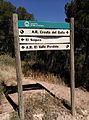
 Detalle de señal de senderos PR y GR.jpg 3,120 × 4,208; 4.85 MB
-
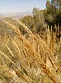 Detalle de una planta de esparto o Stipa tenacissima.jpg 3,120 × 4,208; 3.44 MB
-
 Detalle en una replantación forestal.jpg 3,120 × 4,208; 3.78 MB
-
 Muralla del Castillo del Puerto de la Cadena o de La Asomada.jpg 2,560 × 1,920; 1.76 MB
-
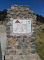 Panel informativo 2.jpg 3,120 × 4,208; 5.53 MB
-
 Panel informativo con indicaciones dentro del parque.jpg 3,120 × 4,208; 5.28 MB
-
 Panel informativo en acceso al parque.jpg 3,120 × 4,208; 5.94 MB
-
 Panel informativo en el Area Recreativa La Cresta del Gallo.jpg 4,208 × 3,120; 4.19 MB
-
 Panel informativo en el Área Recreativa La Cresta del Gallo.jpg 4,208 × 3,120; 3.36 MB
-
 Panel informativo en un depósito de agua para defensa contra incendios.jpg 4,208 × 3,120; 3.74 MB
-
 Panel informativo en una replantación en el Camino de la Mina del Cerrillar.jpg 4,208 × 3,120; 3.98 MB
-
 Panel informativo en Área Recreativa El Valle Perdido..jpg 3,120 × 4,208; 4.03 MB
-
 Panel informativo. Barranco del Sordo..jpg 4,208 × 3,120; 6.51 MB
-
 Panel informativo. Proyecto de restauración de flora amenzada.jpg 4,208 × 3,120; 4.19 MB
-

-
 Perdiz con sus crias.JPG 2,304 × 1,728; 1.93 MB
-
 Planta de esparto o Stipa tenacissima.jpg 3,120 × 4,208; 8.41 MB
-
 Plantas de esparto o Stipa tenacissima.jpg 4,208 × 3,120; 9.2 MB
-
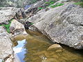 Poza de la Marrana en la Rambla del Puerto.jpg 2,560 × 1,920; 1.77 MB
-
 PR-MU 23 Sendero Antonio Pérez Nortes.jpg 2,560 × 1,920; 1.64 MB
-
 Proyecto de reforestación.jpg 4,208 × 3,120; 8.2 MB
-
 Proyecto de restauración de flora amenazada.jpg 4,208 × 3,120; 7.41 MB
-
 Puesta de Sol desde el pico Relojero.jpg 2,560 × 1,600; 1.72 MB
-
 Renacuajos en la Rambla del Puerto de la Cadena 2.JPG 2,304 × 1,728; 1.78 MB
-
 Renacuajos en la Rambla del Puerto de la Cadena.JPG 2,304 × 1,728; 1.87 MB
-
 Señal de senderos pr gr y de la vera cruz.jpg 3,120 × 4,208; 6.3 MB
-
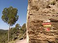 Señal de senderos PR, GR y del Camino de la Vera Cruz.jpg 4,208 × 3,120; 5.91 MB
-
 SIERRA DE CARRASCOY, REGIÓN DE MURCIA.jpg 2,560 × 1,920; 2.31 MB
-
 Totem en acceso al parque regional el valle 3.jpg 3,120 × 4,208; 6.45 MB
-
 Totem en acceso al Parque Regional El Valle.jpg 3,120 × 4,208; 5.05 MB
-
 Totem en acceso al parque regional el valle.jpg 3,120 × 4,208; 5.4 MB
-
 Un grupo de ciclistas durante una marcha en las inmediaciones del pico Relojero.jpg 4,208 × 3,120; 5.17 MB
-

-
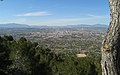 Vistas de Murcia desde la Cresta del Gallo.jpg 2,560 × 1,600; 2.96 MB
-
 Vistas desde Columbares hacia el Oeste.JPG 2,304 × 1,728; 1.84 MB
-
 Vistas desde el Cabezo del Alto hacia el Oeste.jpg 2,560 × 1,920; 1.59 MB
-
 Vistas desde el Pico Relojero.jpg 2,560 × 1,440; 2.71 MB


.jpg)


